
| Memorials | : | 0 |
| Location | : | Gauerslund, Vejle Kommune, Denmark |
| Coordinate | : | 55.6479173, 9.6621918 |
frequently asked questions (FAQ):
-
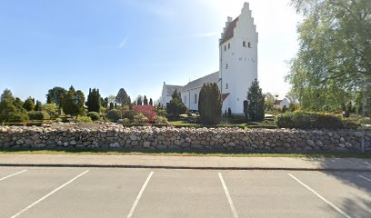
Where is Gauerslund Kirkegård?
Gauerslund Kirkegård is located at Gauerslund, Vejle Kommune ,Syddanmark ,Denmark.
-
Gauerslund Kirkegård cemetery's updated grave count on graveviews.com?
0 memorials
-
Where are the coordinates of the Gauerslund Kirkegård?
Latitude: 55.6479173
Longitude: 9.6621918
Nearby Cemetories:
1. Smidstrup Kirkegård
Smidstrup (Klattrup), Vejle Kommune, Denmark
Coordinate: 55.6118146, 9.5658868
2. Christians Kirkegård
Fredericia Kommune, Denmark
Coordinate: 55.5796474, 9.7577431
3. Daugård Cemetery
Daugard, Hedensted Kommune, Denmark
Coordinate: 55.7323246, 9.7194948
4. Almind kirkegård
Almind, Kolding Kommune, Denmark
Coordinate: 55.5658100, 9.4891500
5. Hover Kirkegård
Hover, Vejle Kommune, Denmark
Coordinate: 55.7359954, 9.4964990
6. Skibet kirkegård
Skibet, Vejle Kommune, Denmark
Coordinate: 55.7051300, 9.4412600
7. Middelfart Kirkegårde Vestre
Middelfart Kommune, Denmark
Coordinate: 55.5074114, 9.7253168
8. Odsted Kirkegård
Odsted, Vejle Kommune, Denmark
Coordinate: 55.6622215, 9.3948929
9. Jelling Church Cemetery
Odense, Odense Kommune, Denmark
Coordinate: 55.7536110, 9.4150000
10. Thyra Mound Jelling
Odense, Odense Kommune, Denmark
Coordinate: 55.7536110, 9.4150000
11. Klakring Cemetery
Juelsminde, Hedensted Kommune, Denmark
Coordinate: 55.7148780, 9.9568030
12. Klejs Cemetery
Klejs, Hedensted Kommune, Denmark
Coordinate: 55.7422501, 9.9387915
13. Kolding Gamle Kirkegaard
Kolding, Kolding Kommune, Denmark
Coordinate: 55.4855006, 9.4695359
14. Taps
Taps, Kolding Kommune, Denmark
Coordinate: 55.3929900, 9.4712862
15. Fjelsted Kirkegård
Fjelsted, Middelfart Kommune, Denmark
Coordinate: 55.4407100, 10.0144800
16. Hårslev Kirkegård
Harslev, Nordfyns Kommune, Denmark
Coordinate: 55.4984600, 10.0967100
17. Aller Kirkegaard
Haderslev, Haderslev Kommune, Denmark
Coordinate: 55.3613000, 9.5322000
18. Christiansfeld
Billund, Billund Kommune, Denmark
Coordinate: 55.3572376, 9.4835293
19. Fjelstrup Kirke
Fjelstrup, Haderslev Kommune, Denmark
Coordinate: 55.3210581, 9.5613261
20. Grindløse Cemetery
Grindlose, Nordfyns Kommune, Denmark
Coordinate: 55.5601700, 10.2329920
21. Kerte cemetery
Assens Kommune, Denmark
Coordinate: 55.3637714, 9.9878079
22. Grene Churchyard
Billund, Billund Kommune, Denmark
Coordinate: 55.7325260, 9.0770470
23. Klinte Cemetery
Klinte, Nordfyns Kommune, Denmark
Coordinate: 55.5826140, 10.2596000
24. Vigerslev Cemetery
Sonderso, Nordfyns Kommune, Denmark
Coordinate: 55.4737580, 10.2148820