| Memorials | : | 53 |
| Location | : | Shelby, Richland County, USA |
| Coordinate | : | 40.8349180, -82.6774410 |
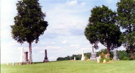
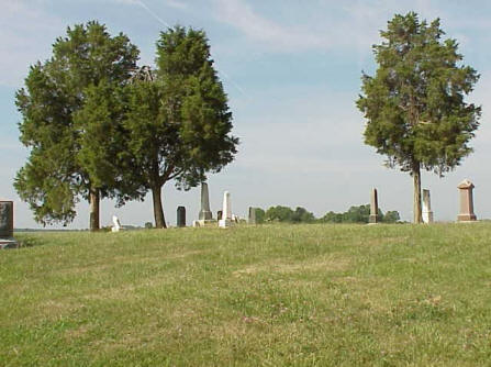
| Description | : | (Originally named Frieden (Peace) Church ) Lutheran & German Reformed Church and Burying Ground Also called Smith Cemetery, German Reform Cemetery, Nazor Cemetery, Schwartz Cemetery, Franks Cemetery, Settlement Road East Cemetery, Frieden (Peace) Cemetery This cemetery is located on an acre of land originally purchased from the government on June 2, 1831. The original purchaser was Robert Kerr who bought this acre and 159 more located in the SE 1/4 of Section 30, in township 22, and range 19, for $200 or $1.25 per acre. About 10 years later on the 11th of February, 1841, Robert Kerr made a covenant with the... Read More |
frequently asked questions (FAQ):
-
Where is German Reform Cemetery?
German Reform Cemetery is located at Hummel Road and Settlement East Road Shelby, Richland County ,Ohio , 44875USA.
-
German Reform Cemetery cemetery's updated grave count on graveviews.com?
53 memorials
-
Where are the coordinates of the German Reform Cemetery?
Latitude: 40.8349180
Longitude: -82.6774410
Nearby Cemetories:
1. Coltman Cemetery
Shelby, Richland County, USA
Coordinate: 40.8572617, -82.6578293
2. Sacred Heart Cemetery
Shelby, Richland County, USA
Coordinate: 40.8384552, -82.7230606
3. Most Pure Heart of Mary Catholic Cemetery
Shelby, Richland County, USA
Coordinate: 40.8702698, -82.6650772
4. Shelby-Oakland Cemetery
Shelby, Richland County, USA
Coordinate: 40.8718987, -82.6652985
5. Myers Cemetery
Shelby, Richland County, USA
Coordinate: 40.8796997, -82.7164001
6. Mount Bethel Cemetery
Jackson Township, Richland County, USA
Coordinate: 40.8427811, -82.6058273
7. Missionaries of the Sacred Heart Cemetery
Shelby, Richland County, USA
Coordinate: 40.8328200, -82.6033870
8. Saint Joseph Cemetery
Sandusky Township, Richland County, USA
Coordinate: 40.7871600, -82.7215628
9. Greenlawn Cemetery
East Crestline, Richland County, USA
Coordinate: 40.7850571, -82.7226782
10. London Cemetery
Shelby, Richland County, USA
Coordinate: 40.8860207, -82.6218033
11. Riblet Cemetery
Springfield Township, Richland County, USA
Coordinate: 40.7612530, -82.6883880
12. Spring Mill Cemetery
Mansfield, Richland County, USA
Coordinate: 40.8052060, -82.5836890
13. B'nai Jacob Cemetery
Ontario, Richland County, USA
Coordinate: 40.7606660, -82.6395680
14. Ontario Cemetery
Ontario, Richland County, USA
Coordinate: 40.7603127, -82.6404524
15. New Castle Cemetery
Ontario, Richland County, USA
Coordinate: 40.7600250, -82.6360510
16. Liberty Cemetery
North Robinson, Crawford County, USA
Coordinate: 40.8577995, -82.7821594
17. Saint Paul Reformed Cemetery
Crawford County, USA
Coordinate: 40.8207880, -82.7859740
18. Dickson Cemetery
Crawford County, USA
Coordinate: 40.8863983, -82.7641983
19. Dapper Cemetery
Crawford County, USA
Coordinate: 40.8278008, -82.7891998
20. Angel Refuge Pet Cemetery
Mansfield, Richland County, USA
Coordinate: 40.7598750, -82.6134520
21. Barnes-Talbot Cemetery
Galion, Crawford County, USA
Coordinate: 40.7698000, -82.7592500
22. Millsboro-Nave Cemetery
Springfield Township, Richland County, USA
Coordinate: 40.7476997, -82.6365967
23. Mansfield Memorial Park
Ontario, Richland County, USA
Coordinate: 40.7574997, -82.6053009
24. Leesville Cemetery
Crawford County, USA
Coordinate: 40.7942940, -82.7914940


