
| Memorials | : | 0 |
| Location | : | Gieten, Aa en Hunze Municipality, Netherlands |
| Coordinate | : | 53.0119900, 6.7625600 |
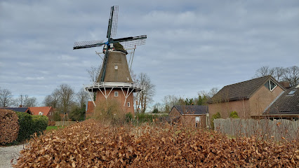
| Description | : | The village of Gieten is 14 kilometres east of Assen, the capital of the province of Drenthe, on the secondary road to Veendam. The cemetery lies north-west of the centre of the village. |
frequently asked questions (FAQ):
-
Where is Gieten General Cemetery?
Gieten General Cemetery is located at Gieten, Aa en Hunze Municipality ,Drenthe ,Netherlands.
-
Gieten General Cemetery cemetery's updated grave count on graveviews.com?
0 memorials
-
Where are the coordinates of the Gieten General Cemetery?
Latitude: 53.0119900
Longitude: 6.7625600
Nearby Cemetories:
1. Joodse Begraafplaats Beth Chajiem
Rolde, Aa en Hunze Municipality, Netherlands
Coordinate: 52.9847000, 6.6354700
2. Joodse begraafplaats
Borger, Borger-Odoorn Municipality, Netherlands
Coordinate: 52.9291240, 6.7993350
3. Zuidlaren General Cemetery
Zuidlaren, Tynaarlo Municipality, Netherlands
Coordinate: 53.0903300, 6.6912700
4. Stadskanaal Noorderbegraafplaats
Stadskanaal, Stadskanaal Municipality, Netherlands
Coordinate: 53.0071900, 6.9182500
5. Joodse Begraafplaats
Zuidlaren, Tynaarlo Municipality, Netherlands
Coordinate: 53.0954300, 6.6635300
6. Boven Pekela cemetery
Boven Pekela, Pekela Municipality, Netherlands
Coordinate: 53.0342900, 6.9338300
7. Joodse Begraafplaats
Ommelanderwijk, Veendam Municipality, Netherlands
Coordinate: 53.0822900, 6.9020500
8. Veendam Buitenwoelhof Cemetery
Veendam, Veendam Municipality, Netherlands
Coordinate: 53.1089600, 6.8582900
9. Veendam General Cemetery
Veendam, Veendam Municipality, Netherlands
Coordinate: 53.1052100, 6.8747400
10. Assen Southern General Cemetery
Assen, Assen Municipality, Netherlands
Coordinate: 52.9824500, 6.5610400
11. Gemeentelijke Begraafplaats Brugstraat
Stadskanaal, Stadskanaal Municipality, Netherlands
Coordinate: 52.9774600, 6.9632400
12. Begraafplaats Oosterkadekerk
Stadskanaal Municipality, Netherlands
Coordinate: 52.9776980, 6.9640720
13. Assen Northern Cemetery
Assen, Assen Municipality, Netherlands
Coordinate: 52.9930800, 6.5519500
14. Vries Cemetery
Vries, Tynaarlo Municipality, Netherlands
Coordinate: 53.0792200, 6.5737100
15. Joodse Begraafplaats
Assen, Assen Municipality, Netherlands
Coordinate: 52.9757700, 6.5490300
16. Joodse Begraafplaats
Stadskanaal Municipality, Netherlands
Coordinate: 52.9686940, 6.9737780
17. Nieuwe Pekela Hervormd
Nieuwe Pekela, Pekela Municipality, Netherlands
Coordinate: 53.0741930, 6.9606250
18. Gemeentelijke Begraafplaats Ceresstraat
Stadskanaal, Stadskanaal Municipality, Netherlands
Coordinate: 52.9702635, 6.9754545
19. Assen De Boskamp Cemetery
Assen, Assen Municipality, Netherlands
Coordinate: 52.9788700, 6.5447200
20. Kropswolde Protestant Churchyard
Kropswolde, Hoogezand-Sappemeer Municipality, Netherlands
Coordinate: 53.1484800, 6.7236900
21. Nieuwe Pekela Luthers
Nieuwe Pekela, Pekela Municipality, Netherlands
Coordinate: 53.0882800, 6.9788500
22. Stille Hof Cemetery
Hoogezand, Hoogezand-Sappemeer Municipality, Netherlands
Coordinate: 53.1657700, 6.7544100
23. Sappemeer Oosterbegraafplaats
Sappemeer, Hoogezand-Sappemeer Municipality, Netherlands
Coordinate: 53.1653100, 6.8047100
24. Joodse begraafplaats
Kolham, Slochteren Municipality, Netherlands
Coordinate: 53.1719150, 6.7532010