
| Memorials | : | 2 |
| Location | : | Colona Township, Henry County, USA |
| Coordinate | : | 41.4530983, -90.4039001 |
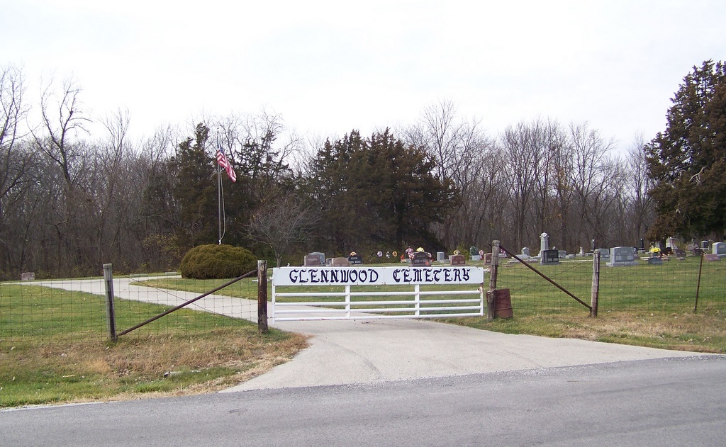
| Description | : | The cemetery is located in Colona Township on the west side of Glenwood Road. The U.S. Geological Survey (USGS) Geographic Names Information System (GNIS) feature ID for the cemetery is 409087 (Glenwood Cemetery). |
frequently asked questions (FAQ):
-
Where is Glennwood Cemetery?
Glennwood Cemetery is located at Glenwood Road Colona Township, Henry County ,Illinois , 61240USA.
-
Glennwood Cemetery cemetery's updated grave count on graveviews.com?
1 memorials
-
Where are the coordinates of the Glennwood Cemetery?
Latitude: 41.4530983
Longitude: -90.4039001
Nearby Cemetories:
1. Bowlesburg Cemetery
Silvis, Rock Island County, USA
Coordinate: 41.4749985, -90.4135971
2. Niabi Zoo
Coal Valley, Rock Island County, USA
Coordinate: 41.4439163, -90.4342957
3. Greenview Memorial Gardens
East Moline, Rock Island County, USA
Coordinate: 41.4841000, -90.4091440
4. Rose Lawn Memorial Estate
Moline, Rock Island County, USA
Coordinate: 41.4742012, -90.4550018
5. Carbon Cliff Cemetery
Rock Island County, USA
Coordinate: 41.4963500, -90.3926500
6. Coal Valley Cemetery
Coal Valley, Rock Island County, USA
Coordinate: 41.4385986, -90.4649963
7. Colona Cemetery
Colona, Henry County, USA
Coordinate: 41.4874992, -90.3488998
8. Moline Memorial Park
Moline, Rock Island County, USA
Coordinate: 41.4807300, -90.4683400
9. Homestead Cemetery
Coal Valley, Rock Island County, USA
Coordinate: 41.3987846, -90.4469910
10. Homeland Cemetery
Rock Island County, USA
Coordinate: 41.5127983, -90.3649979
11. Saint Mary's Cemetery
East Moline, Rock Island County, USA
Coordinate: 41.5093994, -90.4569016
12. Dayton Cemetery
Colona, Henry County, USA
Coordinate: 41.4874992, -90.3197021
13. Rock Island County Cemetery
Coal Valley, Rock Island County, USA
Coordinate: 41.4047220, -90.4752450
14. South Moline Township Cemetery
Moline, Rock Island County, USA
Coordinate: 41.4770737, -90.4966125
15. State Hospital Cemetery
East Moline, Rock Island County, USA
Coordinate: 41.5283012, -90.4030991
16. Oakleaf Memorial Park
Coal Valley, Rock Island County, USA
Coordinate: 41.4002876, -90.4760295
17. Western Township Cemetery
Orion, Henry County, USA
Coordinate: 41.3713989, -90.3968964
18. Riverside Cemetery
Moline, Rock Island County, USA
Coordinate: 41.5078011, -90.4918976
19. Campbell's Island State Historic Site
East Moline, Rock Island County, USA
Coordinate: 41.5383339, -90.4366302
20. Edwards Cemetery
Rock Island County, USA
Coordinate: 41.5275002, -90.3367004
21. Hanna Cemetery
Cleveland, Henry County, USA
Coordinate: 41.5010986, -90.2983017
22. Beulah Rural Township Cemetery
Coal Valley, Rock Island County, USA
Coordinate: 41.3695800, -90.4698100
23. Hampton Township Cemetery
Hampton, Rock Island County, USA
Coordinate: 41.5505981, -90.4067001
24. Morristown Cemetery
Morristown, Henry County, USA
Coordinate: 41.3960991, -90.2960968