
| Memorials | : | 6 |
| Location | : | Glenville, Freeborn County, USA |
| Coordinate | : | 43.6002808, -93.3088913 |
| Description | : | Albert Lea Township, Section 35, Highway 65 south of Albert Lea, go 1 mile past I-35 to County Road 84, turn left, go 3/4 miles. |
frequently asked questions (FAQ):
-
Where is Glenville First Lutheran Cemetery?
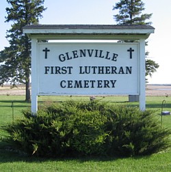
Glenville First Lutheran Cemetery is located at Glenville, Freeborn County ,Minnesota ,USA.
-
Glenville First Lutheran Cemetery cemetery's updated grave count on graveviews.com?
4 memorials
-
Where are the coordinates of the Glenville First Lutheran Cemetery?
Latitude: 43.6002808
Longitude: -93.3088913
Nearby Cemetories:
1. Hillcrest Cemetery
Albert Lea, Freeborn County, USA
Coordinate: 43.6100006, -93.3343964
2. Greenwood Cemetery
Glenville, Freeborn County, USA
Coordinate: 43.5727997, -93.2675018
3. Green Cemetery
Twin Lakes, Freeborn County, USA
Coordinate: 43.5758743, -93.3619156
4. North Round Prairie Cemetery
Glenville, Freeborn County, USA
Coordinate: 43.5531006, -93.3649979
5. Hayward Cemetery
Hayward, Freeborn County, USA
Coordinate: 43.6445618, -93.2436066
6. Round Prairie Cemetery
Glenville, Freeborn County, USA
Coordinate: 43.5411987, -93.3529968
7. Lunder Lutheran Cemetery
Twin Lakes, Freeborn County, USA
Coordinate: 43.5750008, -93.3977814
8. Lakewood Cemetery
Albert Lea, Freeborn County, USA
Coordinate: 43.6591682, -93.3694382
9. Saint Theodores Cemetery
Albert Lea, Freeborn County, USA
Coordinate: 43.6611099, -93.3705597
10. Graceland Cemetery
Albert Lea, Freeborn County, USA
Coordinate: 43.6491699, -93.3930588
11. Shady Oak Cemetery
Conger, Freeborn County, USA
Coordinate: 43.6166687, -93.4452820
12. East Freeborn Lutheran Church Cemetery
Lerdal, Freeborn County, USA
Coordinate: 43.7008286, -93.2991714
13. Itasca Cemetery
Albert Lea, Freeborn County, USA
Coordinate: 43.6758499, -93.4035721
14. Bohemian National Cemetery
Myrtle, Freeborn County, USA
Coordinate: 43.6152992, -93.1691971
15. Saint James Cemetery
Twin Lakes, Freeborn County, USA
Coordinate: 43.5346985, -93.4178009
16. Poor Farm Cemetery
Bancroft, Freeborn County, USA
Coordinate: 43.7013466, -93.3613213
17. Our Saviors Danish Lutheran Cemetery
Myrtle, Freeborn County, USA
Coordinate: 43.5580400, -93.1697300
18. Kestner Cemetery
Myrtle, Freeborn County, USA
Coordinate: 43.6083298, -93.1583328
19. Pilgrims Rest Cemetery
Myrtle, Freeborn County, USA
Coordinate: 43.5430603, -93.1750031
20. Wanderers Rest Cemetery
Gordonsville, Freeborn County, USA
Coordinate: 43.5133286, -93.2094421
21. Brush Hill Cemetery
Twin Lakes, Freeborn County, USA
Coordinate: 43.5491982, -93.4580994
22. Central Freeborn Lutheran Cemetery
Albert Lea, Freeborn County, USA
Coordinate: 43.7088890, -93.3819427
23. Stateline Cemetery
Northwood, Worth County, USA
Coordinate: 43.4874992, -93.2416992
24. Towne Cemetery
Northwood, Worth County, USA
Coordinate: 43.4805000, -93.3502000