
| Memorials | : | 20 |
| Location | : | Lerdal, Freeborn County, USA |
| Coordinate | : | 43.7008286, -93.2991714 |
| Description | : | Bancroft Township, Section 25, go north on Bridge to Hammer Road, turn right, go 1 1/2 miles, turn left on County Road 45, go 1 1/2 miles to county road 23, turn right go 2 miles. |
frequently asked questions (FAQ):
-
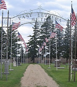
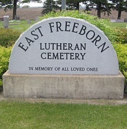
Where is East Freeborn Lutheran Church Cemetery?
East Freeborn Lutheran Church Cemetery is located at Lerdal, Freeborn County ,Minnesota ,USA.
-
East Freeborn Lutheran Church Cemetery cemetery's updated grave count on graveviews.com?
19 memorials
-
Where are the coordinates of the East Freeborn Lutheran Church Cemetery?
Latitude: 43.7008286
Longitude: -93.2991714
Nearby Cemetories:
1. Poor Farm Cemetery
Bancroft, Freeborn County, USA
Coordinate: 43.7013466, -93.3613213
2. Riceland Cemetery
Hollandale, Freeborn County, USA
Coordinate: 43.7376175, -93.2476654
3. Saint Pauls Lutheran Cemetery
Hollandale, Freeborn County, USA
Coordinate: 43.7392006, -93.2482986
4. Central Freeborn Lutheran Cemetery
Albert Lea, Freeborn County, USA
Coordinate: 43.7088890, -93.3819427
5. Saint Theodores Cemetery
Albert Lea, Freeborn County, USA
Coordinate: 43.6611099, -93.3705597
6. Lakewood Cemetery
Albert Lea, Freeborn County, USA
Coordinate: 43.6591682, -93.3694382
7. Clarks Grove Baptist Cemetery
Clarks Grove, Freeborn County, USA
Coordinate: 43.7677994, -93.3097000
8. Hayward Cemetery
Hayward, Freeborn County, USA
Coordinate: 43.6445618, -93.2436066
9. Itasca Cemetery
Albert Lea, Freeborn County, USA
Coordinate: 43.6758499, -93.4035721
10. Graceland Cemetery
Albert Lea, Freeborn County, USA
Coordinate: 43.6491699, -93.3930588
11. Hollandale Cemetery
Hollandale, Freeborn County, USA
Coordinate: 43.7537689, -93.2004471
12. Hillcrest Cemetery
Albert Lea, Freeborn County, USA
Coordinate: 43.6100006, -93.3343964
13. Oakland Lutheran and Trondhjem Cemetery
Oakland, Freeborn County, USA
Coordinate: 43.6733284, -93.1683273
14. Glenville First Lutheran Cemetery
Glenville, Freeborn County, USA
Coordinate: 43.6002808, -93.3088913
15. North Freeborn Lutheran Cemetery
Clarks Grove, Freeborn County, USA
Coordinate: 43.7917100, -93.3649700
16. Sumner-Hildreth Cemetery
Moscow, Freeborn County, USA
Coordinate: 43.6841698, -93.1522217
17. Hillcrest Cemetery
Oakland, Freeborn County, USA
Coordinate: 43.6669388, -93.1569366
18. Seventh Day Adventist Cemetery
Bath, Freeborn County, USA
Coordinate: 43.8107600, -93.3730400
19. Fairview Cemetery
Oakland, Freeborn County, USA
Coordinate: 43.6889000, -93.1292038
20. Moscow Lutheran Church Cemetery
Moscow, Freeborn County, USA
Coordinate: 43.7309799, -93.1295166
21. Bohemian National Cemetery
Myrtle, Freeborn County, USA
Coordinate: 43.6152992, -93.1691971
22. Greenwood Cemetery
Glenville, Freeborn County, USA
Coordinate: 43.5727997, -93.2675018
23. Geneva Cemetery
Geneva, Freeborn County, USA
Coordinate: 43.8292618, -93.2687225
24. Green Cemetery
Twin Lakes, Freeborn County, USA
Coordinate: 43.5758743, -93.3619156