| Memorials | : | 1 |
| Location | : | Clark County, USA |
| Coordinate | : | 37.9422390, -83.9995870 |
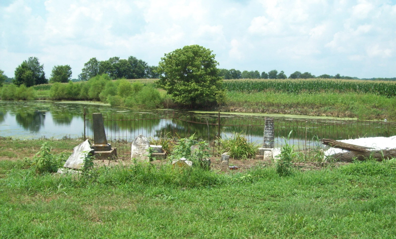
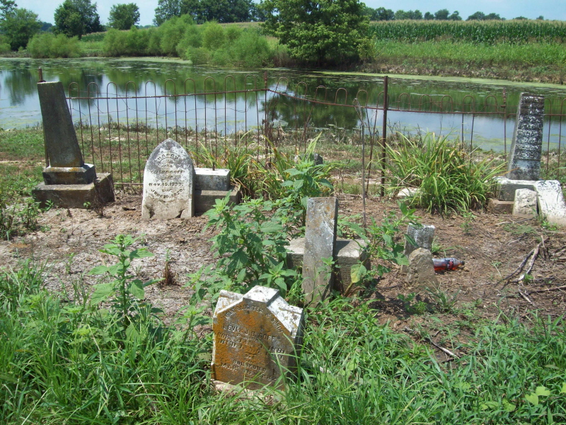
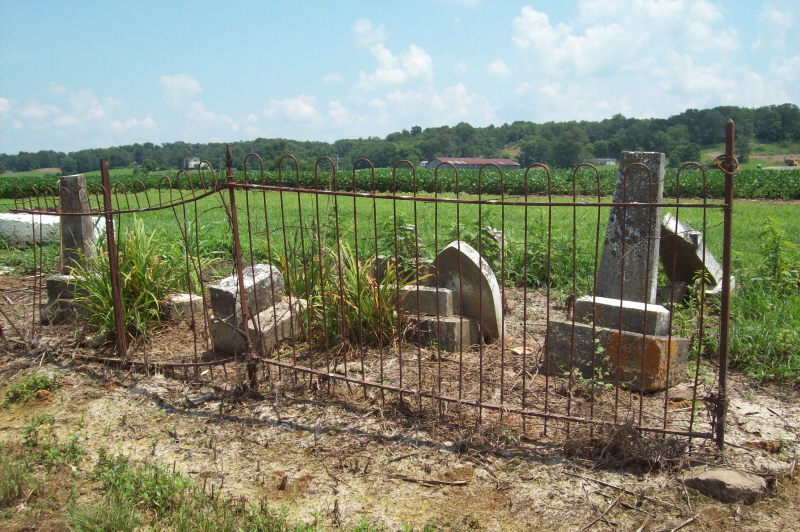
| Description | : | Goff Graveyard, is located near Indian Old Fields Station, on the old F. W. Clay farm. Now it is the Hisle Family farm.(2013) Notes: The cemetery is fairly well kept and easy to drive to on the property. Only part of the iron fence remains. Gravestones have either toppled and broken or threaten to do so. There are 2 Goff Graveyards, this one and the one on Van Meter Road. Directions to the graveyard. FROM KIDDVILLE Baptist Church, Kiddville, take Kiddville Road (974) south about 2 miles (passing the Indian Old Fields (not marked). On the left you will pass Oil Springs... Read More |
frequently asked questions (FAQ):
-
Where is Goff Graveyard?
Goff Graveyard is located at Clark County ,Kentucky ,USA.
-
Goff Graveyard cemetery's updated grave count on graveviews.com?
1 memorials
-
Where are the coordinates of the Goff Graveyard?
Latitude: 37.9422390
Longitude: -83.9995870
Nearby Cemetories:
1. Peel Family Graveyard
Kiddville, Clark County, USA
Coordinate: 37.9614890, -83.9950380
2. Frank Anderson Farm Cemetery
Clark County, USA
Coordinate: 37.9430542, -83.9744415
3. Center Family Cemetery
Levee, Montgomery County, USA
Coordinate: 37.9505330, -83.9709870
4. King Cemetery
Goffs Corner, Clark County, USA
Coordinate: 37.9176243, -84.0066021
5. Kidd Cemetery
Montgomery County, USA
Coordinate: 37.9683330, -83.9877780
6. Elliott Cemetery
Levee, Montgomery County, USA
Coordinate: 37.9600000, -83.9661110
7. Joel Elliott Cemetery
Levee, Montgomery County, USA
Coordinate: 37.9600850, -83.9658130
8. Woosley Cemetery
Levee, Montgomery County, USA
Coordinate: 37.9596200, -83.9633570
9. Dawson Cemetery
Clark County, USA
Coordinate: 37.9082985, -84.0057983
10. Bell Cemetery
Powell County, USA
Coordinate: 37.9141655, -83.9725037
11. Howard Graveyard
Clark County, USA
Coordinate: 37.9025555, -83.9953651
12. Ervin Cemetery
Clark County, USA
Coordinate: 37.9522018, -84.0550003
13. Fox Cemetery
Clark County, USA
Coordinate: 37.9486008, -84.0586014
14. Bethlehem Christian Church Cemetery
Clark County, USA
Coordinate: 37.9868333, -84.0251167
15. Dewitt Cemetery
Powell County, USA
Coordinate: 37.9055557, -83.9580536
16. Hampton Cemetery
Powell County, USA
Coordinate: 37.9008293, -83.9635315
17. Berry Cemetery
Powell County, USA
Coordinate: 37.9066658, -83.9522247
18. Everman Cemetery
Clark County, USA
Coordinate: 37.8894005, -84.0057983
19. Anderson Cemetery
Levee, Montgomery County, USA
Coordinate: 37.9516670, -83.9325000
20. Hainline Cemetery
Montgomery County, USA
Coordinate: 37.9815810, -83.9497990
21. Iker Cemetery
Montgomery County, USA
Coordinate: 37.9350000, -83.9266670
22. Clemons Cemetery
Black Creek, Powell County, USA
Coordinate: 37.9011116, -83.9424973
23. Branham Cemetery
Mount Sterling, Montgomery County, USA
Coordinate: 37.9350014, -83.9216690
24. Everman Cemetery
Powell County, USA
Coordinate: 37.8805542, -83.9922256


