
| Memorials | : | 0 |
| Location | : | Angle Inlet, Lake of the Woods County, USA |
| Coordinate | : | 49.3511110, -95.0822500 |
| Description | : | From Minn. Hwy. 49 at the international border between Manitoba and Minnesota, follow Minn. Hwy. 49 (Northwest Angle Road NW) for 7.8 miles to the junction with Lake of the Woods County Road 331 (Dawson Road NW). At this intersection is Jim's Corner, which is used for the customs station. Go left (west) on Lake of the Woods County Road 331 (Dawson Road NW) for one mile, then turn right (north) onto Lake of the Woods County Road (Pine View Drive NW). After 7/10 of a mile, turn left (west) onto Inlet Drive NW (which is still Lake of the... Read More |
frequently asked questions (FAQ):
-
Where is Good Shepherd Cemetery?
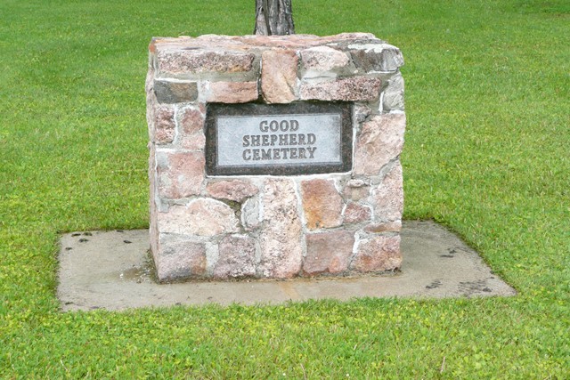
Good Shepherd Cemetery is located at Angle Inlet, Lake of the Woods County ,Minnesota ,USA.
-
Good Shepherd Cemetery cemetery's updated grave count on graveviews.com?
0 memorials
-
Where are the coordinates of the Good Shepherd Cemetery?
Latitude: 49.3511110
Longitude: -95.0822500

Nearby Cemetories:
1. Fort Saint Charles Cemetery
Fort Saint Charles, Lake of the Woods County, USA
Coordinate: 49.3628400, -94.9807120
2. South East Whiteshell Cemetery
Falcon Lake, Eastern Manitoba Census Division, Canada
Coordinate: 49.7142730, -95.2546700
3. Middlebro Community Cemetery
Middlebro, Eastern Manitoba Census Division, Canada
Coordinate: 49.0312000, -95.4318000
4. East Braintree Cemetery
East Braintree, Eastern Manitoba Census Division, Canada
Coordinate: 49.5985150, -95.6123610
5. Cleansing Wave Gospel Church Cemetery
Sprague, Eastern Manitoba Census Division, Canada
Coordinate: 49.0893310, -95.6597290
6. Mount Carmel Lutheran Church Cemetery
Chilgren Township, Lake of the Woods County, USA
Coordinate: 48.8866200, -95.0899300
7. Indian Burial Grounds
Warroad, Roseau County, USA
Coordinate: 48.9061080, -95.3269180
8. Prosper Township Cemetery
Birch Beach, Lake of the Woods County, USA
Coordinate: 48.8863450, -94.9375190
9. Cherne Cugnet Cemetery
Roseau County, USA
Coordinate: 48.8998400, -95.3085800
10. Sprague Cemetery
Sprague, Eastern Manitoba Census Division, Canada
Coordinate: 49.0528300, -95.6648600
11. Riverside Cemetery
Warroad, Roseau County, USA
Coordinate: 48.8911018, -95.3255997
12. Saint Marys Cemetery
Warroad, Roseau County, USA
Coordinate: 48.8880997, -95.3189011
13. Roundy Cemetery
Warroad, Roseau County, USA
Coordinate: 48.8795430, -95.3193910
14. Norland Cemetery
Salol, Roseau County, USA
Coordinate: 48.9330500, -95.5053900
15. Hillside Cemetery
Lake of the Woods County, USA
Coordinate: 48.8436012, -94.8822021
16. Hillside Lutheran Cemetery
Vassar, Eastern Manitoba Census Division, Canada
Coordinate: 49.1339700, -95.8344300
17. Silent City Cemetery
Roosevelt, Roseau County, USA
Coordinate: 48.8068000, -95.1007400
18. Country Church and Cemetery
South Junction, Eastern Manitoba Census Division, Canada
Coordinate: 49.0293320, -95.7547250
19. Our Lady of Assumption Cemetery
South Junction, Eastern Manitoba Census Division, Canada
Coordinate: 49.0381600, -95.7673200
20. Vassar Roman Catholic Cemetery
Vassar, Eastern Manitoba Census Division, Canada
Coordinate: 49.0981570, -95.8333430
21. Vassar United Church Cemetery
Vassar, Eastern Manitoba Census Division, Canada
Coordinate: 49.0979400, -95.8416200
22. Saint Marys Riverside Cemetery
Prawda, Eastern Manitoba Census Division, Canada
Coordinate: 49.6903670, -95.7950330
23. Salem Lutheran Cemetery
Wampum, Eastern Manitoba Census Division, Canada
Coordinate: 49.0524100, -95.8372400
24. Lake Of The Woods Cemetery
Kenora, Kenora District, Canada
Coordinate: 49.7764700, -94.4798500