
| Memorials | : | 892 |
| Location | : | Kenora, Kenora District, Canada |
| Phone | : | 807-467-2067 |
| Coordinate | : | 49.7764700, -94.4798500 |
| Description | : | The City of Kenora and the Lake of the Woods Cemetery are not affiliated with, nor administer this page. The information held within is gathered by volunteers and is not the official record. If you require specific information about a gravesite located at the Lake of the Woods Cemetery, please contact the Cemetery administration by calling 807-467-2067 or by emailing [email protected] . |
frequently asked questions (FAQ):
-
Where is Lake Of The Woods Cemetery?
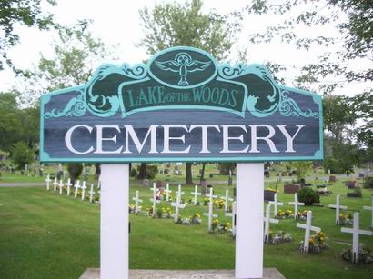
Lake Of The Woods Cemetery is located at 750 – 9 St N Kenora, Kenora District ,Ontario ,Canada.
-
Lake Of The Woods Cemetery cemetery's updated grave count on graveviews.com?
838 memorials
-
Where are the coordinates of the Lake Of The Woods Cemetery?
Latitude: 49.7764700
Longitude: -94.4798500
Nearby Cemetories:
1. Pineridge Cemetery
Sioux Narrows, Kenora District, Canada
Coordinate: 49.3975171, -94.0623584
2. South East Whiteshell Cemetery
Falcon Lake, Eastern Manitoba Census Division, Canada
Coordinate: 49.7142730, -95.2546700
3. Fort Saint Charles Cemetery
Fort Saint Charles, Lake of the Woods County, USA
Coordinate: 49.3628400, -94.9807120
4. Good Shepherd Cemetery
Angle Inlet, Lake of the Woods County, USA
Coordinate: 49.3511110, -95.0822500
5. McIntosh First Nation Residential School Cemetery
McIntosh, Kenora District, Canada
Coordinate: 49.9794440, -93.6108330
6. McIntosh Cemetery
McIntosh, Kenora District, Canada
Coordinate: 49.9813175, -93.5870514
7. Vermilion Bay Catholic Cemetery
Vermilion Bay, Kenora District, Canada
Coordinate: 49.8782390, -93.4265730
8. Quibell Cemetery
Quibell, Kenora District, Canada
Coordinate: 49.9594491, -93.4252027
9. Norman Cottam Memorial Gardens
Nestor Falls, Kenora District, Canada
Coordinate: 49.1343810, -93.9210630
10. East Braintree Cemetery
East Braintree, Eastern Manitoba Census Division, Canada
Coordinate: 49.5985150, -95.6123610
11. Eagle River Cemetery
Eagle River, Kenora District, Canada
Coordinate: 49.7920670, -93.2036170
12. Saint Marys Riverside Cemetery
Prawda, Eastern Manitoba Census Division, Canada
Coordinate: 49.6903670, -95.7950330
13. Birch River Community Cemetery
Prawda, Eastern Manitoba Census Division, Canada
Coordinate: 49.7493580, -95.8491470
14. Minnitaki Cemetery
Minnitaki, Kenora District, Canada
Coordinate: 49.8157393, -93.0846587
15. Twin Rivers Mennonite Church Cemetery
Elma, Eastern Manitoba Census Division, Canada
Coordinate: 49.7973690, -95.8932610
16. Holy Cross Ukrainian Catholic Cemetery
Elma, Eastern Manitoba Census Division, Canada
Coordinate: 49.8742620, -95.9009350
17. Ukrainian Catholic Cemetery Ascension of Our Lord
Hadashville, Eastern Manitoba Census Division, Canada
Coordinate: 49.6945830, -95.9064670
18. St. Anthony of Padua Roman Catholic Cemetery
Elma, Eastern Manitoba Census Division, Canada
Coordinate: 49.8731000, -95.9073670
19. Saint John the Baptist Roman Catholic Cemetery
Hadashville, Eastern Manitoba Census Division, Canada
Coordinate: 49.6753170, -95.9071500
20. Prosper Township Cemetery
Birch Beach, Lake of the Woods County, USA
Coordinate: 48.8863450, -94.9375190
21. Hillside Cemetery
Lake of the Woods County, USA
Coordinate: 48.8436012, -94.8822021
22. Middlebro Community Cemetery
Middlebro, Eastern Manitoba Census Division, Canada
Coordinate: 49.0312000, -95.4318000
23. Stony Hill Cemetery
Stony Hill, Eastern Manitoba Census Division, Canada
Coordinate: 49.8688830, -95.9753670
24. Mount Carmel Lutheran Church Cemetery
Chilgren Township, Lake of the Woods County, USA
Coordinate: 48.8866200, -95.0899300