
| Memorials | : | 5 |
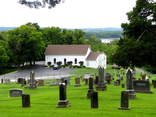
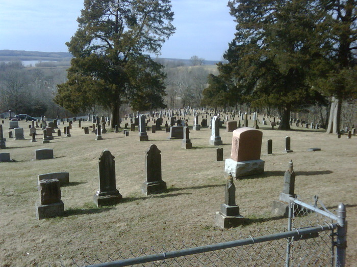
| Location | : | Wilton, Boone County, USA |
| Coordinate | : | 38.7346600, -92.3550000 |
frequently asked questions (FAQ):
-
Where is Goshen Primitive Baptist Church Cemetery?
Goshen Primitive Baptist Church Cemetery is located at Wilton, Boone County ,Missouri ,USA.
-
Goshen Primitive Baptist Church Cemetery cemetery's updated grave count on graveviews.com?
4 memorials
-
Where are the coordinates of the Goshen Primitive Baptist Church Cemetery?
Latitude: 38.7346600
Longitude: -92.3550000
Nearby Cemetories:
1. Shull Cemetery
Moniteau County, USA
Coordinate: 38.7296982, -92.3972015
2. Shull Cemetery
Cole County, USA
Coordinate: 38.7296982, -92.3974991
3. Old Marion Cemetery
Marion, Cole County, USA
Coordinate: 38.7065506, -92.3792801
4. Cook Cemetery
Moniteau County, USA
Coordinate: 38.7393990, -92.4080963
5. John D. Williams Cemetery
Sandy Hook, Moniteau County, USA
Coordinate: 38.7545600, -92.4098800
6. New Hope Cemetery
Marion, Cole County, USA
Coordinate: 38.6955872, -92.3943558
7. Friedens Cemetery
Hartsburg, Boone County, USA
Coordinate: 38.6986000, -92.3087000
8. Miller Cemetery
Sandy Hook, Moniteau County, USA
Coordinate: 38.7618600, -92.4168100
9. Hickman Cemetery
Marion, Cole County, USA
Coordinate: 38.6776300, -92.3595600
10. Kubli Chapel Cemetery
Jamestown, Moniteau County, USA
Coordinate: 38.7417300, -92.4295200
11. Bonds Chapel Cemetery
Hartsburg, Boone County, USA
Coordinate: 38.7093900, -92.2855200
12. Maupin Cemetery
Sandy Hook, Moniteau County, USA
Coordinate: 38.7735800, -92.4196400
13. Forbis Cemetery
Ashland, Boone County, USA
Coordinate: 38.7847100, -92.2987200
14. Bailey Farm Cemetery
Marion, Cole County, USA
Coordinate: 38.6680330, -92.3553800
15. New Liberty Cemetery
Ashland, Boone County, USA
Coordinate: 38.7690300, -92.2809800
16. Knife Cemetery
Marion, Cole County, USA
Coordinate: 38.6681200, -92.3417300
17. Mary Ann Williams Cemetery
California, Moniteau County, USA
Coordinate: 38.6988200, -92.4327900
18. Cofer Cemetery
Jamestown, Moniteau County, USA
Coordinate: 38.7633018, -92.4514008
19. Woodcrest Primitive Baptist Church Cemetery
Ashland, Boone County, USA
Coordinate: 38.7708400, -92.2588100
20. Shiloh Christian Church Cemetery
California, Moniteau County, USA
Coordinate: 38.6951800, -92.4502300
21. Steeley Cemetery
Elston, Cole County, USA
Coordinate: 38.6530883, -92.3282420
22. Steeley Cemetery
Moniteau County, USA
Coordinate: 38.6530991, -92.3281021
23. Mount Pleasant Cemetery
Hartsburg, Boone County, USA
Coordinate: 38.6903000, -92.2577972
24. Nashville Cemetery
Sapp, Boone County, USA
Coordinate: 38.8243484, -92.3498764