
| Memorials | : | 1 |
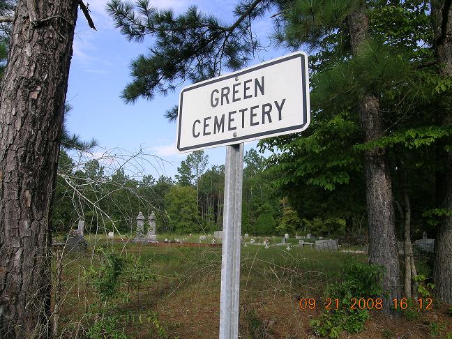
| Location | : | Sulphur Springs (Jacksonville West), Calhoun County, USA |
| Coordinate | : | 33.6903200, -86.0752200 |
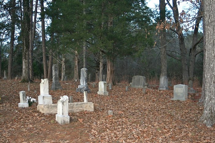
| Description | : | To reach this cemetery from Highway 431, turn west on Highway 144. Turn south on Highway 77. Turn west on Mitchellville Road and travel 0.5 miles. Turn north on Jackson Trace Road. The cemetery is 0.5 miles from the turn on the east side of the road. There are two fenced-in sections divided by a driveway. There are many unmarked graves in this cemetery. |
frequently asked questions (FAQ):
-
Where is Green Cemetery?
Green Cemetery is located at Jackson Trace Road Sulphur Springs (Jacksonville West), Calhoun County ,Alabama ,USA.
-
Green Cemetery cemetery's updated grave count on graveviews.com?
1 memorials
-
Where are the coordinates of the Green Cemetery?
Latitude: 33.6903200
Longitude: -86.0752200

Nearby Cemetories:
1. Green Cemetery
Jacksonville, Calhoun County, USA
Coordinate: 33.6903400, -86.0754600
2. Bailey Springs Cemetery
Sulphur Springs (Francis Mill), Calhoun County, USA
Coordinate: 33.7118988, -86.0781021
3. Mitchell Cemetery
Ohatchee, Calhoun County, USA
Coordinate: 33.7120860, -86.0904810
4. Mount Olive Baptist Church Cemetery
Ohatchee, Calhoun County, USA
Coordinate: 33.7131004, -86.0899963
5. Vinson Cemetery
Sulphur Springs (Jacksonville West), Calhoun County, USA
Coordinate: 33.7056000, -86.0424000
6. Creswell Cemetery
Eastaboga, Calhoun County, USA
Coordinate: 33.6680984, -86.0456009
7. Refuge Baptist Church Cemetery
Lincoln, Talladega County, USA
Coordinate: 33.6552540, -86.1092410
8. Hall Cemetery
Lincoln, Talladega County, USA
Coordinate: 33.6507988, -86.1168976
9. Patton Chapel Community Cemetery
Lincoln, Talladega County, USA
Coordinate: 33.6353000, -86.0694000
10. Wester Cemetery
St. Clair County, USA
Coordinate: 33.6927986, -86.1500015
11. Ragan Chapel Cemetery
Francis, Calhoun County, USA
Coordinate: 33.7510986, -86.0460968
12. Acker's Chapel Church Cemetery
Lincoln, Talladega County, USA
Coordinate: 33.6424560, -86.1344960
13. Saint Mary's Baptist Church Cemetery
Lincoln, Talladega County, USA
Coordinate: 33.6204970, -86.0641910
14. Providence Church Cemetery
Ragland, St. Clair County, USA
Coordinate: 33.7521230, -86.1198090
15. Morning Star Cemetery
Ragland, St. Clair County, USA
Coordinate: 33.7276610, -86.1499840
16. Shady Glen Cemetery
Anniston, Calhoun County, USA
Coordinate: 33.7157600, -85.9924900
17. Pine Grove Baptist Church Cemetery
Lincoln, Talladega County, USA
Coordinate: 33.6266750, -86.1242070
18. Plum Springs Baptist Church Cemetery #02
Old Eastaboga, Talladega County, USA
Coordinate: 33.6230310, -86.0312140
19. Gordon Gravesites
Ragland, St. Clair County, USA
Coordinate: 33.7431080, -86.1452310
20. Townsend-McClellan Cemetery
Talladega County, USA
Coordinate: 33.6154100, -86.1048400
21. Plum Springs Baptist Church Cemetery #01
Old Eastaboga, Talladega County, USA
Coordinate: 33.6225000, -86.0258000
22. Hardins Chapel Cemetery
Ragland, St. Clair County, USA
Coordinate: 33.7133030, -86.1714680
23. Lincoln City Cemetery
Lincoln, Talladega County, USA
Coordinate: 33.6114082, -86.1101074
24. Garden of Memories Cemetery
Ragland, St. Clair County, USA
Coordinate: 33.7393990, -86.1575012