
| Memorials | : | 1 |
| Location | : | Golden Grove, Tea Tree Gully City, Australia |
| Phone | : | +61 8264 1700 |
| Coordinate | : | -34.7849500, 138.7187400 |
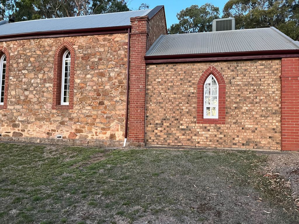
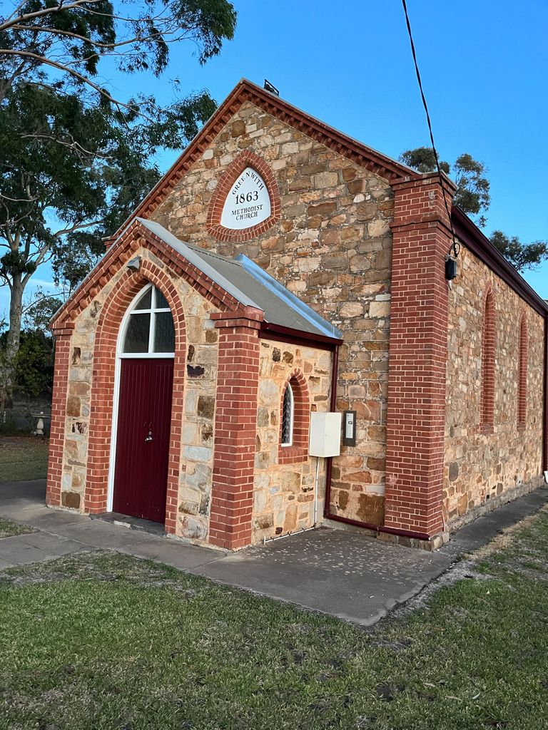
| Description | : | Formely known at Greenwith Methodist Church. In 1863 Mr Paul Roberts son of Thomas Roberts of Greenwith Farm donated the land for a Primitive Methodist church which later became known as the Greenwith Chapel. Before the church was built services were held in the cellar of the home of Thomas and Hannah Roberts. The Foundation stone was laid on 15 November 1863 by Mrs Thomas Roberts. The tender by George Robinson for the masonry work was accepted. The church cost 173 with stone and slate being sourced from local quarries and creeks. The church was to measure 30 feet long x 18... Read More |
frequently asked questions (FAQ):
-
Where is Greenwith Uniting Church?
Greenwith Uniting Church is located at 1245 Golden Grove Rd, Golden Grove SA Golden Grove, Tea Tree Gully City ,South Australia , 5125Australia.
-
Greenwith Uniting Church cemetery's updated grave count on graveviews.com?
1 memorials
-
Where are the coordinates of the Greenwith Uniting Church?
Latitude: -34.7849500
Longitude: 138.7187400
Nearby Cemetories:
1. Golden Grove Uniting Church
Golden Grove, Tea Tree Gully City, Australia
Coordinate: -34.7883129, 138.7091051
2. Golden Grove Cemetery
Golden Grove, Tea Tree Gully City, Australia
Coordinate: -34.7748502, 138.7318420
3. Drumminor Gardens
Ridgehaven, Tea Tree Gully City, Australia
Coordinate: -34.8195240, 138.6968120
4. Little Para Wesleyan Cemetery
Hillbank, Playford City, Australia
Coordinate: -34.7479620, 138.6836570
5. Salisbury Pioneer Catholic Cemetery
Salisbury, Salisbury City, Australia
Coordinate: -34.7627130, 138.6520780
6. Houghton Cemetery
Houghton, Adelaide Hills Council, Australia
Coordinate: -34.8280580, 138.7680070
7. Hope Valley Cemetery
Hope Valley, Tea Tree Gully City, Australia
Coordinate: -34.8441550, 138.6954700
8. St. John's Churchyard
Salisbury, Salisbury City, Australia
Coordinate: -34.7644090, 138.6463600
9. Salisbury Methodist Church Cemetery
Salisbury, Salisbury City, Australia
Coordinate: -34.7616800, 138.6452510
10. Salisbury Memorial Park
Salisbury, Salisbury City, Australia
Coordinate: -34.7737160, 138.6382070
11. One Tree Hill Uniting Church Cemetery
One Tree Hill, Playford City, Australia
Coordinate: -34.7185200, 138.7682710
12. Athelstone Gorge Primitive Methodist Cemetery
Athelstone, Campbelltown City, Australia
Coordinate: -34.8646690, 138.7133650
13. Holy Cross Anglican Church
Elizabeth, Salisbury City, Australia
Coordinate: -34.7147160, 138.6724910
14. Sturton Family Cemetery
Penfield, Playford City, Australia
Coordinate: -34.7255460, 138.6375980
15. Athelstone Independent Cemetery
Athelstone, Campbelltown City, Australia
Coordinate: -34.8744850, 138.6956870
16. Uley Baptist Church Cemetery
Uleybury, Playford City, Australia
Coordinate: -34.6954070, 138.7575960
17. Chain of Ponds Cemetery
Chain of Ponds, Adelaide Hills Council, Australia
Coordinate: -34.8230300, 138.8316500
18. St. Martin's Anglican Church Cemetery
Campbelltown, Campbelltown City, Australia
Coordinate: -34.8762440, 138.6662340
19. Burton Pioneer Cemetery
Paralowie, Salisbury City, Australia
Coordinate: -34.7532480, 138.6013050
20. Kersbrook Wesleyan Methodist Cemetery
Kersbrook, Adelaide Hills Council, Australia
Coordinate: -34.7900482, 138.8482557
21. Kersbrook Cemetery
Kersbrook, Adelaide Hills Council, Australia
Coordinate: -34.8040693, 138.8486109
22. Montacute Cemetery
Montacute, Adelaide Hills Council, Australia
Coordinate: -34.8911600, 138.7505000
23. Cudlee Creek Cemetery
Cudlee Creek, Adelaide Hills Council, Australia
Coordinate: -34.8435390, 138.8342770
24. Enfield Memorial Park
Clearview, Port Adelaide Enfield City, Australia
Coordinate: -34.8580920, 138.6121010