
| Memorials | : | 0 |
| Location | : | Cross Roads, Ozark County, USA |
| Coordinate | : | 36.7057037, -92.2017746 |
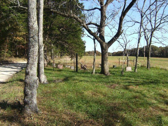
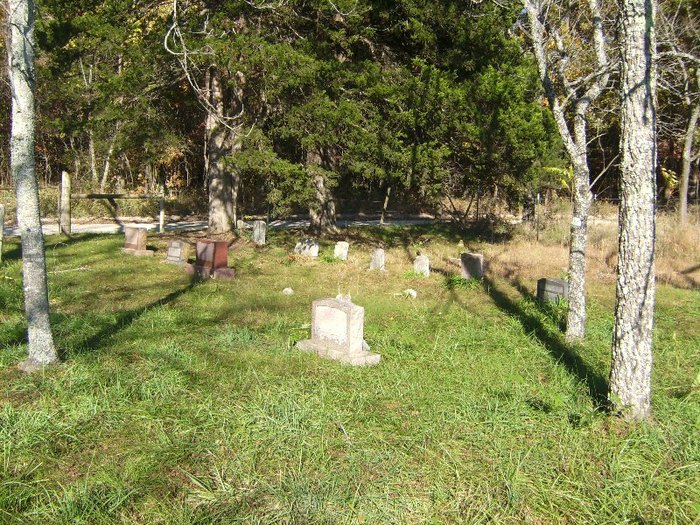
| Description | : | Gunter Family Cemetery T23, R11, S5 County Road 365 to 386, left to cemetery This burial ground, approximately eight-tenths of an acre, lies on land long owned by John R. and Sarah Gunter There are several unmarked graves. The first person to be buried here with an inscribed stone is John R. Gunter's first wife, Ira Tuel Gunter (some say Rachel, some say Martha), 1865-1889. Among other inscribed stones of interest is one giving details of place of birth, where girlhood was spent, marital history, and... Read More |
frequently asked questions (FAQ):
-
Where is Gunter Family Cemetery?
Gunter Family Cemetery is located at Cross Roads, Ozark County ,Missouri ,USA.
-
Gunter Family Cemetery cemetery's updated grave count on graveviews.com?
0 memorials
-
Where are the coordinates of the Gunter Family Cemetery?
Latitude: 36.7057037
Longitude: -92.2017746
Nearby Cemetories:
1. Croney Cemetery
Ozark County, USA
Coordinate: 36.7074900, -92.1838100
2. Woods Cemetery
Ozark County, USA
Coordinate: 36.6842003, -92.2232971
3. Oak Mound Cemetery
Oak Mound, Ozark County, USA
Coordinate: 36.6814003, -92.1793976
4. Ball Cemetery
Dora, Ozark County, USA
Coordinate: 36.7325800, -92.2347700
5. Parsons Cemetery
Ozark County, USA
Coordinate: 36.7433014, -92.2260971
6. Frazier Burial Ground
Dormis, Ozark County, USA
Coordinate: 36.6702766, -92.2480164
7. Frazier Cemetery
Ozark County, USA
Coordinate: 36.6702995, -92.2481003
8. Sanders Cemetery
Sycamore, Ozark County, USA
Coordinate: 36.7064018, -92.2692032
9. Martin Cemetery
Sycamore, Ozark County, USA
Coordinate: 36.6889000, -92.2705994
10. Marshall Cemetery
Elijah, Ozark County, USA
Coordinate: 36.6469002, -92.1678009
11. Dora Cemetery
Ozark County, USA
Coordinate: 36.7782700, -92.2209800
12. County Line Cemetery
Ozark County, USA
Coordinate: 36.7825012, -92.2033005
13. Hale Cemetery
Dora, Ozark County, USA
Coordinate: 36.7799988, -92.2536011
14. Sweeton Pond Cemetery
Dora, Ozark County, USA
Coordinate: 36.7896996, -92.2217026
15. Trail Cemetery
Trail, Ozark County, USA
Coordinate: 36.7736015, -92.2782974
16. James Cemetery
Tecumseh, Ozark County, USA
Coordinate: 36.6255300, -92.2603800
17. Mitts Cemetery
Howell County, USA
Coordinate: 36.7633018, -92.1066971
18. Ledbetter Cemetery
Pottersville, Howell County, USA
Coordinate: 36.7256012, -92.0753021
19. Elijah Church of Christ Cemetery
Elijah, Ozark County, USA
Coordinate: 36.6116982, -92.1456985
20. White Oak Cemetery
Ozark County, USA
Coordinate: 36.6021996, -92.2253036
21. Patrick Cemetery
Luna, Ozark County, USA
Coordinate: 36.6521988, -92.3197021
22. Clear Springs Cemetery
Dawt, Ozark County, USA
Coordinate: 36.6056600, -92.2675400
23. James Isom Burial
Dawt Mill, Ozark County, USA
Coordinate: 36.6093270, -92.2772170
24. Cureall Cemetery
Cureall, Howell County, USA
Coordinate: 36.6713982, -92.0653000