| Memorials | : | 1 |
| Location | : | Aurelia, Cherokee County, USA |
| Coordinate | : | 42.7778400, -95.3781060 |
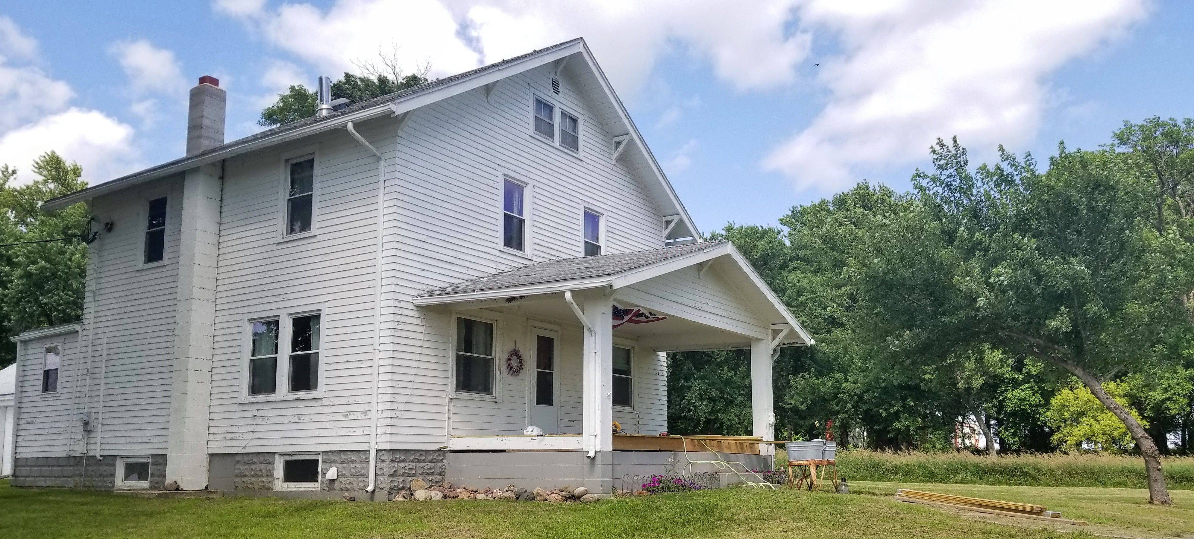
| Description | : | (Note: This is a privately-owned property, but the cemetery may be seen from the road at the lower right corner of the mown lawn before forest line.) The Haight Family Farm was built in 1926 by Howard G. Haight and is still owned by family descendants today. After the passing of Mrs. A. Jeanne Farquhar nee Haight, one of Howard’s daughters, in 2017 (b. 1926), the family chose to have her inurnment at the farm on which she grew up. Mrs. Farquhar is the only individual who has been buried here. |
frequently asked questions (FAQ):
-
Where is Haight Family Farm Cemetery?
Haight Family Farm Cemetery is located at 149 510th Street Aurelia, Cherokee County ,Iowa , 51005USA.
-
Haight Family Farm Cemetery cemetery's updated grave count on graveviews.com?
1 memorials
-
Where are the coordinates of the Haight Family Farm Cemetery?
Latitude: 42.7778400
Longitude: -95.3781060
Nearby Cemetories:
1. Immanuel Lutheran Church Cemetery
Aurelia, Cherokee County, USA
Coordinate: 42.8165000, -95.3885000
2. Plainview Cemetery
Alta, Buena Vista County, USA
Coordinate: 42.8087100, -95.3280200
3. Elk Cemetery
Elk Township, Buena Vista County, USA
Coordinate: 42.7641983, -95.3094025
4. Afton Cemetery
Cherokee County, USA
Coordinate: 42.8064003, -95.4863968
5. Saint Johannes Cemetery
Brooke Township, Buena Vista County, USA
Coordinate: 42.8662758, -95.3669968
6. Pleasant Hill Cemetery
Aurelia, Cherokee County, USA
Coordinate: 42.7024994, -95.4460983
7. Scandinavian Cemetery
Alta, Buena Vista County, USA
Coordinate: 42.6833000, -95.3107986
8. Cherokee County Pioneer Cemetery
Spring Township, Cherokee County, USA
Coordinate: 42.8502998, -95.4906006
9. Woodlawn Cemetery
Alta, Buena Vista County, USA
Coordinate: 42.6730600, -95.2908300
10. Cedar Cemetery
Larrabee, Cherokee County, USA
Coordinate: 42.8361015, -95.5346985
11. Memory Gardens
Cherokee, Cherokee County, USA
Coordinate: 42.7778015, -95.5580978
12. Little Sioux Valley Cemetery
Rembrandt, Buena Vista County, USA
Coordinate: 42.8375015, -95.2074966
13. George Donohoe Grave Site
Cherokee, Cherokee County, USA
Coordinate: 42.7571850, -95.5704080
14. Beacon Hollow Cemetery
Cherokee, Cherokee County, USA
Coordinate: 42.7572057, -95.5727856
15. Fred Feldman Grave
Waterman Township, O'Brien County, USA
Coordinate: 42.9178590, -95.4433340
16. Barnes Township Cemetery
Linn Grove, Buena Vista County, USA
Coordinate: 42.8880997, -95.2397003
17. Oak Hill Cemetery
Cherokee, Cherokee County, USA
Coordinate: 42.7496986, -95.5796967
18. Mount Calvary Cemetery
Cherokee, Cherokee County, USA
Coordinate: 42.7639008, -95.5847015
19. Oakland Cemetery
Peterson, Clay County, USA
Coordinate: 42.9281006, -95.3432999
20. Good Hope Cemetery
Cherokee, Cherokee County, USA
Coordinate: 42.6618996, -95.5258026
21. Hannibal H Waterman Cemetery
O'Brien County, USA
Coordinate: 42.9375530, -95.4170760
22. Buena Vista Memorial Park Cemetery
Storm Lake, Buena Vista County, USA
Coordinate: 42.6539001, -95.2339020
23. Diamond Cemetery
Cherokee County, USA
Coordinate: 42.6156006, -95.4480972
24. Saint John Lutheran Cemetery
Hanover, Buena Vista County, USA
Coordinate: 42.6053467, -95.3725739


