
| Memorials | : | 21 |
| Location | : | Grayson County, USA |
| Coordinate | : | 36.6285830, -81.1168500 |
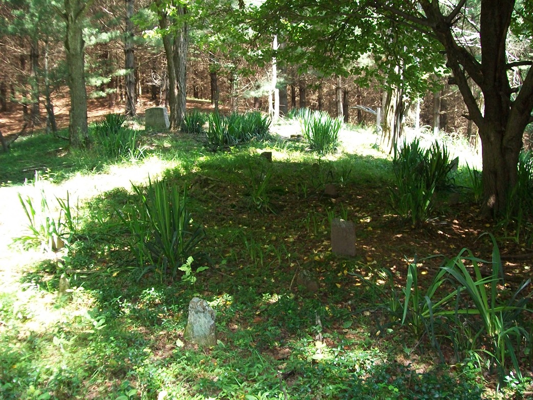
| Description | : | Located past the end of Mystic View Ln., off of Rock Creek Rd. Cross the gate at the end and walk past the old house on the right. Go appx. 50 more yards past the house, cross the fence on the left, and enter the woods. Walk about 50 yards into the woods to reach the cemetery. Most of the graves are marked with fieldstones. additional info from: New River Notes |
frequently asked questions (FAQ):
-
Where is Hall Cemetery?
Hall Cemetery is located at Mystic View Ln Grayson County ,Virginia ,USA.
-
Hall Cemetery cemetery's updated grave count on graveviews.com?
21 memorials
-
Where are the coordinates of the Hall Cemetery?
Latitude: 36.6285830
Longitude: -81.1168500
Nearby Cemetories:
1. Rock Creek Primitive Baptist Church Cemetery
Independence, Grayson County, USA
Coordinate: 36.6311000, -81.1061900
2. Elbert Columbus Fulton Cemetery
Independence, Grayson County, USA
Coordinate: 36.6261000, -81.1358000
3. Flat Rock Cemetery
Independence, Grayson County, USA
Coordinate: 36.6439670, -81.1096540
4. Matthew Dickey Family Cemetery
Independence, Grayson County, USA
Coordinate: 36.6361220, -81.1381460
5. Wyatt McBride Family Cemetery
Independence, Grayson County, USA
Coordinate: 36.6438770, -81.0972940
6. Hale John L Cemetery
Grayson County, USA
Coordinate: 36.6430000, -81.1400000
7. Pleasant Grove Baptist Church Cemetery
Independence, Grayson County, USA
Coordinate: 36.6088660, -81.0972000
8. Chestnut Hill Cemetery
Independence, Grayson County, USA
Coordinate: 36.6506430, -81.1335430
9. Davis Family Cemetery
Independence, Grayson County, USA
Coordinate: 36.6249170, -81.1506460
10. David Sexton Cemetery
Independence, Grayson County, USA
Coordinate: 36.6220000, -81.1510000
11. Lewis Bryant Cemetery
Grayson County, USA
Coordinate: 36.6550630, -81.1305770
12. Fulton Family Cemetery
Independence, Grayson County, USA
Coordinate: 36.6484470, -81.0901500
13. Fleming S Thomas Cemetery
Independence, Grayson County, USA
Coordinate: 36.6158340, -81.1510190
14. Independence Cemetery
Independence, Grayson County, USA
Coordinate: 36.6231660, -81.1546420
15. Bedwell - Wiley Cemetery
Independence, Grayson County, USA
Coordinate: 36.6598600, -81.1152200
16. Independence Town Cemetery
Independence, Grayson County, USA
Coordinate: 36.6260790, -81.1603590
17. Old Bethel Church Cemetery
Independence, Grayson County, USA
Coordinate: 36.5949010, -81.1312190
18. Elliott Cemetery
Independence, Grayson County, USA
Coordinate: 36.5947810, -81.1373240
19. Dickey Cemetery
Independence, Grayson County, USA
Coordinate: 36.6427280, -81.1612680
20. Brush Creek Baptist Church Cemetery
Independence, Grayson County, USA
Coordinate: 36.6023280, -81.1520450
21. Boyer-Poe Cemetery
Independence, Grayson County, USA
Coordinate: 36.6213400, -81.1640800
22. Andrew Hampton Cemetery
Grayson County, USA
Coordinate: 36.6044000, -81.0760100
23. James C. Vaughan Cemetery
Independence, Grayson County, USA
Coordinate: 36.6009420, -81.1552320
24. Pilgrims Rest Primitive Baptist Church Cemetery
Independence, Grayson County, USA
Coordinate: 36.6658330, -81.0933970