
| Memorials | : | 4 |
| Location | : | Portersburg, Clay County, USA |
| Coordinate | : | 37.1574710, -83.9449170 |
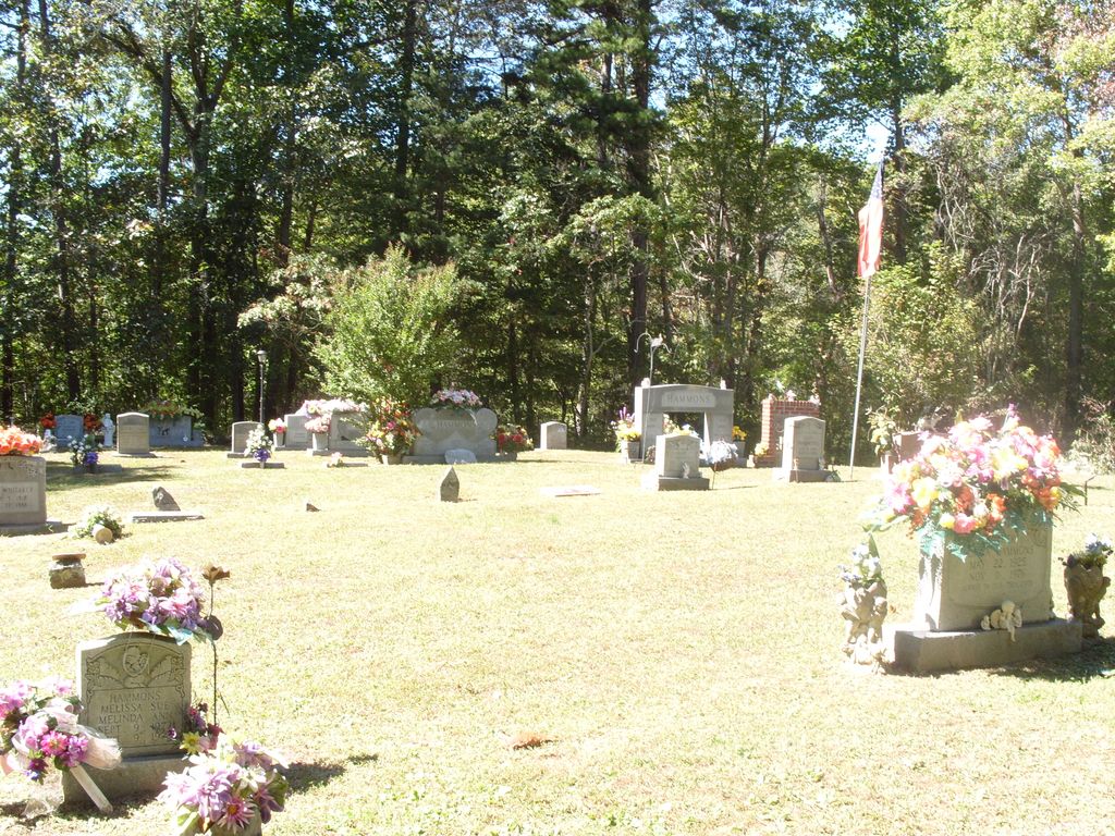
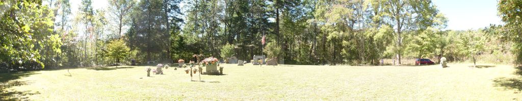
| Description | : | Directions from London. From the intersection of 25 (Main Street) and Hal Rogers Parkway, turn East on Hal Rogers Parkway (9906), go 3.0 miles to Johnson Rd (472). Turn left on Johson Rd. Go 6.7 miles to Pistol Creek Rd (687). Turn right on Pistol Creek. Go 2.5 miles to Portersburg Rd. Turn left onto Portersburg Rd. Go .2 miles, the first road that isn't a driveway is May Cemetery Rd. It is across from several mailboxes and down off a little hill. I have no idea why they named it... Read More |
frequently asked questions (FAQ):
-
Where is Hammons Family Cemetery?
Hammons Family Cemetery is located at Portersburg, Clay County ,Kentucky ,USA.
-
Hammons Family Cemetery cemetery's updated grave count on graveviews.com?
4 memorials
-
Where are the coordinates of the Hammons Family Cemetery?
Latitude: 37.1574710
Longitude: -83.9449170
Nearby Cemetories:
1. Sellards Cemetery
Portersburg, Clay County, USA
Coordinate: 37.1643770, -83.9435240
2. Baker Cemetery
Portersburg, Clay County, USA
Coordinate: 37.1685700, -83.9376900
3. Old Garland Cemetery
Portersburg, Clay County, USA
Coordinate: 37.1686700, -83.9373500
4. Allen Cemetery
Portersburg, Clay County, USA
Coordinate: 37.1767300, -83.9483300
5. Baker Hill Cemetery
Portersburg, Clay County, USA
Coordinate: 37.1698190, -83.9226690
6. Bundy Cemetery
Fogertown, Clay County, USA
Coordinate: 37.1670000, -83.9200000
7. France-Mathis Cemetery
Laurel County, USA
Coordinate: 37.1614560, -83.9736300
8. Hatcher Cemetery
Langnau, Laurel County, USA
Coordinate: 37.1877800, -83.9558300
9. J.R. Bundy Cemetery
Portersburg, Clay County, USA
Coordinate: 37.1462668, -83.9044092
10. Mosley Cemetery
Deer Lick, Clay County, USA
Coordinate: 37.1236000, -83.9213700
11. Wyatts Chapel Cemetery
Langnau, Laurel County, USA
Coordinate: 37.1659851, -83.9934082
12. Martin Cemetery #1
Clay County, USA
Coordinate: 37.1930000, -83.9170000
13. Nicholson Cemetery #1
Brock, Laurel County, USA
Coordinate: 37.1199420, -83.9683780
14. Weaver Missionary Baptist Church Cemetery
Brock, Laurel County, USA
Coordinate: 37.1197790, -83.9681720
15. Brummitt Cemetery
Laurel County, USA
Coordinate: 37.1394420, -83.9962660
16. Creech Cemetery
Clay County, USA
Coordinate: 37.2007210, -83.9284100
17. Cupp Cemetery
Laurel County, USA
Coordinate: 37.1432050, -84.0008210
18. Asher-Vandy Cemetery
Laurel County, USA
Coordinate: 37.1432140, -84.0008460
19. Mount Salem Cemetery
Bush, Laurel County, USA
Coordinate: 37.1068980, -83.9598800
20. Beckham House Cemetery
Laurel County, USA
Coordinate: 37.2075300, -83.9657000
21. East Salem Cemetery
Langnau, Laurel County, USA
Coordinate: 37.1641650, -84.0136450
22. John F. Reams Cemetery
Laurel County, USA
Coordinate: 37.1988970, -83.9944160
23. Brown Cemetery
Laurel County, USA
Coordinate: 37.2021320, -83.9933520
24. Jackson Family Cemetery
Bush, Laurel County, USA
Coordinate: 37.0973000, -83.9378300