
| Memorials | : | 5 |
| Location | : | San Pedro, Los Angeles County, USA |
| Coordinate | : | 33.7221240, -118.2901410 |
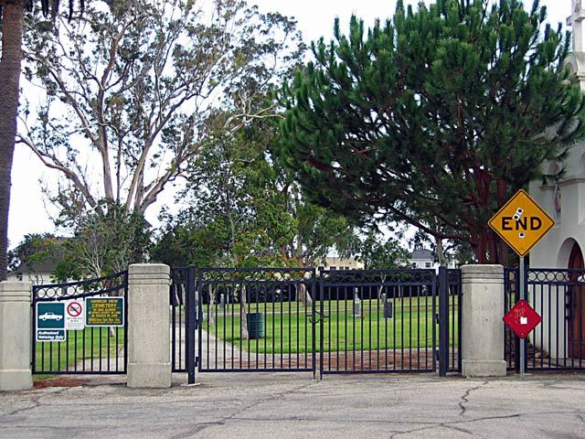
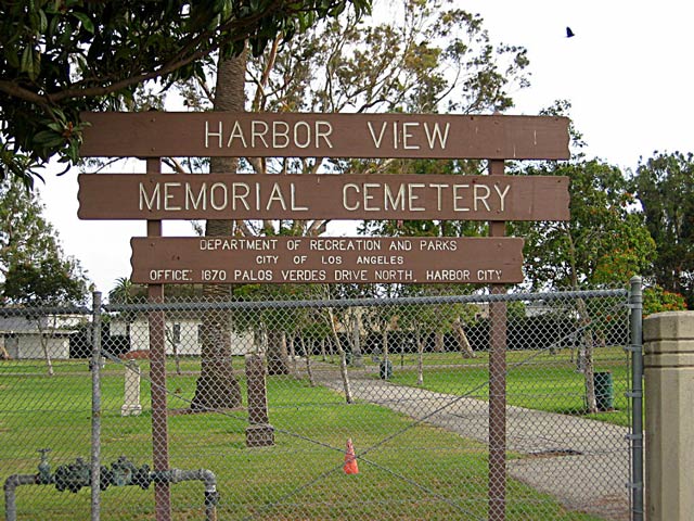
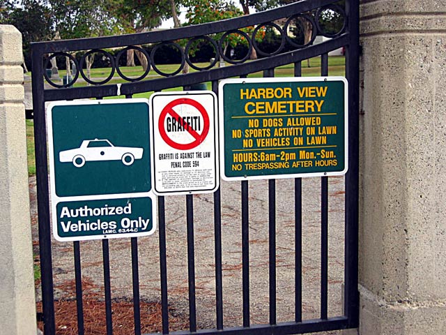
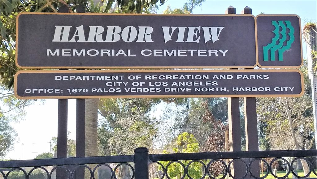
| Description | : | The records for Harbor View Cemetery San Pedro CA are located at the Parks and Recreation office on Anaheim Street near Western Avenue ( I think there are flags out front and trees hide the driveway a bit). The Parks office also said that the original records (that might have a map or additional paperwork) are missing. The man who took care of the cemetery records moved his office and maybe died, and no one knows where he put those files. The South Bay Cities Genealogical Society did a survey of and photographed this cemetery in 2003. |
frequently asked questions (FAQ):
-
Where is Harbor View Cemetery?
Harbor View Cemetery is located at 2411 South Grand San Pedro, Los Angeles County ,California , 90731USA.
-
Harbor View Cemetery cemetery's updated grave count on graveviews.com?
5 memorials
-
Where are the coordinates of the Harbor View Cemetery?
Latitude: 33.7221240
Longitude: -118.2901410
Nearby Cemetories:
1. K-9 Command Cemetery
San Pedro, Los Angeles County, USA
Coordinate: 33.7119636, -118.2961824
2. Saint Peters Episcopal Church Columbarium
San Pedro, Los Angeles County, USA
Coordinate: 33.7370500, -118.3136400
3. Green Hills Memorial Park
Rancho Palos Verdes, Los Angeles County, USA
Coordinate: 33.7731018, -118.3133011
4. Drum Barracks Cemetery (Defunct)
Wilmington, Los Angeles County, USA
Coordinate: 33.7855320, -118.2533170
5. Wilmington Cemetery
Wilmington, Los Angeles County, USA
Coordinate: 33.7922300, -118.2550900
6. Saint John Fisher Columbarium
Rancho Palos Verdes, Los Angeles County, USA
Coordinate: 33.7626800, -118.3693600
7. South Coast Botanical Garden
Palos Verdes Estates, Los Angeles County, USA
Coordinate: 33.7844800, -118.3480100
8. First Lutheran Church and School
Torrance, Los Angeles County, USA
Coordinate: 33.8310400, -118.3388000
9. Saint Lawrence Martyr Church Columbarium
Redondo Beach, Los Angeles County, USA
Coordinate: 33.8177012, -118.3767580
10. Sunnyside Cemetery
Long Beach, Los Angeles County, USA
Coordinate: 33.8044700, -118.1789100
11. Long Beach Municipal Cemetery
Long Beach, Los Angeles County, USA
Coordinate: 33.8044700, -118.1769200
12. All Saints Anglican Church Columbarium
Long Beach, Los Angeles County, USA
Coordinate: 33.7696600, -118.1461300
13. Pet Haven Cemetery
Gardena, Los Angeles County, USA
Coordinate: 33.8642006, -118.2807999
14. Roosevelt Memorial Park
Gardena, Los Angeles County, USA
Coordinate: 33.8643990, -118.2947006
15. Pacific Crest Cemetery
Redondo Beach, Los Angeles County, USA
Coordinate: 33.8675003, -118.3591995
16. Forest Lawn Memorial Park
Long Beach, Los Angeles County, USA
Coordinate: 33.8436012, -118.1691971
17. All Souls Cemetery
Long Beach, Los Angeles County, USA
Coordinate: 33.8405991, -118.1647034
18. Gardena Buddhist Church
Gardena, Los Angeles County, USA
Coordinate: 33.8804950, -118.3023170
19. Palm Cemetery
Long Beach, Los Angeles County, USA
Coordinate: 33.8447200, -118.1682500
20. Lincoln Memorial Park
Carson, Los Angeles County, USA
Coordinate: 33.8806000, -118.2521973
21. Woodlawn Memorial Park
Compton, Los Angeles County, USA
Coordinate: 33.8812700, -118.2468800
22. Saint Gregory Episcopal Church Columbarium
Long Beach, Los Angeles County, USA
Coordinate: 33.8036100, -118.1105600
23. United States Naval Weapons Station Grounds
Seal Beach, Orange County, USA
Coordinate: 33.7505850, -118.0882970
24. Christ Lutheran Church Columbarium
Long Beach, Los Angeles County, USA
Coordinate: 33.7952500, -118.1044100