
| Memorials | : | 77 |
| Location | : | Long Beach, Los Angeles County, USA |
| Phone | : | 562-570-6524 |
| Coordinate | : | 33.8044700, -118.1769200 |
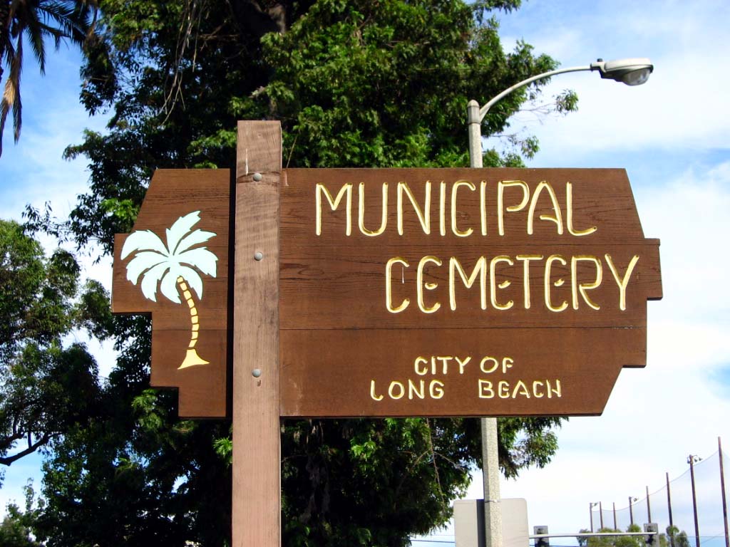
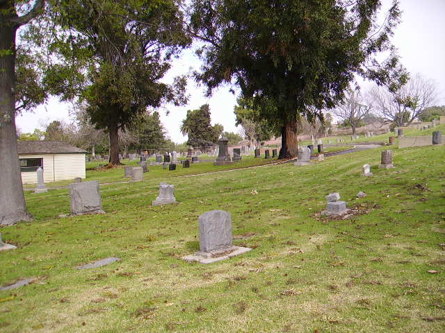
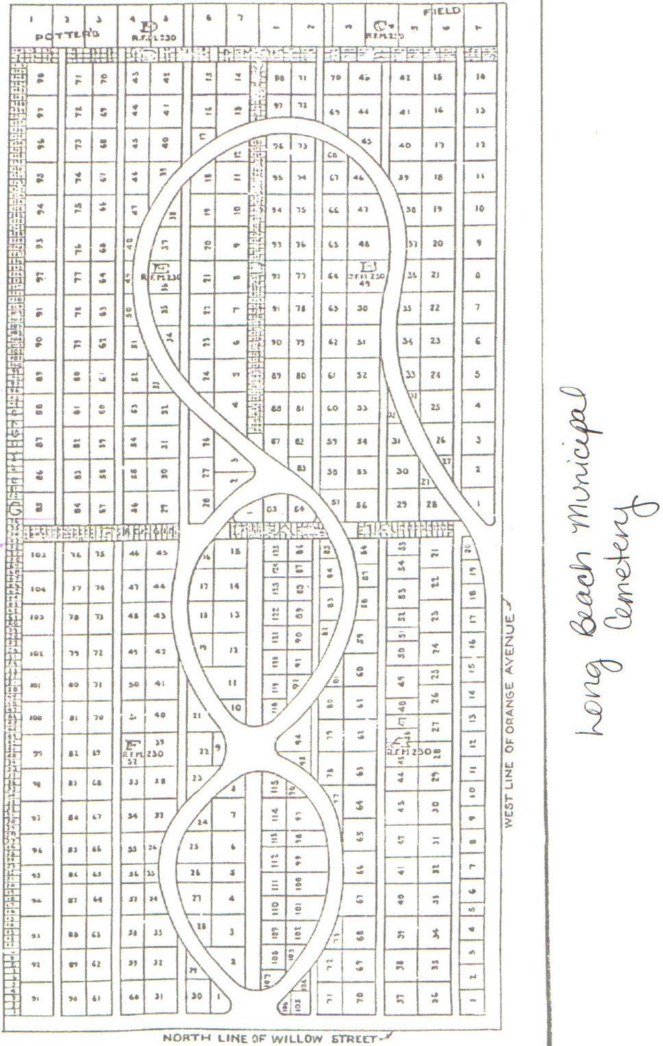
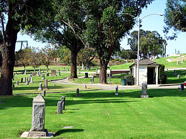
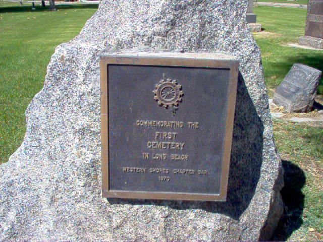
| Description | : | Long Beach Municipal Cemetery was the first Cemetery in Long Beach. It is located on the Corner of Willow Street and Orange Avenue, East of the Sunnyside Cemetery. Its 4.3 acres are maintained and operated by the Department of Parks, Recreation, and Marine. Contact Ken Mason at 562-570-6634 or when you can get the docent to answer, her name is Marie and is at 562-556-6700. |
frequently asked questions (FAQ):
-
Where is Long Beach Municipal Cemetery?
Long Beach Municipal Cemetery is located at 1151 E. Willow St. Long Beach, Los Angeles County ,California , 90806-3438USA.
-
Long Beach Municipal Cemetery cemetery's updated grave count on graveviews.com?
71 memorials
-
Where are the coordinates of the Long Beach Municipal Cemetery?
Latitude: 33.8044700
Longitude: -118.1769200
Nearby Cemetories:
1. Sunnyside Cemetery
Long Beach, Los Angeles County, USA
Coordinate: 33.8044700, -118.1789100
2. All Souls Cemetery
Long Beach, Los Angeles County, USA
Coordinate: 33.8405991, -118.1647034
3. Forest Lawn Memorial Park
Long Beach, Los Angeles County, USA
Coordinate: 33.8436012, -118.1691971
4. Palm Cemetery
Long Beach, Los Angeles County, USA
Coordinate: 33.8447200, -118.1682500
5. All Saints Anglican Church Columbarium
Long Beach, Los Angeles County, USA
Coordinate: 33.7696600, -118.1461300
6. Saint Gregory Episcopal Church Columbarium
Long Beach, Los Angeles County, USA
Coordinate: 33.8036100, -118.1105600
7. Christ Lutheran Church Columbarium
Long Beach, Los Angeles County, USA
Coordinate: 33.7952500, -118.1044100
8. Wilmington Cemetery
Wilmington, Los Angeles County, USA
Coordinate: 33.7922300, -118.2550900
9. Drum Barracks Cemetery (Defunct)
Wilmington, Los Angeles County, USA
Coordinate: 33.7855320, -118.2533170
10. Long Beach Police Academy K-9 Cemetery
Long Beach, Los Angeles County, USA
Coordinate: 33.8274000, -118.0895300
11. United States Naval Weapons Station Grounds
Seal Beach, Orange County, USA
Coordinate: 33.7505850, -118.0882970
12. Artesia Cemetery
Cerritos, Los Angeles County, USA
Coordinate: 33.8717003, -118.0958023
13. Woodlawn Memorial Park
Compton, Los Angeles County, USA
Coordinate: 33.8812700, -118.2468800
14. Angeles Abbey Memorial Park
Compton, Los Angeles County, USA
Coordinate: 33.8982887, -118.2065582
15. Lincoln Memorial Park
Carson, Los Angeles County, USA
Coordinate: 33.8806000, -118.2521973
16. Forest Lawn Memorial Park
Cypress, Orange County, USA
Coordinate: 33.8339005, -118.0560989
17. Pet Haven Cemetery
Gardena, Los Angeles County, USA
Coordinate: 33.8642006, -118.2807999
18. Downey District Cemetery
Downey, Los Angeles County, USA
Coordinate: 33.9102783, -118.1399994
19. Roosevelt Memorial Park
Gardena, Los Angeles County, USA
Coordinate: 33.8643990, -118.2947006
20. Young Israel Cemetery
Norwalk, Los Angeles County, USA
Coordinate: 33.9071000, -118.1081300
21. Green Hills Memorial Park
Rancho Palos Verdes, Los Angeles County, USA
Coordinate: 33.7731018, -118.3133011
22. Los Angeles County Farm Cemetery
Downey, Los Angeles County, USA
Coordinate: 33.9235609, -118.1694582
23. Harbor View Cemetery
San Pedro, Los Angeles County, USA
Coordinate: 33.7221240, -118.2901410
24. Gardena Buddhist Church
Gardena, Los Angeles County, USA
Coordinate: 33.8804950, -118.3023170