
| Memorials | : | 260 |
| Location | : | Hardin Township, Webster County, USA |
| Coordinate | : | 42.2411003, -93.9708023 |
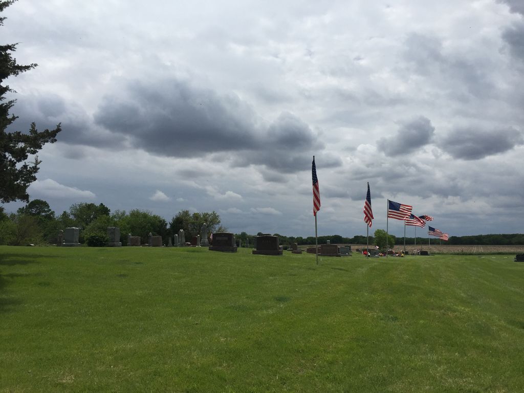
| Description | : | Near Stratford Located outside Stratford, Hamilton, Iowa (which town straddles the line with Webster County) AKA Hardin Township Cemetery or "Richey Cemetery" located in Section 22, 1 mile W, 2 miles S, 1/2 mile W of Stratford, behind farm buildings. Found by driving west up a lane, lies behind a farmer's home. It has over 305 marked graves, mostly Scandinavians. Some of the earlist persons buried here are: Emily Sackrison who died Jan 1, 1855; Mrs. J. Peterson born 1834 died 1877; and Lisa Lundgren born 1806, died 1878. Called Johnson Cemetery on the USGS page. |
frequently asked questions (FAQ):
-
Where is Hardin Township Cemetery?
Hardin Township Cemetery is located at Hardin Township, Webster County ,Iowa ,USA.
-
Hardin Township Cemetery cemetery's updated grave count on graveviews.com?
258 memorials
-
Where are the coordinates of the Hardin Township Cemetery?
Latitude: 42.2411003
Longitude: -93.9708023
Nearby Cemetories:
1. Linn Cemetery
Pilot Mound, Boone County, USA
Coordinate: 42.2045330, -93.9970230
2. White Cemetery
Boone County, USA
Coordinate: 42.1777992, -93.9636002
3. Bass Cemetery
Dayton, Webster County, USA
Coordinate: 42.2966995, -94.0149994
4. Hooks Point Cemetery
Hamilton County, USA
Coordinate: 42.2944530, -93.9199090
5. Oakwood Cemetery
Stratford, Hamilton County, USA
Coordinate: 42.2942009, -93.9182968
6. Runyan Cemetery
Pilot Mound, Boone County, USA
Coordinate: 42.1749992, -94.0015030
7. South Marion Cemetery
Stratford, Hamilton County, USA
Coordinate: 42.2327995, -93.8735962
8. Mineral Ridge Cemetery
Ridgeport, Boone County, USA
Coordinate: 42.1749992, -93.9266968
9. Christ the King Catholic Cemetery
Dayton, Webster County, USA
Coordinate: 42.2601929, -94.0727539
10. Vegors Cemetery
Webster County, USA
Coordinate: 42.3177986, -93.9421997
11. Dayton Cemetery
Dayton, Webster County, USA
Coordinate: 42.2675000, -94.0755000
12. Pilot Mound Cemetery
Pilot Mound, Boone County, USA
Coordinate: 42.1636200, -94.0282600
13. Boone County Poor Farm Cemetery
Boone County, USA
Coordinate: 42.1591100, -93.9159000
14. Schlicht Cemetery
Fraser, Boone County, USA
Coordinate: 42.1444200, -93.9780100
15. McGuire Bend Cemetery
Dayton, Webster County, USA
Coordinate: 42.3410000, -93.9880000
16. Neese Cemetery
Homer, Hamilton County, USA
Coordinate: 42.3250000, -93.8935000
17. Nesse Cemetery
Hamilton County, USA
Coordinate: 42.3250008, -93.8933029
18. Swedish Lutheran Church Cemetery
Dayton, Webster County, USA
Coordinate: 42.2175000, -94.1065000
19. Lawn Cemetery
Boone County, USA
Coordinate: 42.1771011, -94.0867996
20. Oak Grove Cemetery
Lehigh, Webster County, USA
Coordinate: 42.3438988, -94.0475006
21. Hartman Cemetery
Lehigh, Webster County, USA
Coordinate: 42.3666397, -93.9835627
22. Union Cemetery
Boxholm, Boone County, USA
Coordinate: 42.1369019, -94.0852966
23. Hickory Grove Cemetery
Boone County, USA
Coordinate: 42.1074982, -93.9507980
24. Homer Cemetery
Homer, Hamilton County, USA
Coordinate: 42.3680992, -93.9088974