
| Memorials | : | 0 |
| Location | : | Hari Hari, Westland District, New Zealand |
| Coordinate | : | -43.1501430, 170.5576110 |
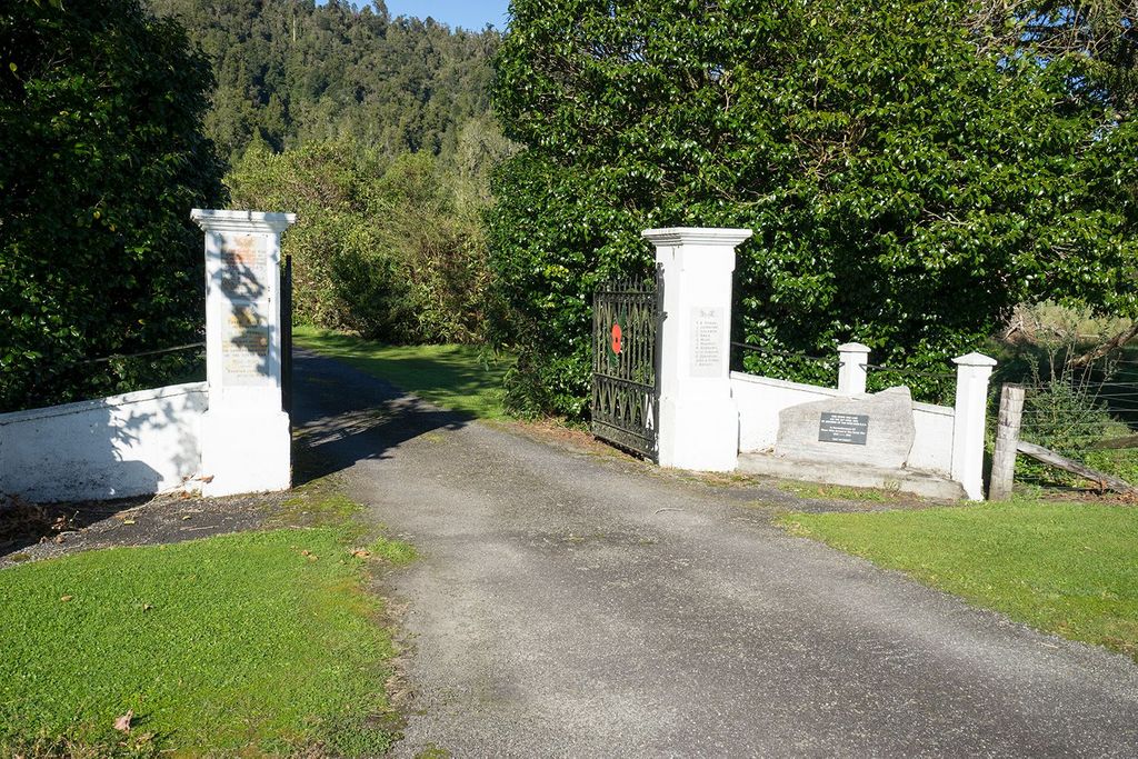
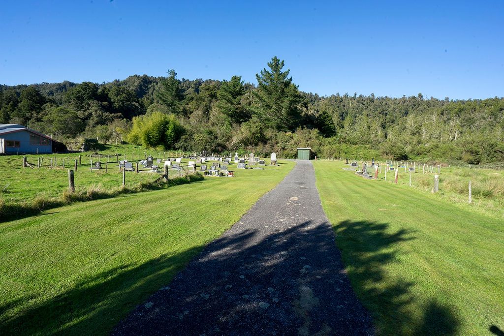
| Description | : | Hari Hari Cemetery is situated on the State Highway 6 at the southern end of the rural settlement of Hari Hari. Access to the cemetery is gained via the War Memorial Gates and up a tree lined drive. The gates have a plaque memorialising 11 locals who died during the First World War and 4 locals who died during the Second World War. It has also seen the addition of a river stone and plaque commemorating those who served during the Great War. The stone and plaque are located in the right hand corner of the gate. Additionally 11 oak... Read More |
frequently asked questions (FAQ):
-
Where is Hari Hari Cemetery?
Hari Hari Cemetery is located at Main Rd Hari Hari, Westland District ,West Coast , 7884New Zealand.
-
Hari Hari Cemetery cemetery's updated grave count on graveviews.com?
0 memorials
-
Where are the coordinates of the Hari Hari Cemetery?
Latitude: -43.1501430
Longitude: 170.5576110
Nearby Cemetories:
1. Whataroa Cemetery
Whataroa, Westland District, New Zealand
Coordinate: -43.2530190, 170.3587130
2. Ross Historic Cemetery
Ross, Westland District, New Zealand
Coordinate: -42.9023200, 170.8113230
3. Ross Cemetery
Ross, Westland District, New Zealand
Coordinate: -42.8898440, 170.8226160
4. Our Lady of the Snows Cemetery
Fox Glacier, Westland District, New Zealand
Coordinate: -43.4623130, 170.0077480
5. Hokitika Municipal Cemetery
Hokitika, Westland District, New Zealand
Coordinate: -42.7102940, 170.9759800
6. Gillespies Beach Miners Cemetery
Fox Glacier, Westland District, New Zealand
Coordinate: -43.4184830, 169.8219480
7. Old Stafford Cemetery
Hokitika, Westland District, New Zealand
Coordinate: -42.6662370, 171.0893140
8. Karangarua Cemetery
Karangarua, Westland District, New Zealand
Coordinate: -43.5287190, 169.8466200
9. Kumara Cemetery
Kumara, Westland District, New Zealand
Coordinate: -42.6464650, 171.1721970
10. Thomas Burnett Gravesite
Lake Pukaki, Mackenzie District, New Zealand
Coordinate: -43.7990580, 170.1542130
11. Upper Rangitata Cemetery
Rangitata, Timaru District, New Zealand
Coordinate: -43.7575112, 171.0907394
12. John Lloyd's Grave
Aoraki Mount Cook, Mackenzie District, New Zealand
Coordinate: -43.7950580, 170.1078163
13. Greenstone Cemetery
Kumara, Westland District, New Zealand
Coordinate: -42.6361450, 171.2751350
14. Lake Coleridge Cemetery
Lake Coleridge, Selwyn District, New Zealand
Coordinate: -43.3695530, 171.5264300
15. Gladstone Cemetery
Greymouth, Grey District, New Zealand
Coordinate: -42.5381220, 171.1522540
16. John Brown's Grave
Aoraki Mount Cook, Mackenzie District, New Zealand
Coordinate: -43.8285602, 170.1105843
17. Mount Cook Station Cemetery
Lake Tekapo, Mackenzie District, New Zealand
Coordinate: -43.8563980, 170.1735700
18. Mt Somers Old Cemetery
Mount Somers, Ashburton District, New Zealand
Coordinate: -43.7050700, 171.3969000
19. Karoro Cemetery
Greymouth, Grey District, New Zealand
Coordinate: -42.4678260, 171.1893800
20. Mount Somers Cemetery
Mount Somers, Ashburton District, New Zealand
Coordinate: -43.7093900, 171.3962830
21. Alford Forest Cemetery
Alford Forest, Ashburton District, New Zealand
Coordinate: -43.6428200, 171.4933300
22. St Pauls Methodist Church (Defunct)
Greymouth, Grey District, New Zealand
Coordinate: -42.4500880, 171.2114610
23. Church of the Holy Innocents Churchyard
Peel Forest, Timaru District, New Zealand
Coordinate: -43.8398520, 171.2471820
24. Cobden Cemetery
Greymouth, Grey District, New Zealand
Coordinate: -42.4371700, 171.2019000