| Memorials | : | 0 |
| Location | : | Aoraki Mount Cook, Mackenzie District, New Zealand |
| Coordinate | : | -43.8285602, 170.1105843 |
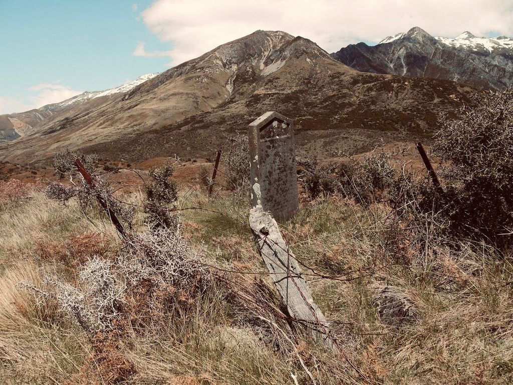
| Description | : | In the 1870's John Brown, from the Isle of Skye, was the head shepherd for "Glentanner" was out snowraking with his friend Browning. Browning returned to camp and realised Brown had not returned from down Fred's Creek. Fred Creek, some six miles upstream from Glentanner, was named after a Glentanner shepherd, Fred Baker, in the 1860's. Thinking Brown had gone to the Birch Hill homestead Browning did not look for him. Three days later Browning arrived at the Birch Hill homestead and Brown was not there. A search party was organised and Andrew Burnett advised that a Highland shepherd would... Read More |
frequently asked questions (FAQ):
-
Where is John Brown's Grave?
John Brown's Grave is located at Aoraki Mount Cook, Mackenzie District ,Canterbury ,New Zealand.
-
John Brown's Grave cemetery's updated grave count on graveviews.com?
0 memorials
-
Where are the coordinates of the John Brown's Grave?
Latitude: -43.8285602
Longitude: 170.1105843
Nearby Cemetories:
1. John Lloyd's Grave
Aoraki Mount Cook, Mackenzie District, New Zealand
Coordinate: -43.7950580, 170.1078163
2. Thomas Burnett Gravesite
Lake Pukaki, Mackenzie District, New Zealand
Coordinate: -43.7990580, 170.1542130
3. Mount Cook Station Cemetery
Lake Tekapo, Mackenzie District, New Zealand
Coordinate: -43.8563980, 170.1735700
4. Tekapo Cemetery
Lake Tekapo, Mackenzie District, New Zealand
Coordinate: -44.0131750, 170.4890150
5. Karangarua Cemetery
Karangarua, Westland District, New Zealand
Coordinate: -43.5287190, 169.8466200
6. Our Lady of the Snows Cemetery
Fox Glacier, Westland District, New Zealand
Coordinate: -43.4623130, 170.0077480
7. Twizel Cemetery
Twizel, Mackenzie District, New Zealand
Coordinate: -44.2455550, 170.0921950
8. Morrison Cemetery
Ohau, Mackenzie District, New Zealand
Coordinate: -44.2810700, 170.0830880
9. Gillespies Beach Miners Cemetery
Fox Glacier, Westland District, New Zealand
Coordinate: -43.4184830, 169.8219480
10. Burkes Pass Cemetery
Burkes Pass, Mackenzie District, New Zealand
Coordinate: -44.0897270, 170.6426950
11. Fairlie Cemetery
Fairlie, Mackenzie District, New Zealand
Coordinate: -44.1075700, 170.8301500
12. Whataroa Cemetery
Whataroa, Westland District, New Zealand
Coordinate: -43.2530190, 170.3587130
13. Omarama Cemetery
Omarama, Waitaki District, New Zealand
Coordinate: -44.4518010, 169.9792570
14. Old Omarama Cemetery
Omarama, Waitaki District, New Zealand
Coordinate: -44.4917970, 169.9673490
15. Albury Cemetery
Albury, Mackenzie District, New Zealand
Coordinate: -44.2371220, 170.8736570
16. Upper Rangitata Cemetery
Rangitata, Timaru District, New Zealand
Coordinate: -43.7575112, 171.0907394
17. St David’s Anglican Churchyard
Mackenzie District, New Zealand
Coordinate: -44.1706380, 170.9887810
18. Hari Hari Cemetery
Hari Hari, Westland District, New Zealand
Coordinate: -43.1501430, 170.5576110
19. Burnett Family Cemetery
Cave, Timaru District, New Zealand
Coordinate: -44.3156830, 170.9457270
20. Old Otematata Cemetery
Otematata, Waitaki District, New Zealand
Coordinate: -44.6067230, 170.2109190
21. Saint Aidan's Churchyard
Geraldine, Timaru District, New Zealand
Coordinate: -44.1544420, 171.0980340
22. Makarora Cemetery
Makarora, Queenstown-Lakes District, New Zealand
Coordinate: -44.2838080, 169.2032950
23. Church of the Holy Innocents Churchyard
Peel Forest, Timaru District, New Zealand
Coordinate: -43.8398520, 171.2471820
24. Woodbury Cemetery
Woodbury, Timaru District, New Zealand
Coordinate: -44.0360900, 171.2127000

