
| Memorials | : | 8 |
| Location | : | Mount Airy, Surry County, USA |
| Coordinate | : | 36.4148120, -80.6607750 |
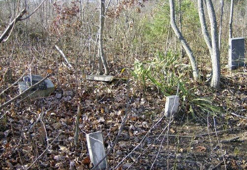
| Description | : | Directions for finding the cemetery starting at the intersection of US Hwy 52 and US 601 in Mt. Airy head south on US Hwy 601 for 1.35 miles and turn left on Old US Hwy 601. Travel 3.2 miles and turn left on Fireside Lane. Go 0.3 mile on Fireside Lane and trun right onto Turner Mtn. Rd and travel 1.5 miles to a unpaved dirt road on the right that leads partway up the mountain. A Good off road vehicle is advised on this road or just walk to the end of the road. At the end of the... Read More |
frequently asked questions (FAQ):
-
Where is Harrell-Lewis Family Cemetery?
Harrell-Lewis Family Cemetery is located at Mount Airy, Surry County ,North Carolina ,USA.
-
Harrell-Lewis Family Cemetery cemetery's updated grave count on graveviews.com?
8 memorials
-
Where are the coordinates of the Harrell-Lewis Family Cemetery?
Latitude: 36.4148120
Longitude: -80.6607750
Nearby Cemetories:
1. Marion Family Cemetery
Dobson, Surry County, USA
Coordinate: 36.4101530, -80.6633480
2. Piney Grove Baptist Church Cemetery
White Plains, Surry County, USA
Coordinate: 36.4138080, -80.6742100
3. Venable Family Cemetery
Surry County, USA
Coordinate: 36.4045315, -80.6444179
4. Blackwater Community Church Cemetery
Black Water, Surry County, USA
Coordinate: 36.4019720, -80.6393330
5. Turkey Ford Baptist Church Cemetery
Turkey Ford, Surry County, USA
Coordinate: 36.3866360, -80.6636720
6. The Community Church Cemetery
Mount Airy, Surry County, USA
Coordinate: 36.3986860, -80.6312360
7. Community Church Cemetery
Black Water, Surry County, USA
Coordinate: 36.3986300, -80.6312750
8. Dover Baptist Church Cemetery
White Plains, Surry County, USA
Coordinate: 36.4376678, -80.6373901
9. Gordon Cemetery
Mount Airy, Surry County, USA
Coordinate: 36.4234440, -80.6966390
10. Masadona Cemetery
Dobson, Surry County, USA
Coordinate: 36.4321940, -80.6973270
11. Kidd Family Cemetery
Dobson, Surry County, USA
Coordinate: 36.3844530, -80.6805900
12. Blackwater United Methodist Church Cemetery
Black Water, Surry County, USA
Coordinate: 36.3976220, -80.6236920
13. Old Fisher River Church Cemetery
Dobson, Surry County, USA
Coordinate: 36.4304420, -80.6992580
14. Fisher River Primitive Baptist Church Cemetery
Dobson, Surry County, USA
Coordinate: 36.4112220, -80.7046110
15. Badgett Family Cemetery
Mount Airy, Surry County, USA
Coordinate: 36.4122500, -80.7061670
16. Collins Family Cemetery
Dobson, Surry County, USA
Coordinate: 36.3971190, -80.7027550
17. Church of God Cemetery
Dobson, Surry County, USA
Coordinate: 36.3982460, -80.7046440
18. Dobson Church of God
Dobson, Surry County, USA
Coordinate: 36.3975040, -80.7043410
19. Copeland Home Graveyard
Dobson, Surry County, USA
Coordinate: 36.4223490, -80.7089350
20. White Plains Friends Meeting Cemetery
White Plains, Surry County, USA
Coordinate: 36.4478607, -80.6326141
21. Hutchens-Venable Family Cemetery
Mount Airy, Surry County, USA
Coordinate: 36.4309170, -80.6131390
22. Union Primitive Baptist Church Cemetery
Black Water, Surry County, USA
Coordinate: 36.3821983, -80.6282425
23. Little Mountain Baptist Church Cemetery
Ararat, Surry County, USA
Coordinate: 36.4213066, -80.6090012
24. Blues Grove Baptist Church Cemetery
Red Brush, Surry County, USA
Coordinate: 36.4382210, -80.7058334