
| Memorials | : | 91 |
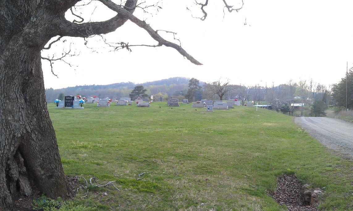
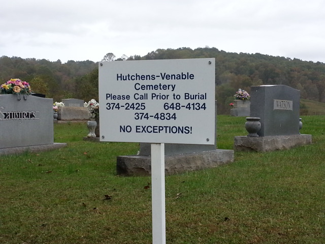
| Location | : | Mount Airy, Surry County, USA |
| Coordinate | : | 36.4309170, -80.6131390 |
| Description | : | Beginning at the intersection of Hwy 52 and Hwy 601 in Mt. Airy, go west on Hwy 601 for abt 1.5 miles and turn left on Old US Hwy 601. Then go abt 1.5 miles and turn left on Siloam Rd (SR 1003). Then go abt 1.5 miles and turn left on Venable Farm Road and the cemetery will be ahead of you a few yards but not visible from Siloam Rd. |
frequently asked questions (FAQ):
-
Where is Hutchens-Venable Family Cemetery?
Hutchens-Venable Family Cemetery is located at Venable Farm Rd Mount Airy, Surry County ,North Carolina ,USA.
-
Hutchens-Venable Family Cemetery cemetery's updated grave count on graveviews.com?
91 memorials
-
Where are the coordinates of the Hutchens-Venable Family Cemetery?
Latitude: 36.4309170
Longitude: -80.6131390
Nearby Cemetories:
1. Little Mountain Baptist Church Cemetery
Ararat, Surry County, USA
Coordinate: 36.4213066, -80.6090012
2. Dover Baptist Church Cemetery
White Plains, Surry County, USA
Coordinate: 36.4376678, -80.6373901
3. White Plains Friends Meeting Cemetery
White Plains, Surry County, USA
Coordinate: 36.4478607, -80.6326141
4. Charles Beck Family Cemetery
Ararat, Surry County, USA
Coordinate: 36.4147800, -80.5909700
5. Doss Cemetery
Mount Airy, Surry County, USA
Coordinate: 36.4553337, -80.6131363
6. Watson Cemetery
Ararat, Surry County, USA
Coordinate: 36.4254140, -80.5822060
7. White Plains Baptist Church Cemetery
White Plains, Surry County, USA
Coordinate: 36.4534820, -80.6296600
8. Lawson and Sawyers Family Cemetery
Ararat, Surry County, USA
Coordinate: 36.4144700, -80.5837500
9. Johnson Family Cemetery
Ararat, Surry County, USA
Coordinate: 36.4050833, -80.5928333
10. W.C. Hiatt Cemetery
Mount Airy, Surry County, USA
Coordinate: 36.4484329, -80.5796204
11. Blackwater United Methodist Church Cemetery
Black Water, Surry County, USA
Coordinate: 36.3976220, -80.6236920
12. The Community Church Cemetery
Mount Airy, Surry County, USA
Coordinate: 36.3986860, -80.6312360
13. Community Church Cemetery
Black Water, Surry County, USA
Coordinate: 36.3986300, -80.6312750
14. Blackwater Community Church Cemetery
Black Water, Surry County, USA
Coordinate: 36.4019720, -80.6393330
15. Venable Family Cemetery
Surry County, USA
Coordinate: 36.4045315, -80.6444179
16. Bryant-Simpson Cemetery
Eldora Township, Surry County, USA
Coordinate: 36.3991900, -80.5871100
17. Bryant Chapel Baptist Church Cemetery
Ararat, Surry County, USA
Coordinate: 36.4106840, -80.5728080
18. Harrell-Lewis Family Cemetery
Mount Airy, Surry County, USA
Coordinate: 36.4148120, -80.6607750
19. McGee Cemetery
Mount Airy, Surry County, USA
Coordinate: 36.4550800, -80.5700400
20. Marion Family Cemetery
Dobson, Surry County, USA
Coordinate: 36.4101530, -80.6633480
21. Mount Zion Baptist Church Cemetery
Ash Hill, Surry County, USA
Coordinate: 36.3949432, -80.5725021
22. Skyline Memory Gardens
Mount Airy, Surry County, USA
Coordinate: 36.4745610, -80.5856500
23. Union Primitive Baptist Church Cemetery
Black Water, Surry County, USA
Coordinate: 36.3821983, -80.6282425
24. Dunbar Cemetery
Mount Airy, Surry County, USA
Coordinate: 36.4690010, -80.6567720