
| Memorials | : | 35 |
| Location | : | Hannibal, Monroe County, USA |
| Coordinate | : | 39.6756020, -80.8692880 |
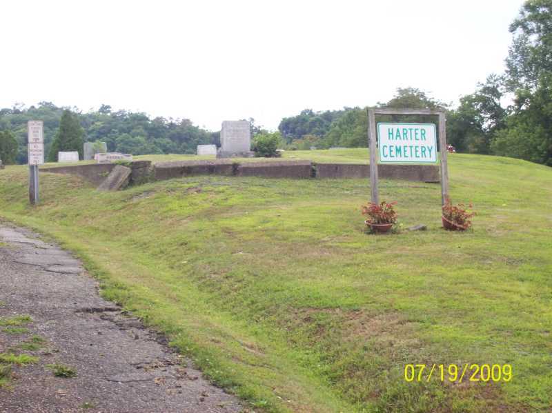
| Description | : | The cemetery is located at the west end of Harter Cemetery Road about 225 feet west of its junction with Ohio River Scenic Byway (Ohio State Route 7). The cemetery was established in 1869 and is 1.53 acres in size. The cemetery is located in Ohio Township, Monroe County, Ohio, and is # 15218 (Harter Cemetery / Hannibal Cemetery) and # 8137 (Harter Cemetery / Hannibal Cemetery) in “Ohio Cemeteries 1803-2003”, compiled by the Ohio Genealogical Society. The cemetery is registered with the Ohio Division of Real Estate and Professional Licensing (ODRE) as Harter Cemetery with registration license number... Read More |
frequently asked questions (FAQ):
-
Where is Harter Cemetery?
Harter Cemetery is located at Harter Cemetery Road Hannibal, Monroe County ,Ohio , 43915USA.
-
Harter Cemetery cemetery's updated grave count on graveviews.com?
31 memorials
-
Where are the coordinates of the Harter Cemetery?
Latitude: 39.6756020
Longitude: -80.8692880
Nearby Cemetories:
1. Emma Grove Cemetery
Hannibal, Monroe County, USA
Coordinate: 39.6713982, -80.8752975
2. Greenlawn Memorial Park
New Martinsville, Wetzel County, USA
Coordinate: 39.6755981, -80.8591995
3. Old Hannibal Cemetery
Monroe County, USA
Coordinate: 39.6669810, -80.8692950
4. Northview Cemetery
New Martinsville, Wetzel County, USA
Coordinate: 39.6730995, -80.8566971
5. Williams Cemetery
New Martinsville, Wetzel County, USA
Coordinate: 39.6688995, -80.8589020
6. Mount Union Cemetery
Hannibal, Monroe County, USA
Coordinate: 39.7003500, -80.8839900
7. Zion Memorial Gardens
Sardis, Monroe County, USA
Coordinate: 39.6788630, -80.9093820
8. Zion Evangelical Cemetery
Hannibal, Monroe County, USA
Coordinate: 39.6816400, -80.9091800
9. Duffy Cemetery
Duffy, Monroe County, USA
Coordinate: 39.6436190, -80.8730500
10. Buck Hill Bottom Cemetery
Hannibal, Monroe County, USA
Coordinate: 39.7022980, -80.8412070
11. Mount Vernon Cemetery
Clarington, Monroe County, USA
Coordinate: 39.7120207, -80.8634298
12. Apostolic Church Cemetery
Ohio Township, Monroe County, USA
Coordinate: 39.6554460, -80.9092250
13. Saint Johns Methodist Church Cemetery
Goodwin, Monroe County, USA
Coordinate: 39.6684914, -80.9221802
14. Parsons Cemetery
Wetzel County, USA
Coordinate: 39.6831017, -80.8135986
15. Lude Cemetery
Clarington, Monroe County, USA
Coordinate: 39.7189270, -80.8792370
16. Walker Cemetery
New Martinsville, Wetzel County, USA
Coordinate: 39.6310997, -80.8589020
17. Huff Family Cemetery
Wetzel County, USA
Coordinate: 39.6727982, -80.8050003
18. Ollum Cemetery
Monroe County, USA
Coordinate: 39.7259100, -80.8631500
19. Mount Zion Cemetery
Wetzel County, USA
Coordinate: 39.6735992, -80.8016968
20. Bokelman Cemetery
Wetzel County, USA
Coordinate: 39.6576881, -80.8044205
21. Huff Cemetery
Wetzel County, USA
Coordinate: 39.6685982, -80.7994003
22. Baxter Cemetery
Wetzel County, USA
Coordinate: 39.7014008, -80.8022003
23. Wayman Cemetery
Fairview, Wetzel County, USA
Coordinate: 39.7012130, -80.7999680
24. Sardis Cemetery
Sardis, Monroe County, USA
Coordinate: 39.6259100, -80.9151000