
| Memorials | : | 45 |
| Location | : | Spencerville, Allen County, USA |
| Coordinate | : | 40.7386017, -84.3158035 |
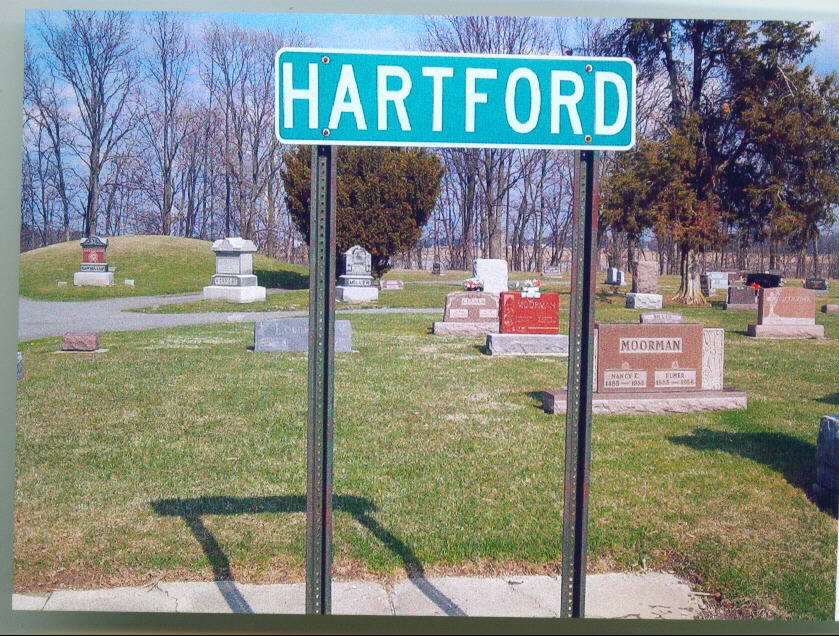
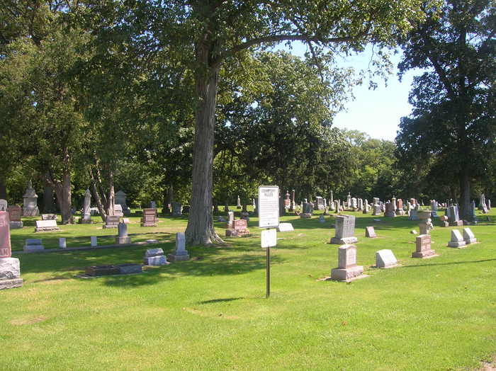
| Description | : | There is a separate cemetery called Old Hartford Cemetery, which is different than this one. The cemetery is located on the east side of Allentown Road / Defiance Trail (Ohio State Route 81). The cemetery is located in Amada Township, Allen County, Ohio, and is # 124 (New Hartford Cemetery / Hartford Association Cemetery / Hartford Cemetery) in “Ohio Cemeteries 1803-2003”, compiled by the Ohio Genealogical Society. The cemetery is registered with the Ohio Division of Real Estate and Professional Licensing (ODRE) as Hartford Cemetery with registration license number CGR.0000981332. The U.S. Geological Survey (USGS) Geographic Names... Read More |
frequently asked questions (FAQ):
-
Where is Hartford Cemetery?
Hartford Cemetery is located at 300 Defiance Trail Spencerville, Allen County ,Ohio , 45887USA.
-
Hartford Cemetery cemetery's updated grave count on graveviews.com?
41 memorials
-
Where are the coordinates of the Hartford Cemetery?
Latitude: 40.7386017
Longitude: -84.3158035


Nearby Cemetories:
1. Old Hartford Cemetery
Allen County, USA
Coordinate: 40.7371788, -84.3140564
2. Moeller Family Cemetery
Spencerville, Allen County, USA
Coordinate: 40.7070990, -84.3001040
3. Amanda Baptist Church Cemetery
Spencerville, Allen County, USA
Coordinate: 40.7094002, -84.2797012
4. Maplewood Cemetery
Spencerville, Allen County, USA
Coordinate: 40.7085991, -84.2789001
5. West Union Cemetery
Spencerville, Allen County, USA
Coordinate: 40.7574997, -84.3641968
6. Saint Patricks Cemetery
Spencerville, Allen County, USA
Coordinate: 40.7030983, -84.3585968
7. Spencerville Cemetery
Spencerville, Allen County, USA
Coordinate: 40.7002983, -84.3566971
8. Mack Cemetery
Spencerville, Allen County, USA
Coordinate: 40.6858120, -84.3109060
9. Fissel Lauth Cemetery
Van Wert County, USA
Coordinate: 40.7216988, -84.3972015
10. Fort Amanda National Cemetery
Auglaize County, USA
Coordinate: 40.6819000, -84.2699966
11. German Zion Cemetery
Logan Township, Auglaize County, USA
Coordinate: 40.6715889, -84.3174896
12. Pike Cemetery
Elida, Allen County, USA
Coordinate: 40.7947006, -84.2585983
13. King Cemetery
Marion Township, Allen County, USA
Coordinate: 40.8060989, -84.2869034
14. Mount Union Cemetery
Auglaize County, USA
Coordinate: 40.6781006, -84.3771973
15. Sharon Mennonite Cemetery
Elida, Allen County, USA
Coordinate: 40.7828080, -84.2332721
16. Hance Cemetery
Converse, Van Wert County, USA
Coordinate: 40.7142000, -84.4136000
17. Saint John the Baptist Catholic Cemetery
Landeck, Allen County, USA
Coordinate: 40.7999992, -84.3874969
18. Kossuth Cemetery
Kossuth, Auglaize County, USA
Coordinate: 40.6582985, -84.3471985
19. Doner Cemetery
Elida, Allen County, USA
Coordinate: 40.7951330, -84.2277470
20. Allentown Cemetery
Allentown, Allen County, USA
Coordinate: 40.7539540, -84.1987040
21. Greenlawn Cemetery
Elida, Allen County, USA
Coordinate: 40.7691994, -84.2024994
22. Wright Cemetery
Venedocia, Van Wert County, USA
Coordinate: 40.7543983, -84.4356003
23. Walnut Grove Cemetery
Delphos, Allen County, USA
Coordinate: 40.8300018, -84.2906036
24. Lutheran Cemetery
Elida, Allen County, USA
Coordinate: 40.7877998, -84.2050018