
| Memorials | : | 0 |
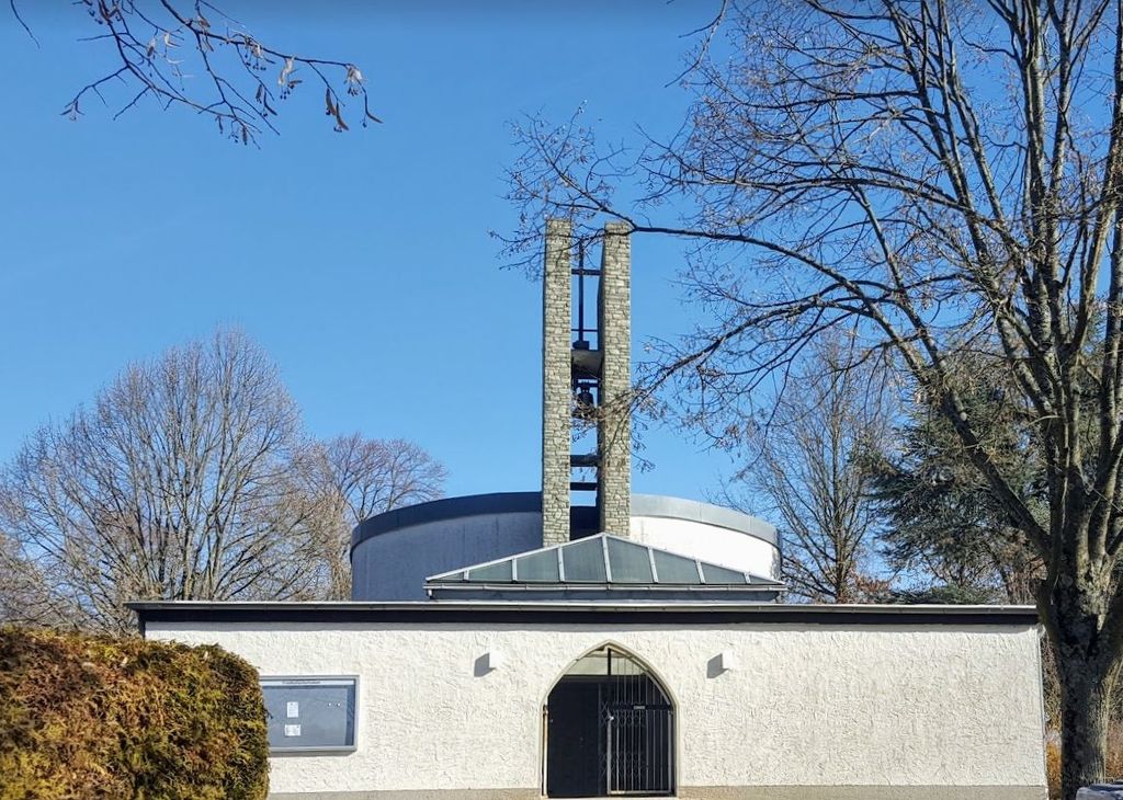
| Location | : | Friedrichsdorf, Hochtaunuskreis, Germany |
| Website | : | www.friedrichsdorf.de/lebeninfriedrichsdorf/unserestadt/oeffentlicheeinrichtungen/friedhoefe.php |
| Coordinate | : | 50.2496200, 8.6428100 |
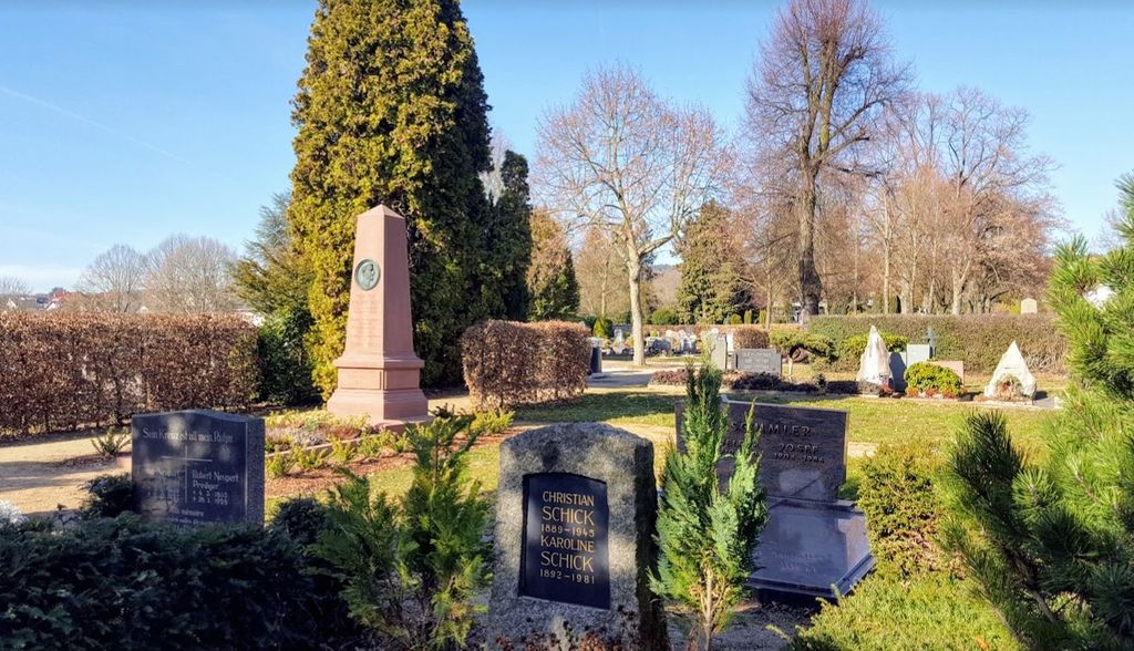
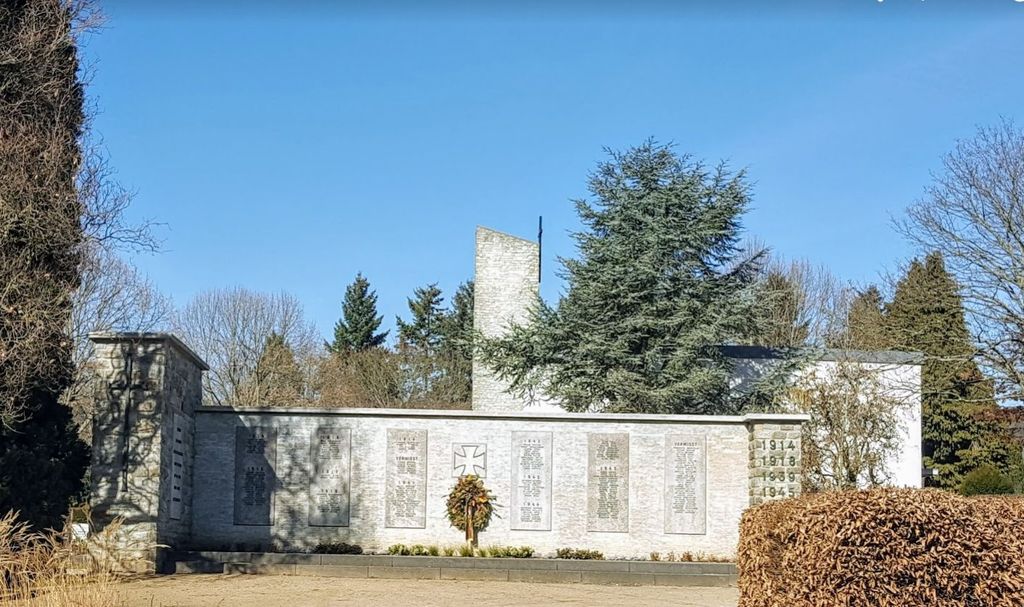
| Description | : | The main cemetery was originally directly behind the church, but was moved here in 1862. The oldest gravestones were moved to the inner walls of the new cemetery in 1973. Some inscriptions are in French and document the history of the town, including famous names such as the inventor of the telephone, Philipp Reis, the physics professor, Karl Willy Wagner, the founder of the boys’ school, Professor Louis Frédéric Garnier, the founder of the girls’ school, Martha Freiin von Puttkamer, as well as the parents of Marie Blanc, etc. In 1962, the town erected a memorial for fallen soldiers of... Read More |
frequently asked questions (FAQ):
-
Where is Hauptfriedhof Friedrichsdorf?
Hauptfriedhof Friedrichsdorf is located at Taunusstraße 32-88 Friedrichsdorf, Hochtaunuskreis ,Hessen , 61381Germany.
-
Hauptfriedhof Friedrichsdorf cemetery's updated grave count on graveviews.com?
0 memorials
-
Where are the coordinates of the Hauptfriedhof Friedrichsdorf?
Latitude: 50.2496200
Longitude: 8.6428100
Nearby Cemetories:
1. Friedhof Seulberg
Friedrichsdorf, Hochtaunuskreis, Germany
Coordinate: 50.2456980, 8.6507630
2. Friedhof Dillingen
Friedrichsdorf, Hochtaunuskreis, Germany
Coordinate: 50.2644669, 8.6292466
3. Waldfriedhof Köppern
Friedrichsdorf, Hochtaunuskreis, Germany
Coordinate: 50.2730009, 8.6603922
4. Alter Friedhof Köppern
Friedrichsdorf, Hochtaunuskreis, Germany
Coordinate: 50.2793590, 8.6494540
5. Schlosskirche Bad Homburg
Bad Homburg, Hochtaunuskreis, Germany
Coordinate: 50.2275000, 8.6100000
6. Bestattungswald am Ketzerborn
Rosbach vor der Höhe, Wetteraukreis, Germany
Coordinate: 50.2867992, 8.6503860
7. Alter Friedhof Oberstedten
Oberstedten, Hochtaunuskreis, Germany
Coordinate: 50.2284382, 8.5733913
8. Friedhof Nieder-Eschbach
Frankfurt am Main, Stadtkreis Frankfurt, Germany
Coordinate: 50.2032270, 8.6706470
9. Friedhof Nieder-Erlenbach - Neuer Friedhof
Frankfurt am Main, Stadtkreis Frankfurt, Germany
Coordinate: 50.2083874, 8.7061275
10. Friedhof Kalbach
Frankfurt am Main, Stadtkreis Frankfurt, Germany
Coordinate: 50.1898580, 8.6342400
11. Friedhof Nieder-Erlenbach - Alter Friedhof
Frankfurt am Main, Stadtkreis Frankfurt, Germany
Coordinate: 50.2027120, 8.7066370
12. Suedfriedhof Oberursel
Oberursel, Hochtaunuskreis, Germany
Coordinate: 50.1961960, 8.5912060
13. Friedhof Bonames
Frankfurt am Main, Stadtkreis Frankfurt, Germany
Coordinate: 50.1817560, 8.6676970
14. Friedhof Harheim
Frankfurt am Main, Stadtkreis Frankfurt, Germany
Coordinate: 50.1854720, 8.6887580
15. Waldfriedhof Oberursel
Oberursel, Hochtaunuskreis, Germany
Coordinate: 50.2099240, 8.5394930
16. Friedhof Niederursel
Frankfurt am Main, Stadtkreis Frankfurt, Germany
Coordinate: 50.1678590, 8.6153030
17. Friedhof Eschersheim
Frankfurt am Main, Stadtkreis Frankfurt, Germany
Coordinate: 50.1610960, 8.6579400
18. Jüdischer Friedhof Bad Vilbel
Bad Vilbel, Wetteraukreis, Germany
Coordinate: 50.1786200, 8.7358600
19. Friedhof Lohstrasse
Bad Vilbel, Wetteraukreis, Germany
Coordinate: 50.1854008, 8.7522900
20. Friedhof Heddernheim
Frankfurt am Main, Stadtkreis Frankfurt, Germany
Coordinate: 50.1535760, 8.6371630
21. Friedhof Praunheim
Frankfurt am Main, Stadtkreis Frankfurt, Germany
Coordinate: 50.1514690, 8.6200820
22. Friedhof Preungesheim
Frankfurt am Main, Stadtkreis Frankfurt, Germany
Coordinate: 50.1544320, 8.6871910
23. Parkfriedhof Heiligenstock
Frankfurt am Main, Stadtkreis Frankfurt, Germany
Coordinate: 50.1621370, 8.7206430
24. Kronberg-Schönberg
Kronberg im Taunus, Hochtaunuskreis, Germany
Coordinate: 50.1824596, 8.5218230