| Memorials | : | 0 |
| Location | : | Bad Homburg, Hochtaunuskreis, Germany |
| Coordinate | : | 50.2275000, 8.6100000 |
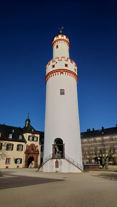
| Description | : | The castle's history dates back to the 12th century. Built originally as a fortress Count Frederich II von Hessen-Homburg had the entire structure demolished and built the current castle, starting in 1680. When Hessen-Homburg fell to Prussia in 1866, the castle became the summer residence of the Prussian/German kings and emperors. The same year the last count of Hessen-Homburg was buried in the ducal crypt, aka mausoleum of the landgraves (Landgräfliche Familiengruft) underneath the castle church (Schlosskirche). Among the 77 interred aristocrats are eight stillborn children, without given names. |
frequently asked questions (FAQ):
-
Where is Schlosskirche Bad Homburg?
Schlosskirche Bad Homburg is located at Bad Homburg, Hochtaunuskreis ,Hessen ,Germany.
-
Schlosskirche Bad Homburg cemetery's updated grave count on graveviews.com?
0 memorials
-
Where are the coordinates of the Schlosskirche Bad Homburg?
Latitude: 50.2275000
Longitude: 8.6100000
Nearby Cemetories:
1. Alter Friedhof Oberstedten
Oberstedten, Hochtaunuskreis, Germany
Coordinate: 50.2284382, 8.5733913
2. Hauptfriedhof Friedrichsdorf
Friedrichsdorf, Hochtaunuskreis, Germany
Coordinate: 50.2496200, 8.6428100
3. Friedhof Seulberg
Friedrichsdorf, Hochtaunuskreis, Germany
Coordinate: 50.2456980, 8.6507630
4. Suedfriedhof Oberursel
Oberursel, Hochtaunuskreis, Germany
Coordinate: 50.1961960, 8.5912060
5. Friedhof Dillingen
Friedrichsdorf, Hochtaunuskreis, Germany
Coordinate: 50.2644669, 8.6292466
6. Friedhof Kalbach
Frankfurt am Main, Stadtkreis Frankfurt, Germany
Coordinate: 50.1898580, 8.6342400
7. Friedhof Nieder-Eschbach
Frankfurt am Main, Stadtkreis Frankfurt, Germany
Coordinate: 50.2032270, 8.6706470
8. Waldfriedhof Oberursel
Oberursel, Hochtaunuskreis, Germany
Coordinate: 50.2099240, 8.5394930
9. Waldfriedhof Köppern
Friedrichsdorf, Hochtaunuskreis, Germany
Coordinate: 50.2730009, 8.6603922
10. Alter Friedhof Köppern
Friedrichsdorf, Hochtaunuskreis, Germany
Coordinate: 50.2793590, 8.6494540
11. Friedhof Bonames
Frankfurt am Main, Stadtkreis Frankfurt, Germany
Coordinate: 50.1817560, 8.6676970
12. Friedhof Niederursel
Frankfurt am Main, Stadtkreis Frankfurt, Germany
Coordinate: 50.1678590, 8.6153030
13. Friedhof Nieder-Erlenbach - Neuer Friedhof
Frankfurt am Main, Stadtkreis Frankfurt, Germany
Coordinate: 50.2083874, 8.7061275
14. Bestattungswald am Ketzerborn
Rosbach vor der Höhe, Wetteraukreis, Germany
Coordinate: 50.2867992, 8.6503860
15. Friedhof Harheim
Frankfurt am Main, Stadtkreis Frankfurt, Germany
Coordinate: 50.1854720, 8.6887580
16. Friedhof Nieder-Erlenbach - Alter Friedhof
Frankfurt am Main, Stadtkreis Frankfurt, Germany
Coordinate: 50.2027120, 8.7066370
17. Kronberg-Schönberg
Kronberg im Taunus, Hochtaunuskreis, Germany
Coordinate: 50.1824596, 8.5218230
18. Friedhof Eschersheim
Frankfurt am Main, Stadtkreis Frankfurt, Germany
Coordinate: 50.1610960, 8.6579400
19. Friedhof Heddernheim
Frankfurt am Main, Stadtkreis Frankfurt, Germany
Coordinate: 50.1535760, 8.6371630
20. Friedhof Praunheim
Frankfurt am Main, Stadtkreis Frankfurt, Germany
Coordinate: 50.1514690, 8.6200820
21. Alter Friedhof Kronberg im Taunus
Kronberg im Taunus, Hochtaunuskreis, Germany
Coordinate: 50.1787250, 8.5135020
22. Friedhof Eschborn
Eschborn, Main-Taunus-Kreis, Germany
Coordinate: 50.1483278, 8.5745140
23. Kirche St. Johann
Kronberg im Taunus, Hochtaunuskreis, Germany
Coordinate: 50.1833330, 8.5000000
24. Friedhof Preungesheim
Frankfurt am Main, Stadtkreis Frankfurt, Germany
Coordinate: 50.1544320, 8.6871910

