
| Memorials | : | 0 |
| Location | : | Oklahoma City, Oklahoma County, USA |
| Coordinate | : | 35.4986482, -97.5274010 |
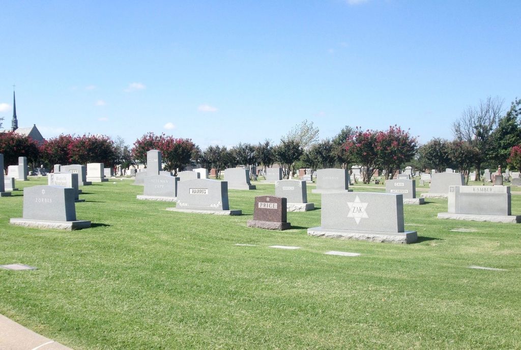
| Description | : | Before 1937, Emanuel Synagogue's members bought burial plots in the consecrated section of Fairlawn Cemetery, which runs from NW 26th to NW 30th Street between N Shartel and N Western Avenue. The entrance to this cemetery is on Shartel at 27th. The Hebrew Cemetery is located inside of Fairlawn Cemetery which is location 2700 North Shartel Avenue, Oklahoma City, Oklahoma 73103. The cemetery office (405-524-2559) can direct you to the Jewish section. Information for interments at the cemetery contact: Emanuel Synagogue 900 NW 47th Street Oklahoma City, OK 73118 Telephone: (405) 528-2113 Fax: (405) 528-2121 General e-mail: [email protected] |
frequently asked questions (FAQ):
-
Where is Hebrew Cemetery?
Hebrew Cemetery is located at 2700 North Shartel Avenue Oklahoma City, Oklahoma County ,Oklahoma , 73102USA.
-
Hebrew Cemetery cemetery's updated grave count on graveviews.com?
0 memorials
-
Where are the coordinates of the Hebrew Cemetery?
Latitude: 35.4986482
Longitude: -97.5274010


Nearby Cemetories:
1. Fairlawn Cemetery
Oklahoma City, Oklahoma County, USA
Coordinate: 35.4981003, -97.5271988
2. Our Ladys Cathedral
Oklahoma City, Oklahoma County, USA
Coordinate: 35.5019000, -97.5310000
3. Saint Lukes Columbarium
Oklahoma City, Oklahoma County, USA
Coordinate: 35.4844000, -97.5161000
4. First Unitarian Church Memorial Garden
Oklahoma City, Oklahoma County, USA
Coordinate: 35.4818600, -97.5232110
5. Westminster Presbyterian Church Columbarium
Oklahoma City, Oklahoma County, USA
Coordinate: 35.5160200, -97.5247400
6. Saint Paul's Episcopal Cathedral Columbarium
Oklahoma City, Oklahoma County, USA
Coordinate: 35.4753800, -97.5158500
7. Oklahoma City National Memorial
Oklahoma City, Oklahoma County, USA
Coordinate: 35.4727500, -97.5170200
8. Rose Hill Burial Park
Oklahoma City, Oklahoma County, USA
Coordinate: 35.5313988, -97.5369034
9. All Souls Church Columbarium
Oklahoma City, Oklahoma County, USA
Coordinate: 35.5373000, -97.5472100
10. Saint Johns Episcopal Church Columbarium
Oklahoma City, Oklahoma County, USA
Coordinate: 35.5247000, -97.5690000
11. Nichols Hills United Methodist Church Columbarium
Nichols Hills, Oklahoma County, USA
Coordinate: 35.5411000, -97.5343000
12. Oklahoma Veterans Cemetery
Oklahoma City, Oklahoma County, USA
Coordinate: 35.5072900, -97.4752600
13. Lyon Cemetery
Oklahoma City, Oklahoma County, USA
Coordinate: 35.5360000, -97.5650700
14. National Cowboy and Western Heritage Museum
Oklahoma City, Oklahoma County, USA
Coordinate: 35.5357200, -97.4831600
15. Christ the King Catholic Church Cemetery
Oklahoma City, Oklahoma County, USA
Coordinate: 35.5528000, -97.5576000
16. Mayflower Congregational UCC Columbarium
Oklahoma City, Oklahoma County, USA
Coordinate: 35.5372200, -97.5863310
17. Trice Hill Cemetery
Oklahoma City, Oklahoma County, USA
Coordinate: 35.5236800, -97.4438700
18. Britton Cemetery
Oklahoma City, Oklahoma County, USA
Coordinate: 35.5723076, -97.5323105
19. Riverside Gardens Cemetery
Oklahoma City, Oklahoma County, USA
Coordinate: 35.5064660, -97.4289890
20. Czech National Cemetery
Oklahoma City, Oklahoma County, USA
Coordinate: 35.4202995, -97.5556030
21. Rogan Cemetery
Oklahoma City, Oklahoma County, USA
Coordinate: 35.5364690, -97.4334310
22. East View Cemetery
Oklahoma City, Oklahoma County, USA
Coordinate: 35.5347220, -97.4319440
23. Pilgrims Rest Cemetery
Oklahoma City, Oklahoma County, USA
Coordinate: 35.5361550, -97.4320580
24. Reflection Pointe Gardens
Oklahoma City, Oklahoma County, USA
Coordinate: 35.5801000, -97.4781000