
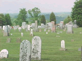
| Memorials | : | 28 |
| Location | : | Madison, Jefferson County, USA |
| Coordinate | : | 38.8396988, -85.3692017 |
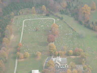
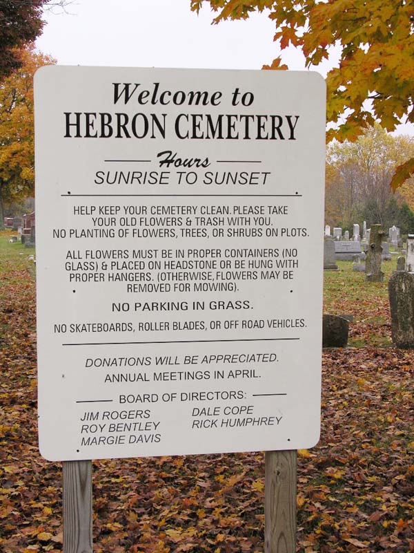
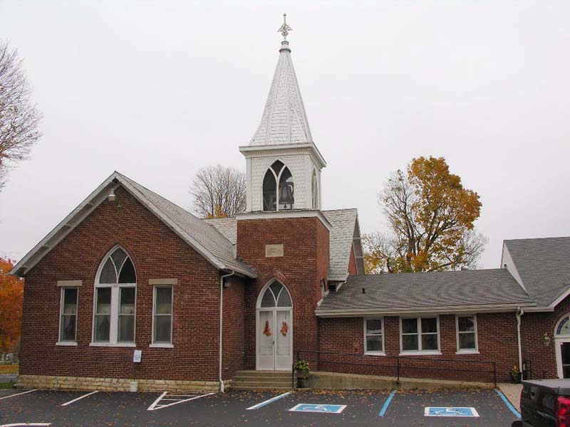
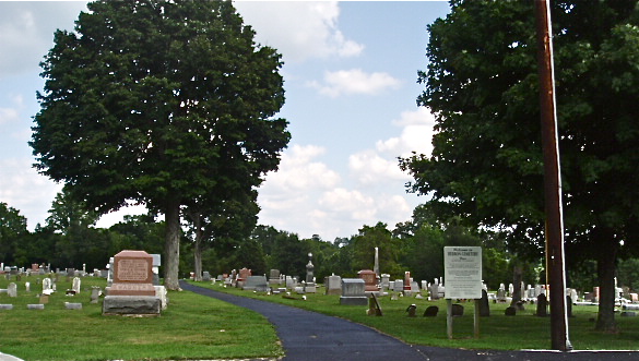
| Description | : | The cemetery is located in Monroe Township on the east side of N. Graham Road about 0.2 miles north of its intersection with Indiana State Highway 250. Indiana Cemetery Locations, Volume 4, published by the Indiana Genealogical Society (April 2009), gives the primary cemetery name as Hebron Cemetery. The cemetery is listed in the Cemetery and Burial Grounds Registry of the Indiana Department of Natural Resources (DNR) and in the State Historical Architectural and Archaeological Research Database (SHAARD) with Cemetery Record Number CR-39-123 (Hebron / Hebron Baptist Church). The U.S. Geological Survey (USGS) Geographic Names Information System (GNIS)... Read More |
frequently asked questions (FAQ):
-
Where is Hebron Cemetery?
Hebron Cemetery is located at N. Graham Road Madison, Jefferson County ,Indiana , 47250USA.
-
Hebron Cemetery cemetery's updated grave count on graveviews.com?
26 memorials
-
Where are the coordinates of the Hebron Cemetery?
Latitude: 38.8396988
Longitude: -85.3692017

Nearby Cemetories:
1. Smith Cemetery
Jefferson County, USA
Coordinate: 38.8417015, -85.3692017
2. Saint Anthony Catholic Cemetery
China, Jefferson County, USA
Coordinate: 38.8244019, -85.3411026
3. Grandview Memorial Gardens
Madison, Jefferson County, USA
Coordinate: 38.8737450, -85.3756790
4. Olive Branch Cemetery
Madison, Jefferson County, USA
Coordinate: 38.8044014, -85.3503036
5. Demaree Cemetery
China, Jefferson County, USA
Coordinate: 38.8181000, -85.3248000
6. Copeland Cemetery
Canaan, Jefferson County, USA
Coordinate: 38.8639120, -85.3213540
7. Monroe Cemetery (Defunct)
Belleview, Jefferson County, USA
Coordinate: 38.8611920, -85.4246960
8. Indian Kentucky Cemetery
Canaan, Jefferson County, USA
Coordinate: 38.8727720, -85.3230380
9. Woodfill Cemetery
Jefferson County, USA
Coordinate: 38.7893800, -85.3509700
10. Underwood Cemetery
Madison, Jefferson County, USA
Coordinate: 38.7813890, -85.3713890
11. Lemen Graveyard
Canaan, Jefferson County, USA
Coordinate: 38.8544100, -85.2963300
12. Brown Cemetery
Jefferson County, USA
Coordinate: 38.8210800, -85.2943400
13. Canaan Cemetery
Canaan, Jefferson County, USA
Coordinate: 38.8684082, -85.2960892
14. Craig Cemetery (Defunct)
Monroe Township, Jefferson County, USA
Coordinate: 38.8564480, -85.4525990
15. Mount Pleasant Cemetery
Canaan, Jefferson County, USA
Coordinate: 38.8329086, -85.2823257
16. Rykers Ridge Cemetery New
Central, Jefferson County, USA
Coordinate: 38.7774300, -85.3321500
17. Rykers Ridge Cemetery Old
Central, Jefferson County, USA
Coordinate: 38.7749760, -85.3327420
18. Lee Graveyard
Canaan, Jefferson County, USA
Coordinate: 38.8379000, -85.2771900
19. Wirt Baptist Cemetery
Wirt, Jefferson County, USA
Coordinate: 38.8081500, -85.4521910
20. Jefferson Church Cemetery
Jefferson County, USA
Coordinate: 38.8951759, -85.3066788
21. Miner Cemetery
Madison, Jefferson County, USA
Coordinate: 38.7714480, -85.4055140
22. Brisbane Cemetery
Madison, Jefferson County, USA
Coordinate: 38.7642680, -85.3798900
23. Brown Cemetery
Smyrna, Jefferson County, USA
Coordinate: 38.8196560, -85.4637900
24. Grace Cemetery
Madison, Jefferson County, USA
Coordinate: 38.8024790, -85.4575060