
| Memorials | : | 1 |
| Location | : | Claxton, Anderson County, USA |
| Coordinate | : | 36.0592630, -84.1287790 |
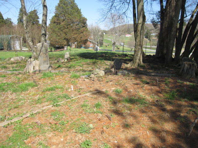
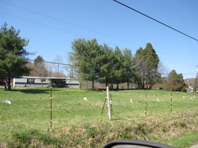
| Description | : | This cemetery is located on private property, once the farm of Azariah & William Herrell, located about one-half mile west of the intersection of US-25W and West Wolf Valley Road. The cemetery is located about one hundred feet north of the road and in the side-yard of a mobile home. (The Robert McGinnis book "Gone to Rest, The Cemeteries of Anderson County Tennessee, Volume I" incorrectly listed the cemetery as being on West Brushy Valley Road, but it is, in fact, West Wolf Valley Road. Nevertheless, a great deal of gratitude is given to Mr. McGinnis for helping... Read More |
frequently asked questions (FAQ):
-
Where is Herrell Family Cemetery?
Herrell Family Cemetery is located at Claxton, Anderson County ,Tennessee ,USA.
-
Herrell Family Cemetery cemetery's updated grave count on graveviews.com?
1 memorials
-
Where are the coordinates of the Herrell Family Cemetery?
Latitude: 36.0592630
Longitude: -84.1287790
Nearby Cemetories:
1. Vosmus Cemetery
Clinton, Anderson County, USA
Coordinate: 36.0711900, -84.1414400
2. Woodhaven Memorial Gardens
Claxton, Anderson County, USA
Coordinate: 36.0421982, -84.1177979
3. Keisling Family Cemetery
Claxton, Anderson County, USA
Coordinate: 36.0476070, -84.1054490
4. Lane Cemetery
Anderson County, USA
Coordinate: 36.0657997, -84.1549988
5. York-Hill Cemetery
Clinton, Anderson County, USA
Coordinate: 36.0839550, -84.1315930
6. Wilkerson
Claxton, Anderson County, USA
Coordinate: 36.0342900, -84.1306900
7. Altum Cemetery
Anderson County, USA
Coordinate: 36.0760994, -84.1050034
8. Farmer Cemetery
Anderson County, USA
Coordinate: 36.0532990, -84.1596985
9. Haven Chapel Cemetery
Anderson County, USA
Coordinate: 36.0546989, -84.0943985
10. Greenway Cemetery
Anderson County, USA
Coordinate: 36.0798745, -84.0996458
11. Farmers Grove Cemetery
Clinton, Anderson County, USA
Coordinate: 36.0491982, -84.1658020
12. Valley View Methodist Cemetery
Edgemoor, Anderson County, USA
Coordinate: 36.0280991, -84.1397018
13. Jennings Cemetery
Anderson County, USA
Coordinate: 36.0353012, -84.1016998
14. John Herrell Family Cemetery
Claxton, Anderson County, USA
Coordinate: 36.0620080, -84.0885120
15. Shelton Cemetery
Edgemoor, Anderson County, USA
Coordinate: 36.0353920, -84.0984960
16. Sunset Cemetery
Clinton, Anderson County, USA
Coordinate: 36.0964012, -84.1433029
17. Old Clinton Baptist Church Cemetery
Clinton, Anderson County, USA
Coordinate: 36.0978470, -84.1376020
18. Liberty Cemetery
Anderson County, USA
Coordinate: 36.0732994, -84.1746979
19. King Cemetery
Anderson County, USA
Coordinate: 36.0377998, -84.0849991
20. Johnson Cemetery
Anderson County, USA
Coordinate: 36.0574989, -84.1821976
21. Mount Sinai Baptist Church Cemetery
Clinton, Anderson County, USA
Coordinate: 36.1012101, -84.1422513
22. Aulton Cemetery
Knox County, USA
Coordinate: 36.0536003, -84.0749969
23. Young-Cummings Cemetery
Clinton, Anderson County, USA
Coordinate: 36.1018982, -84.1082993
24. Riverview Cemetery
Claxton, Anderson County, USA
Coordinate: 36.0133018, -84.1466980