
| Memorials | : | 0 |
| Location | : | Goudswaard, Korendijk Municipality, Netherlands |
| Coordinate | : | 51.7952271, 4.2743742 |
frequently asked questions (FAQ):
-
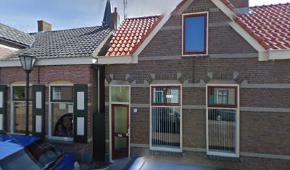
Where is Hervormde Gemeente Goudswaard?
Hervormde Gemeente Goudswaard is located at Dorpsstraat 15 Goudswaard, Korendijk Municipality ,Zuid-Holland , 3267 AENetherlands.
-
Hervormde Gemeente Goudswaard cemetery's updated grave count on graveviews.com?
0 memorials
-
Where are the coordinates of the Hervormde Gemeente Goudswaard?
Latitude: 51.7952271
Longitude: 4.2743742
Nearby Cemetories:
1. Goudswaard Algemene Begraafplaats
Goudswaard, Korendijk Municipality, Netherlands
Coordinate: 51.7918900, 4.2763700
2. Piershil Protestant Churchyard
Piershil, Korendijk Municipality, Netherlands
Coordinate: 51.7935800, 4.3141700
3. Begraafplaats Kerkweg
Zuidland, Nissewaard Municipality, Netherlands
Coordinate: 51.8210330, 4.2568590
4. Piershil Algemene Begraafplaats
Piershil, Korendijk Municipality, Netherlands
Coordinate: 51.7936127, 4.3203654
5. Joodse Begraafplaats
Zuidland, Nissewaard Municipality, Netherlands
Coordinate: 51.8210000, 4.2532700
6. Simonshaven Protestant Churchyard
Simonshaven, Nissewaard Municipality, Netherlands
Coordinate: 51.8237400, 4.2914400
7. Oude Algemene Begraafplaats
Nieuw-Beijerland, Korendijk Municipality, Netherlands
Coordinate: 51.8104500, 4.3421100
8. Algemene Begraafplaats
Nieuw-Beijerland, Korendijk Municipality, Netherlands
Coordinate: 51.8060905, 4.3472770
9. Nieuwe Begraafplaats
Abbenbroek, Nissewaard Municipality, Netherlands
Coordinate: 51.8469476, 4.2378221
10. Oude begraafplaats
Abbenbroek, Nissewaard Municipality, Netherlands
Coordinate: 51.8483566, 4.2408714
11. Begraafplaats Stad aan 't Haringvliet
Stad aan 't Haringvliet, Goeree-Overflakkee Municipality, Netherlands
Coordinate: 51.7387553, 4.2408816
12. Joodse begraafplaats
Geervliet, Nissewaard Municipality, Netherlands
Coordinate: 51.8602530, 4.2556100
13. Protestant Church Cemetery
Heenvliet, Nissewaard Municipality, Netherlands
Coordinate: 51.8643528, 4.2439972
14. Oude Begraafplaats
Zuid-Beijerland, Korendijk Municipality, Netherlands
Coordinate: 51.7490968, 4.3670754
15. Begraafplaats Heenvliet
Heenvliet, Nissewaard Municipality, Netherlands
Coordinate: 51.8654244, 4.2359608
16. Middelharnis Algemene Begraafplaats
Middelharnis, Goeree-Overflakkee Municipality, Netherlands
Coordinate: 51.7526600, 4.1685100
17. Joodse Begraafplaats Middelharnis
Middelharnis, Goeree-Overflakkee Municipality, Netherlands
Coordinate: 51.7583100, 4.1615500
18. Middelharnis Protestant Cemetery
Middelharnis, Goeree-Overflakkee Municipality, Netherlands
Coordinate: 51.7582300, 4.1608400
19. Den Bommel General Cemetery
Den Bommel, Goeree-Overflakkee Municipality, Netherlands
Coordinate: 51.7159400, 4.2812700
20. Sommelsdijk Old Churchyard
Sommelsdijk, Goeree-Overflakkee Municipality, Netherlands
Coordinate: 51.7589805, 4.1516930
21. Zwartewaal General Cemetery
Zwartewaal, Brielle Municipality, Netherlands
Coordinate: 51.8781800, 4.2135600
22. Joodse Begraafplaats
Oud-Beijerland, Oud-Beijerland Municipality, Netherlands
Coordinate: 51.8228750, 4.4203050
23. Begraafplaats Oudeland
Hoogvliet, Rotterdam Municipality, Netherlands
Coordinate: 51.8730895, 4.3670523
24. Nieuw-Helvoet General Cemetery
Nieuw-Helvoet, Hellevoetsluis Municipality, Netherlands
Coordinate: 51.8400400, 4.1244610