
| Memorials | : | 0 |
| Location | : | Nieuw-Helvoet, Hellevoetsluis Municipality, Netherlands |
| Coordinate | : | 51.8400400, 4.1244610 |
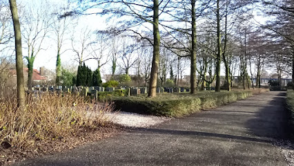
| Description | : | Nieuw-Helvoet is a coastal village in the province of South Holland lying 36 kilometres west of Rotterdam and 42 kilometres south-west of The Hague. The cemetery is on the northern outskirts of the village, in the road known as Smitsweg which leads to the beach. Commemorated at this cemetery is an unknown Canadian airman of World War Two. |
frequently asked questions (FAQ):
-
Where is Nieuw-Helvoet General Cemetery?
Nieuw-Helvoet General Cemetery is located at Nieuw-Helvoet, Hellevoetsluis Municipality ,Zuid-Holland ,Netherlands.
-
Nieuw-Helvoet General Cemetery cemetery's updated grave count on graveviews.com?
0 memorials
-
Where are the coordinates of the Nieuw-Helvoet General Cemetery?
Latitude: 51.8400400
Longitude: 4.1244610
Nearby Cemetories:
1. Zeeweg General Cemetery
Rockanje, Westvoorne Municipality, Netherlands
Coordinate: 51.8747900, 4.0674300
2. Brielle Nieuwe Algemene Begraafplaats
Brielle, Brielle Municipality, Netherlands
Coordinate: 51.8861377, 4.1633283
3. Oostvoorne Roman Catholic Cemetery
Oostvoorne, Westvoorne Municipality, Netherlands
Coordinate: 51.8962300, 4.1527600
4. Brielle Oude Algemene Begraafplaats
Brielle, Brielle Municipality, Netherlands
Coordinate: 51.8974400, 4.1595100
5. Zwartewaal General Cemetery
Zwartewaal, Brielle Municipality, Netherlands
Coordinate: 51.8781800, 4.2135600
6. Nieuwe Begraafplaats
Abbenbroek, Nissewaard Municipality, Netherlands
Coordinate: 51.8469476, 4.2378221
7. Oostvoorne Protestant Cemetery
Oostvoorne, Westvoorne Municipality, Netherlands
Coordinate: 51.9103000, 4.0997100
8. Oude begraafplaats
Abbenbroek, Nissewaard Municipality, Netherlands
Coordinate: 51.8483566, 4.2408714
9. Begraafplaats Heenvliet
Heenvliet, Nissewaard Municipality, Netherlands
Coordinate: 51.8654244, 4.2359608
10. Protestant Church Cemetery
Heenvliet, Nissewaard Municipality, Netherlands
Coordinate: 51.8643528, 4.2439972
11. Joodse Begraafplaats
Zuidland, Nissewaard Municipality, Netherlands
Coordinate: 51.8210000, 4.2532700
12. Sommelsdijk Old Churchyard
Sommelsdijk, Goeree-Overflakkee Municipality, Netherlands
Coordinate: 51.7589805, 4.1516930
13. Joodse begraafplaats
Geervliet, Nissewaard Municipality, Netherlands
Coordinate: 51.8602530, 4.2556100
14. Begraafplaats Kerkweg
Zuidland, Nissewaard Municipality, Netherlands
Coordinate: 51.8210330, 4.2568590
15. Middelharnis Protestant Cemetery
Middelharnis, Goeree-Overflakkee Municipality, Netherlands
Coordinate: 51.7582300, 4.1608400
16. Joodse Begraafplaats Middelharnis
Middelharnis, Goeree-Overflakkee Municipality, Netherlands
Coordinate: 51.7583100, 4.1615500
17. Joodse Begraafplaats
Dirksland, Goeree-Overflakkee Municipality, Netherlands
Coordinate: 51.7509730, 4.1045730
18. Middelharnis Algemene Begraafplaats
Middelharnis, Goeree-Overflakkee Municipality, Netherlands
Coordinate: 51.7526600, 4.1685100
19. Goedereede General Cemetery
Goedereede, Goeree-Overflakkee Municipality, Netherlands
Coordinate: 51.8166200, 3.9764300
20. Dirksland Oude Begraafplaats
Dirksland, Goeree-Overflakkee Municipality, Netherlands
Coordinate: 51.7461100, 4.1021200
21. Rozenburg General Cemetery
Rozenburg, Rotterdam Municipality, Netherlands
Coordinate: 51.9034500, 4.2513600
22. Hervormde Gemeente Goudswaard
Goudswaard, Korendijk Municipality, Netherlands
Coordinate: 51.7952271, 4.2743742
23. Simonshaven Protestant Churchyard
Simonshaven, Nissewaard Municipality, Netherlands
Coordinate: 51.8237400, 4.2914400
24. Goudswaard Algemene Begraafplaats
Goudswaard, Korendijk Municipality, Netherlands
Coordinate: 51.7918900, 4.2763700