| Memorials | : | 0 |
| Location | : | Rutledge, Scotland County, USA |
| Coordinate | : | 40.3131300, -92.0617600 |
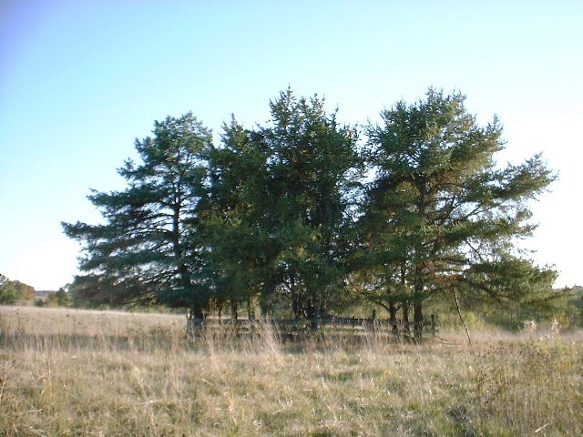
| Description | : | This cemetery is located on the farm that James Hicks had owned. To get to the cemetery, leave the town of Rutledge going north on the paved road. Turn east on the first pavement north of town, go about 1 mile east to the first dirt road going south, which is designated as Irvin Road. Go south on this dirt road (Irvin Road) for between a quarter and a half a mile to the only house on this road, which is on the west side of the road. This is the house of Brian and Michelle Johnston (in... Read More |
frequently asked questions (FAQ):
-
Where is Hicks Farm Cemetery?
Hicks Farm Cemetery is located at Rutledge, Scotland County ,Missouri ,USA.
-
Hicks Farm Cemetery cemetery's updated grave count on graveviews.com?
0 memorials
-
Where are the coordinates of the Hicks Farm Cemetery?
Latitude: 40.3131300
Longitude: -92.0617600
Nearby Cemetories:
1. Pauline Cemetery
Rutledge, Scotland County, USA
Coordinate: 40.3093987, -92.0892029
2. Ewing-Lasswell Cemetery
Scotland County, USA
Coordinate: 40.3022003, -92.0346985
3. Harmony Grove Cemetery
Knox County, USA
Coordinate: 40.2973300, -92.0297200
4. Dancing Rabbit
Rutledge, Scotland County, USA
Coordinate: 40.3324900, -92.0962100
5. Indian Creek Cemetery
Sand Hill Township, Scotland County, USA
Coordinate: 40.3539009, -92.0781021
6. Carder Cemetery
Colony, Knox County, USA
Coordinate: 40.2692850, -92.0398290
7. Sand Hill Cemetery
Sand Hill, Scotland County, USA
Coordinate: 40.3130989, -92.1250000
8. Millport Cemetery
Millport, Knox County, USA
Coordinate: 40.2670000, -92.0930000
9. Millport Mennonite Cemetery
Millport, Knox County, USA
Coordinate: 40.2673690, -92.0953400
10. Matlick Cemetery
Sand Hill, Scotland County, USA
Coordinate: 40.3307690, -92.1308330
11. Pleasant Grove Cemetery
Gorin, Scotland County, USA
Coordinate: 40.3669014, -92.0250015
12. Standifird Cemetery
Colony, Knox County, USA
Coordinate: 40.2947006, -91.9839020
13. Cunningham Cemetery
Benton Township, Knox County, USA
Coordinate: 40.2888985, -92.1393967
14. South Bethel Cemetery
Sand Hill, Scotland County, USA
Coordinate: 40.3468710, -92.1361430
15. Spilman Cemetery
Scotland County, USA
Coordinate: 40.3311930, -92.1501190
16. Mauck Cemetery
Knox County, USA
Coordinate: 40.2386700, -92.0832900
17. Colony Cemetery
Colony, Knox County, USA
Coordinate: 40.2550300, -91.9958200
18. Hicks-Shacklett Cemetery
Gorin, Scotland County, USA
Coordinate: 40.3880860, -92.0127620
19. Suter Cemetery
Gorin, Scotland County, USA
Coordinate: 40.3292007, -91.9522018
20. Strange Cemetery
Knox County, USA
Coordinate: 40.2286300, -92.0060300
21. Bear Creek Cemetery
Wyaconda, Clark County, USA
Coordinate: 40.3120600, -91.9317100
22. Union Cemetery
Scotland County, USA
Coordinate: 40.4157982, -92.0836029
23. Forrester Cemetery
Scotland County, USA
Coordinate: 40.3361015, -92.1949997
24. Bailey Cemetery
Clark County, USA
Coordinate: 40.2580986, -91.9458008

