
| Memorials | : | 7 |
| Location | : | Montgomery, Franklin County, USA |
| Coordinate | : | 44.8562480, -72.6572540 |
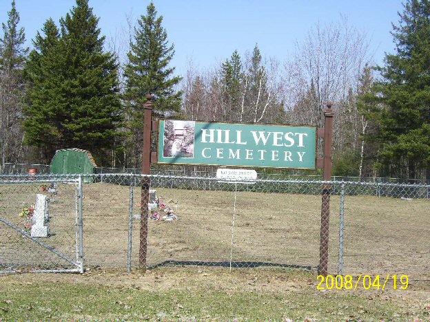
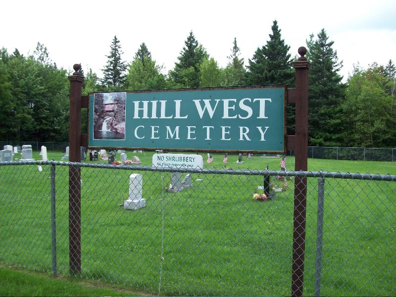
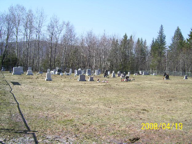
| Description | : | Well kept, small cemetery. Stones are in excellent shape. Oldest burial dates back to 1871. Cemetery still being used. Photographed completely on April 19th, 2008. Surnames: Aiken, Alexander, Andress, Austin, Babbitt, Bean, Coffron, Diana, Dollois, Domana, Domina, Faller, Gagnon, Jewett, Keelan, Lawyer, Lumbra, Maynard, Mayotte, Messier, Murray and Murry, Paronto, Piancerelli, Ranville, Raymond, Reighley, Rifenburgh, Rivers, Rochefort, Rowley, Rowse, Rushford, Shangraw, Wetherby and Williams. |
frequently asked questions (FAQ):
-
Where is Hill West Cemetery?
Hill West Cemetery is located at W Hill Road Montgomery, Franklin County ,Vermont , 05450USA.
-
Hill West Cemetery cemetery's updated grave count on graveviews.com?
7 memorials
-
Where are the coordinates of the Hill West Cemetery?
Latitude: 44.8562480
Longitude: -72.6572540
Nearby Cemetories:
1. Montgomery Center Cemetery
Montgomery, Franklin County, USA
Coordinate: 44.8826900, -72.6129900
2. Saint Isidore Catholic Cemetery
Franklin County, USA
Coordinate: 44.8800600, -72.6037000
3. Old Montgomery Cemetery
Montgomery, Franklin County, USA
Coordinate: 44.9004900, -72.6368500
4. Montgomery Village Cemetery
Montgomery, Franklin County, USA
Coordinate: 44.9020000, -72.6366600
5. East Enosburgh Cemetery
East Enosburg, Franklin County, USA
Coordinate: 44.8542560, -72.7352210
6. Cook Cemetery
Bakersfield, Franklin County, USA
Coordinate: 44.8178400, -72.7310200
7. Enosburgh Center Cemetery
Enosburg Center, Franklin County, USA
Coordinate: 44.8720200, -72.7549000
8. South Richford Cemetery
South Richford, Franklin County, USA
Coordinate: 44.9328200, -72.6514700
9. East Berkshire Congregational Cemetery
East Berkshire, Franklin County, USA
Coordinate: 44.9316200, -72.7037600
10. East Berkshire Episcopal Cemetery
East Berkshire, Franklin County, USA
Coordinate: 44.9312000, -72.7170600
11. Burroughs Family Cemetery
Belvidere, Lamoille County, USA
Coordinate: 44.7736702, -72.6120300
12. Stevens Ferry Cemetery
Enosburg, Franklin County, USA
Coordinate: 44.9209700, -72.7535500
13. West Enosburg Cemetery
West Enosburg, Franklin County, USA
Coordinate: 44.8562200, -72.8020800
14. Saint John the Baptist Cemetery New
Enosburg Falls, Franklin County, USA
Coordinate: 44.9026200, -72.7890600
15. Missisquoi Cemetery
Enosburg Falls, Franklin County, USA
Coordinate: 44.9091200, -72.7963700
16. Belvidere Center Cemetery
Belvidere Center, Lamoille County, USA
Coordinate: 44.7479900, -72.7009400
17. Saint John the Baptist Cemetery Old
Enosburg Falls, Franklin County, USA
Coordinate: 44.9072600, -72.8012700
18. Bordoville-Advent Cemetery
Enosburg, Franklin County, USA
Coordinate: 44.8431810, -72.8187990
19. Main Street Cemetery
Enosburg Falls, Franklin County, USA
Coordinate: 44.9068800, -72.8057700
20. Richford Center Cemetery
Richford, Franklin County, USA
Coordinate: 44.9737800, -72.6502900
21. Maple Grove Cemetery
Bakersfield, Franklin County, USA
Coordinate: 44.7814400, -72.7990000
22. Saint Georges Catholic Cemetery
Bakersfield, Franklin County, USA
Coordinate: 44.7854900, -72.8031700
23. Berkshire Center Cemetery
Berkshire, Franklin County, USA
Coordinate: 44.9596000, -72.7732700
24. All Saints Catholic Cemetery
Richford, Franklin County, USA
Coordinate: 44.9886700, -72.6793300