
| Memorials | : | 0 |
| Location | : | Baierbrunn, Landkreis München, Germany |
| Website | : | www.erzbistum-muenchen.de/pfarrei/pv-schaeftlarn/cont/79744 |
| Coordinate | : | 48.0192498, 11.4865870 |
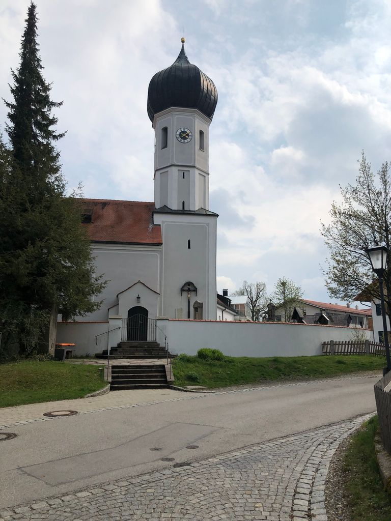
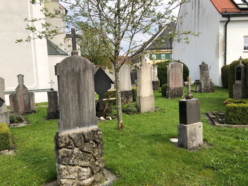
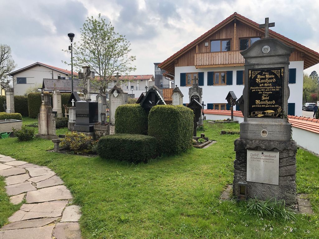
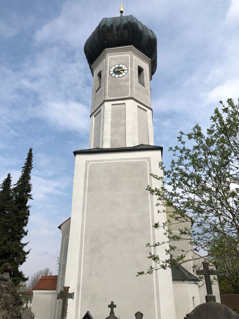
| Description | : | The present church has been built from 1686 to 1709 but before older churches have been standing there where already in 776 the existence of a stone brick church has been mentioned in historic documents. Still following the tradition this small cemetery lies around the church in the middle of the village. Nowadays the cemetery contains old graves mainly from the first half of the 20th century. Burials are normally no longer done here but in the new cemetery at the end of the village. |
frequently asked questions (FAQ):
-
Where is Hl. Petrus und Paulus Kirchhof?
Hl. Petrus und Paulus Kirchhof is located at Kirchenstr. Baierbrunn, Landkreis München ,Bavaria (Bayern) , 82065Germany.
-
Hl. Petrus und Paulus Kirchhof cemetery's updated grave count on graveviews.com?
0 memorials
-
Where are the coordinates of the Hl. Petrus und Paulus Kirchhof?
Latitude: 48.0192498
Longitude: 11.4865870
Nearby Cemetories:
1. Baierbrunner Friedhof
Baierbrunn, Landkreis München, Germany
Coordinate: 48.0157540, 11.4821770
2. Friedhof Straßlach
Strasslach-Dingharting, Landkreis München, Germany
Coordinate: 48.0003180, 11.5044650
3. Waldfriedhof Grünwald
Grunwald, Landkreis München, Germany
Coordinate: 48.0301450, 11.5217830
4. Friedhof Schäftlarn
Schaftlarn, Landkreis München, Germany
Coordinate: 47.9923060, 11.4517440
5. Jesuitenfriedhof des Berchmanskollegs
Pullach im Isartal, Landkreis München, Germany
Coordinate: 48.0583260, 11.5098580
6. Friedhof Zell-Ebenhausen
Schaftlarn, Landkreis München, Germany
Coordinate: 47.9803000, 11.4465100
7. Klosterfriedhof Warnberg
Warnberg, Stadtkreis München, Germany
Coordinate: 48.0652980, 11.5094810
8. Friedhof Pullach
Pullach im Isartal, Landkreis München, Germany
Coordinate: 48.0638700, 11.5215100
9. Waldfriedhof Solln
Solln, Stadtkreis München, Germany
Coordinate: 48.0686110, 11.5138890
10. Starnberg - Friedhof Wangen St. Ulrich
Wangen, Landkreis Starnberg, Germany
Coordinate: 48.0113419, 11.4031405
11. Kirchhof St. Anian
Irschenhausen, Landkreis Bad Tölz-Wolfratshausen, Germany
Coordinate: 47.9672340, 11.4362170
12. Friedhof Solln
Solln, Stadtkreis München, Germany
Coordinate: 48.0788300, 11.5177960
13. Friedhof Deining
Deining, Landkreis Bad Tölz-Wolfratshausen, Germany
Coordinate: 47.9538900, 11.4991600
14. Friedhof Forstenried Heilig-Kreuz-Friedhof
Forstenried, Stadtkreis München, Germany
Coordinate: 48.0856020, 11.4942360
15. Friedhof Buchendorf
Gauting, Landkreis Starnberg, Germany
Coordinate: 48.0570570, 11.4026510
16. Waldfriedhof
Icking, Landkreis Bad Tölz-Wolfratshausen, Germany
Coordinate: 47.9573740, 11.4303350
17. Kirchhof Neuried
Neuried, Landkreis München, Germany
Coordinate: 48.0918226, 11.4640865
18. Kirchhof Heilig Kreuz
Icking, Landkreis Bad Tölz-Wolfratshausen, Germany
Coordinate: 47.9522550, 11.4381050
19. Gemeindefriedhof Oberhaching
Oberhaching, Landkreis München, Germany
Coordinate: 48.0263490, 11.5993830
20. Gemeindefriedhof Taufkirchen
Taufkirchen, Landkreis München, Germany
Coordinate: 48.0475575, 11.5946541
21. Waldfriedhof-Italienischer Militärfriedhof
Grosshadern, Stadtkreis München, Germany
Coordinate: 48.0975400, 11.4883760
22. Neuer Friedhof Neuried
Neuried, Landkreis München, Germany
Coordinate: 48.0952494, 11.4565626
23. Waldfriedhof Krieger-Ehrenhain
Grosshadern, Stadtkreis München, Germany
Coordinate: 48.0991000, 11.4786200
24. St. Alto Kirchhof
Starnberg, Landkreis Starnberg, Germany
Coordinate: 48.0291040, 11.3669780