
| Memorials | : | 0 |
| Location | : | Solln, Stadtkreis München, Germany |
| Website | : | www.muenchen.de/rathaus/Stadtverwaltung/Referat-fuer-Gesundheit-und-Umwelt/Friedhof_und_Bestattung/SFM/Friedhoefe/Friedhof_S |
| Coordinate | : | 48.0788300, 11.5177960 |
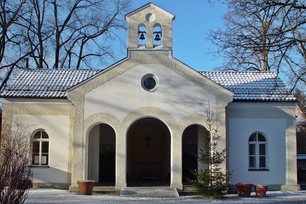
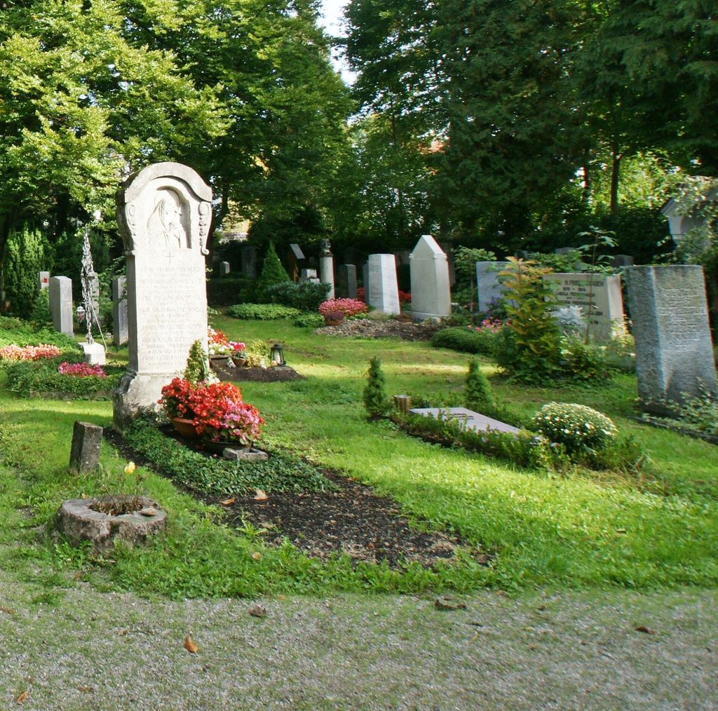
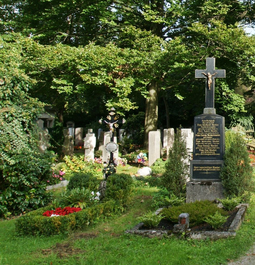
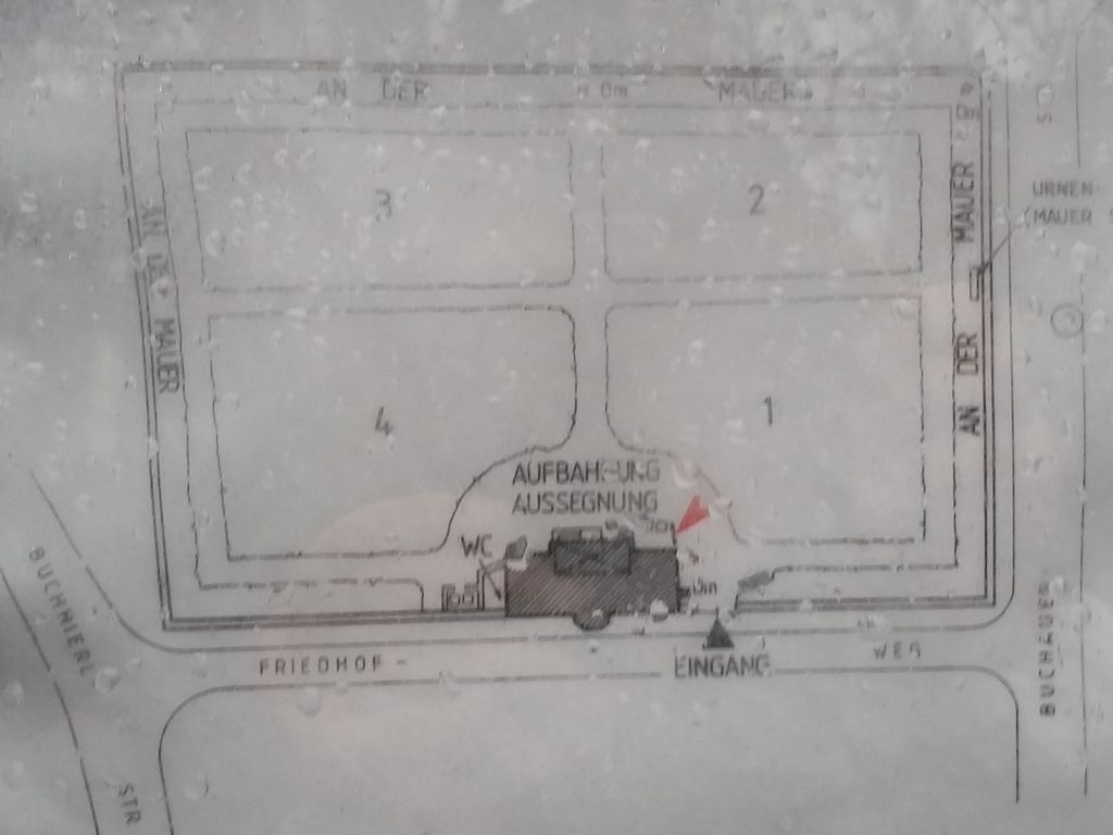
| Description | : | The cemetery was opened in 1883. AKA: Alter Friedhof Solln.It is only one acre in size. Please note that the graves in Germany are not perpetual. After a certain period of repose (20-30 years) the graves are being leveled and re-used. There is no toxic embalming being done in Germany, so the coffin and the corpse have decomposed naturally. If the family of the deceased decides to purchase another period the duration can be extended by another 30 years. War Graves are considered memorials and are kept up by the owner of the cemetery. Those are kept forever. |
frequently asked questions (FAQ):
-
Where is Friedhof Solln?
Friedhof Solln is located at Friedhofsweg 1 Solln, Stadtkreis München ,Bavaria (Bayern) , 81479Germany.
-
Friedhof Solln cemetery's updated grave count on graveviews.com?
0 memorials
-
Where are the coordinates of the Friedhof Solln?
Latitude: 48.0788300
Longitude: 11.5177960
Nearby Cemetories:
1. Waldfriedhof Solln
Solln, Stadtkreis München, Germany
Coordinate: 48.0686110, 11.5138890
2. Klosterfriedhof Warnberg
Warnberg, Stadtkreis München, Germany
Coordinate: 48.0652980, 11.5094810
3. Friedhof Pullach
Pullach im Isartal, Landkreis München, Germany
Coordinate: 48.0638700, 11.5215100
4. Friedhof Forstenried Heilig-Kreuz-Friedhof
Forstenried, Stadtkreis München, Germany
Coordinate: 48.0856020, 11.4942360
5. Jesuitenfriedhof des Berchmanskollegs
Pullach im Isartal, Landkreis München, Germany
Coordinate: 48.0583260, 11.5098580
6. Waldfriedhof-Italienischer Militärfriedhof
Grosshadern, Stadtkreis München, Germany
Coordinate: 48.0975400, 11.4883760
7. Waldfriedhof München
Grosshadern, Stadtkreis München, Germany
Coordinate: 48.1027780, 11.4936110
8. Waldfriedhof Krieger-Ehrenhain
Grosshadern, Stadtkreis München, Germany
Coordinate: 48.0991000, 11.4786200
9. Alter Israelitischer Friedhof
Sendling, Stadtkreis München, Germany
Coordinate: 48.1099730, 11.5457390
10. Kirchhof Neuried
Neuried, Landkreis München, Germany
Coordinate: 48.0918226, 11.4640865
11. Sendlinger Friedhof
Sendling, Stadtkreis München, Germany
Coordinate: 48.1157036, 11.5369864
12. Friedhof Grosshadern
Grosshadern, Stadtkreis München, Germany
Coordinate: 48.1138460, 11.4782660
13. Neuer Friedhof Neuried
Neuried, Landkreis München, Germany
Coordinate: 48.0952494, 11.4565626
14. Waldfriedhof Grünwald
Grunwald, Landkreis München, Germany
Coordinate: 48.0301450, 11.5217830
15. Friedhof am Perlacher Forst
Fasangarten, Stadtkreis München, Germany
Coordinate: 48.0991470, 11.5964970
16. Alter Südfriedhof München
Isarvorstadt, Stadtkreis München, Germany
Coordinate: 48.1272202, 11.5649996
17. Gemeindefriedhof Taufkirchen
Taufkirchen, Landkreis München, Germany
Coordinate: 48.0475575, 11.5946541
18. Friedhof Planegg
Planegg, Landkreis München, Germany
Coordinate: 48.1023530, 11.4330650
19. Ostfriedhof München
Giesing, Stadtkreis München, Germany
Coordinate: 48.1177788, 11.5888891
20. Friedhof Gräfelfing
Grafelfing, Landkreis München, Germany
Coordinate: 48.1191400, 11.4468500
21. Kirchhof St.-Ulrich
Laim, Stadtkreis München, Germany
Coordinate: 48.1398961, 11.4995437
22. Hl. Petrus und Paulus Kirchhof
Baierbrunn, Landkreis München, Germany
Coordinate: 48.0192498, 11.4865870
23. Ostfriedhof Munich
Munich (München), Stadtkreis München, Germany
Coordinate: 48.1201101, 11.5900883
24. Angerkloster
Altstadt, Stadtkreis München, Germany
Coordinate: 48.1340320, 11.5718650