
| Memorials | : | 6 |
| Location | : | Louisville, Clay County, USA |
| Coordinate | : | 38.7925460, -88.4111573 |
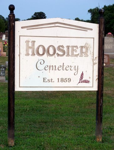
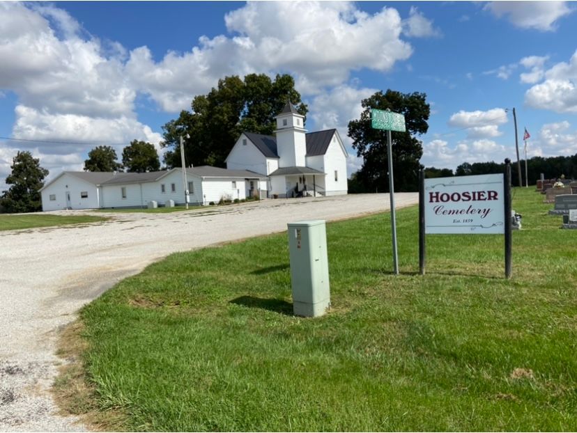
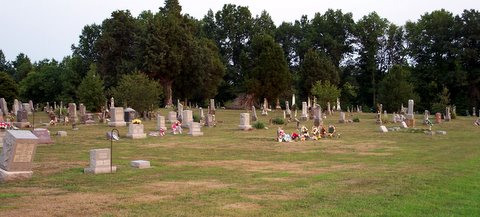
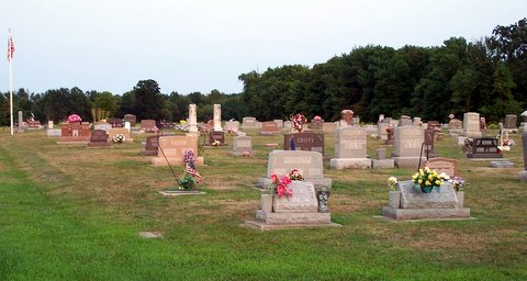
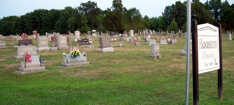
| Description | : | The cemetery is located in Hoosier Township on the northeast corner of the intersection of Moonstone Drive and County Road 1525 E. The cemetery was established in 1859. The U.S. Geological Survey (USGS) Geographic Names Information System (GNIS) feature ID for the cemetery is 1821628 (Hoosier Prairie Cemetery / Baptist Cemetery). |
frequently asked questions (FAQ):
-
Where is Hoosier Prairie Cemetery?
Hoosier Prairie Cemetery is located at Moonstone Drive and County Road 1525 E Louisville, Clay County ,Illinois , 62858USA.
-
Hoosier Prairie Cemetery cemetery's updated grave count on graveviews.com?
6 memorials
-
Where are the coordinates of the Hoosier Prairie Cemetery?
Latitude: 38.7925460
Longitude: -88.4111573
Nearby Cemetories:
1. Fields Cemetery
Clay County, USA
Coordinate: 38.7747002, -88.4100037
2. Kinnamon Cemetery
Louisville, Clay County, USA
Coordinate: 38.7872009, -88.4586029
3. White Cemetery
Sailor Springs, Clay County, USA
Coordinate: 38.7728004, -88.3692017
4. Dillman Cemetery
Sailor Springs, Clay County, USA
Coordinate: 38.7630997, -88.3788986
5. Ditter Cemetery
Sailor Springs, Clay County, USA
Coordinate: 38.7943993, -88.3542023
6. Shouse Chapel Cemetery
Bible Grove, Clay County, USA
Coordinate: 38.8407300, -88.3993200
7. Number Four Cemetery
Sailor Springs, Clay County, USA
Coordinate: 38.7428017, -88.3906021
8. McKinney Cemetery
Sailor Springs, Clay County, USA
Coordinate: 38.7552986, -88.3574982
9. Brooks Cemetery
Bible Grove, Clay County, USA
Coordinate: 38.8495300, -88.3802000
10. Lewis Cemetery
Bible Grove Township, Clay County, USA
Coordinate: 38.8514348, -88.4364355
11. Bible Grove Cemetery
Bible Grove, Clay County, USA
Coordinate: 38.8544006, -88.4396973
12. Woods Cemetery
Clay County, USA
Coordinate: 38.8321991, -88.3343964
13. Levitt Cemetery
Sailor Springs, Clay County, USA
Coordinate: 38.7682991, -88.3210983
14. Red Brush Cemetery
Louisville, Clay County, USA
Coordinate: 38.7969250, -88.5085415
15. Orchard Hill Cemetery
Louisville, Clay County, USA
Coordinate: 38.7764500, -88.5097800
16. Old Louisville Cemetery
Clay County, USA
Coordinate: 38.7652800, -88.5066700
17. Smith Cemetery
Sailor Springs, Clay County, USA
Coordinate: 38.7428017, -88.3319016
18. Old Louisville Cemetery
Louisville, Clay County, USA
Coordinate: 38.7667000, -88.5075000
19. Jenkins Cemetery
Louisville, Clay County, USA
Coordinate: 38.7369003, -88.4847031
20. Ingraham Cemetery
Ingraham, Clay County, USA
Coordinate: 38.8360620, -88.3243210
21. Tolliver Cemetery
Louisville, Clay County, USA
Coordinate: 38.8217010, -88.5171967
22. Rusk Cemetery
Flora, Clay County, USA
Coordinate: 38.7113991, -88.4580994
23. Weidner Cemetery
Sailor Springs, Clay County, USA
Coordinate: 38.7792130, -88.2911530
24. Leonard Cemetery
Clay County, USA
Coordinate: 38.7421989, -88.3050003