
| Memorials | : | 12 |
| Location | : | Union County, USA |
| Coordinate | : | 34.5078900, -81.5693200 |
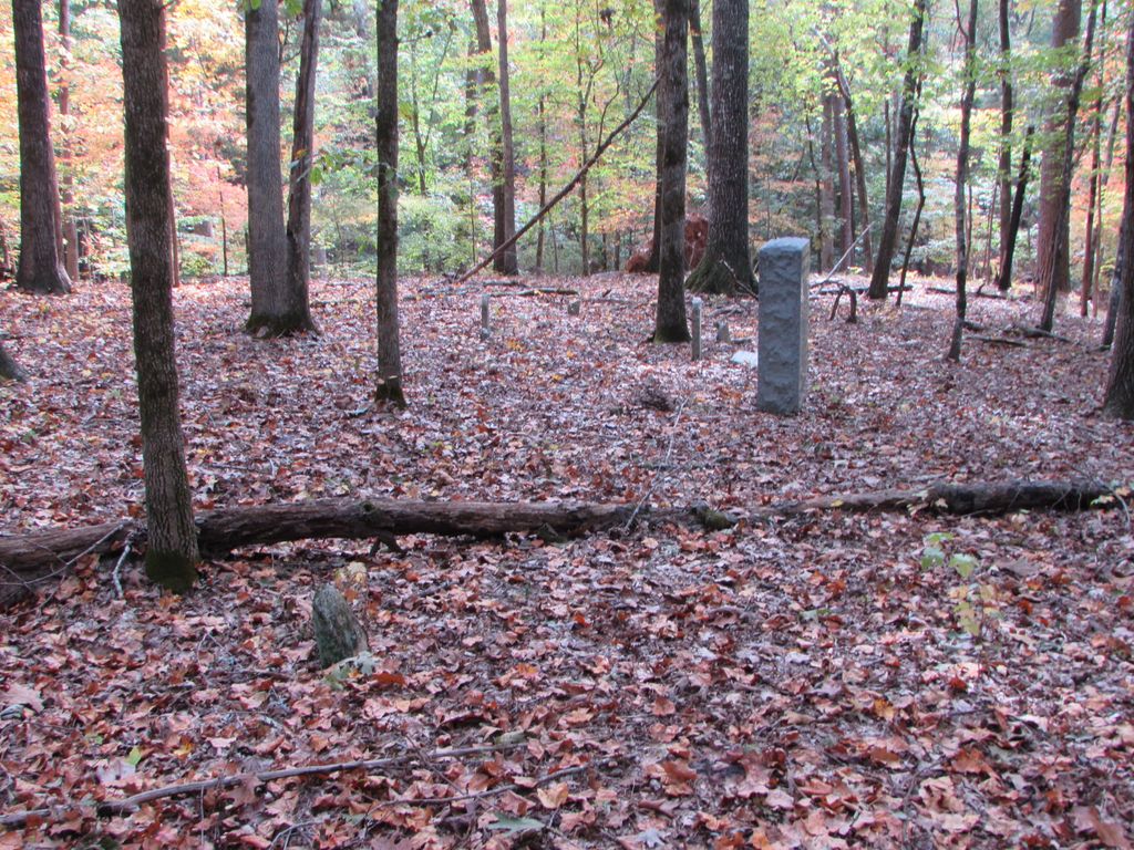
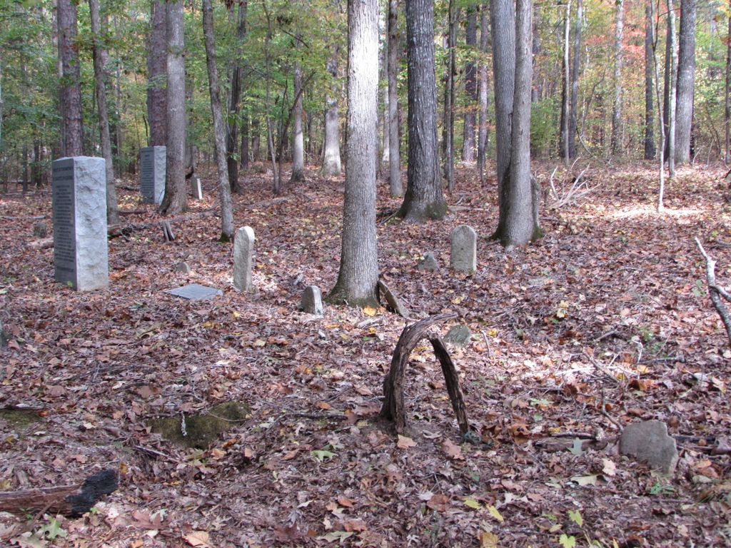
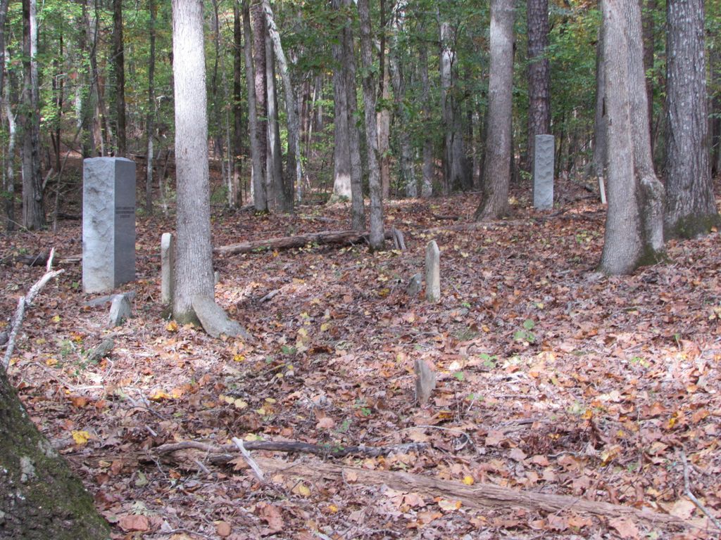
| Description | : | Cemetery is on the Sumter National Forest, south of Goshen Hill. It contains approximately 45 graves of the Hunter, Jenkins and Burel families and probably other families from this area. From US Highway 72/121 drive Maybinton Road, highway 45, south 1/3 mile and take gravel USFS Road 392C to the right(west). About 150 feet from the beginning of this gravel road, an old overgrown road bed runs off to the left, south. Walking this overgrown road will take you in the direction of the cemetery. About 400 yards along this overgrown road a second overgrown woods road leads off... Read More |
frequently asked questions (FAQ):
-
Where is Hunter-Burel-Jenkins Cemetery?
Hunter-Burel-Jenkins Cemetery is located at Union County ,South Carolina ,USA.
-
Hunter-Burel-Jenkins Cemetery cemetery's updated grave count on graveviews.com?
12 memorials
-
Where are the coordinates of the Hunter-Burel-Jenkins Cemetery?
Latitude: 34.5078900
Longitude: -81.5693200
Nearby Cemetories:
1. Saint Mathew's Cemetery
Union County, USA
Coordinate: 34.5039360, -81.5553220
2. Second Rogers Methodist Church Cemetery
Union County, USA
Coordinate: 34.5211300, -81.5650700
3. First Rogers Methodist Church Cemetery
Union County, USA
Coordinate: 34.5296100, -81.5536200
4. Flanagan
Newberry County, USA
Coordinate: 34.4821600, -81.5643800
5. Lee Cemetery
Delta, Union County, USA
Coordinate: 34.5349998, -81.6110992
6. Herndon Family Graveyard
Newberry County, USA
Coordinate: 34.4909770, -81.6202860
7. Duckett Cemetery
Sedalia, Union County, USA
Coordinate: 34.5259514, -81.6235962
8. Hogan Cemetery
Sedalia, Union County, USA
Coordinate: 34.5390015, -81.6287994
9. Cooper Phillips Cemetery
Sedalia, Union County, USA
Coordinate: 34.5539100, -81.6199100
10. Gordon Cemetery
Maybinton, Newberry County, USA
Coordinate: 34.4508210, -81.5315400
11. Mount Tabor Methodist Church Cemetery
Newberry County, USA
Coordinate: 34.4658590, -81.6335730
12. Jeters Chapel AME Church Cemetery
Carlisle, Union County, USA
Coordinate: 34.5598310, -81.5138240
13. Otterson Fort Cemetery
Union County, USA
Coordinate: 34.5778008, -81.5764008
14. Brock Cemetery
Union County, USA
Coordinate: 34.5357100, -81.4814800
15. Cold Well Cemetery
Union County, USA
Coordinate: 34.5769005, -81.6147003
16. McDaniel Cemetery
Union County, USA
Coordinate: 34.5758018, -81.6228027
17. Fant Cemetery
Union County, USA
Coordinate: 34.5833015, -81.6055984
18. Ebenezer Cemetery
Newberry County, USA
Coordinate: 34.4536018, -81.4931030
19. Gladney Family Cemetery
Newberry County, USA
Coordinate: 34.4711950, -81.4728740
20. Flannagan Family Cemetery
Clinton, Laurens County, USA
Coordinate: 34.4925995, -81.6744995
21. Briggs Cemetery
Union County, USA
Coordinate: 34.5894012, -81.6125031
22. O'Dell's Chapel Methodist Church Cemetery
Clinton, Laurens County, USA
Coordinate: 34.5302840, -81.6753850
23. Saint Luke AME Zion Church Cemetery
Carlisle, Union County, USA
Coordinate: 34.5041120, -81.4550130
24. Spring Hill Cemetery
Laurens County, USA
Coordinate: 34.5362200, -81.6811200