
| Memorials | : | 4 |
| Location | : | Big Island, Bedford County, USA |
| Coordinate | : | 37.5354988, -79.4041302 |
frequently asked questions (FAQ):
-
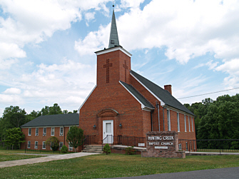
Where is Hunting Creek Baptist Church Cemetery?
Hunting Creek Baptist Church Cemetery is located at Big Island Highway (Route 122) Big Island, Bedford County ,Virginia , 24526USA.
-
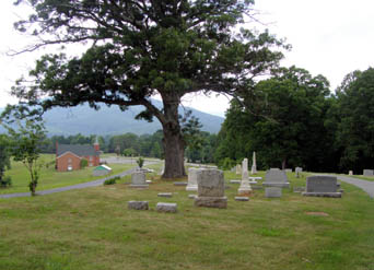
Hunting Creek Baptist Church Cemetery cemetery's updated grave count on graveviews.com?
3 memorials
-
Where are the coordinates of the Hunting Creek Baptist Church Cemetery?
Latitude: 37.5354988
Longitude: -79.4041302
Nearby Cemetories:
1. Sharon Cemetery
Big Island, Bedford County, USA
Coordinate: 37.5450640, -79.3896030
2. Reed Creek Baptist Church Cemetery
Big Island, Bedford County, USA
Coordinate: 37.5170890, -79.4185340
3. Big Island Cemetery
Big Island, Bedford County, USA
Coordinate: 37.5344570, -79.3625370
4. Putt's Cemetery
Amherst County, USA
Coordinate: 37.5560074, -79.3666916
5. Penn-Parks Family Cemetery
Big Island, Bedford County, USA
Coordinate: 37.4961870, -79.4009120
6. Chestnut Hill Baptist Church Cemetery
Big Island, Bedford County, USA
Coordinate: 37.5706315, -79.3759826
7. Waugh Switch Cemetery
Big Island, Bedford County, USA
Coordinate: 37.5209131, -79.3517741
8. McCulloch Family Cemetery
Monroe, Amherst County, USA
Coordinate: 37.5198230, -79.3305690
9. Ivy Hill Cemetery
Monroe, Amherst County, USA
Coordinate: 37.5452270, -79.3178590
10. Cheatham Cemetery
Naola, Amherst County, USA
Coordinate: 37.5744090, -79.3199070
11. Corner Stone Baptist Church Cemetery
Monroe, Amherst County, USA
Coordinate: 37.5491250, -79.3051220
12. Centenary Burial Association Cemetery
Naola, Amherst County, USA
Coordinate: 37.5464420, -79.3018490
13. Ebenezer United Methodist Church Cemetery
Bedford, Bedford County, USA
Coordinate: 37.4764300, -79.4804920
14. Old Ebenezer Church Cemetery
Bedford, Bedford County, USA
Coordinate: 37.4764300, -79.4881300
15. Cove United Methodist Church Cemetery
Coleman Falls, Bedford County, USA
Coordinate: 37.4989894, -79.3010842
16. Brown Family Cemetery
Naola, Amherst County, USA
Coordinate: 37.5622220, -79.2930560
17. Garland H. Freeman Cemetery
Goode, Bedford County, USA
Coordinate: 37.4380000, -79.3917000
18. Zachariah Wheat Family Cemetery
Bedford, Bedford County, USA
Coordinate: 37.4713700, -79.5066700
19. Minor Family Cemetery
Pedlar Mills, Amherst County, USA
Coordinate: 37.5564200, -79.2720900
20. Antioch Baptist Church Cemetery
Coleman Falls, Bedford County, USA
Coordinate: 37.4858666, -79.2842774
21. Pera Road Cemetery
Pera, Amherst County, USA
Coordinate: 37.6189315, -79.3161628
22. Ernest L. White Cemetery
Monroe, Amherst County, USA
Coordinate: 37.6179680, -79.3098330
23. Mount Rock Baptist Church Cemetery
Goode, Bedford County, USA
Coordinate: 37.4246823, -79.3750462
24. Sligh - Martin Cemetery
Eagles Eyrie, Bedford County, USA
Coordinate: 37.4819150, -79.2764340