
| Memorials | : | 1 |
| Location | : | Orillia, Simcoe County, Canada |
| Coordinate | : | 44.5849300, -79.4268600 |
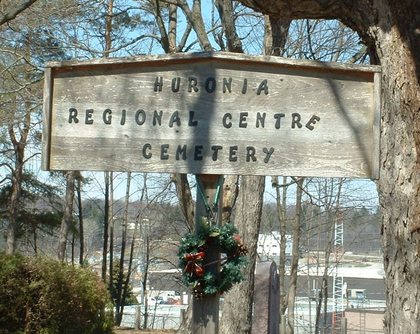
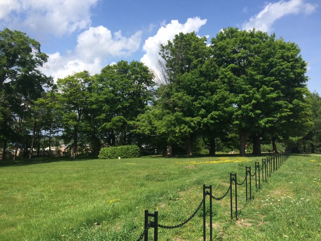
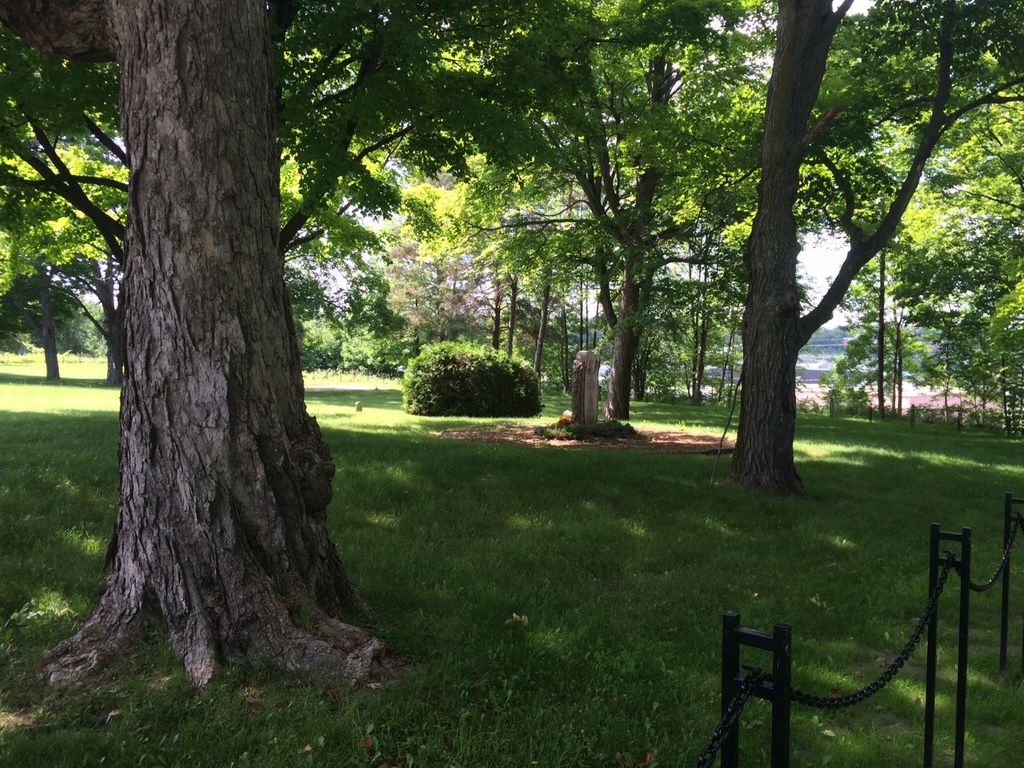
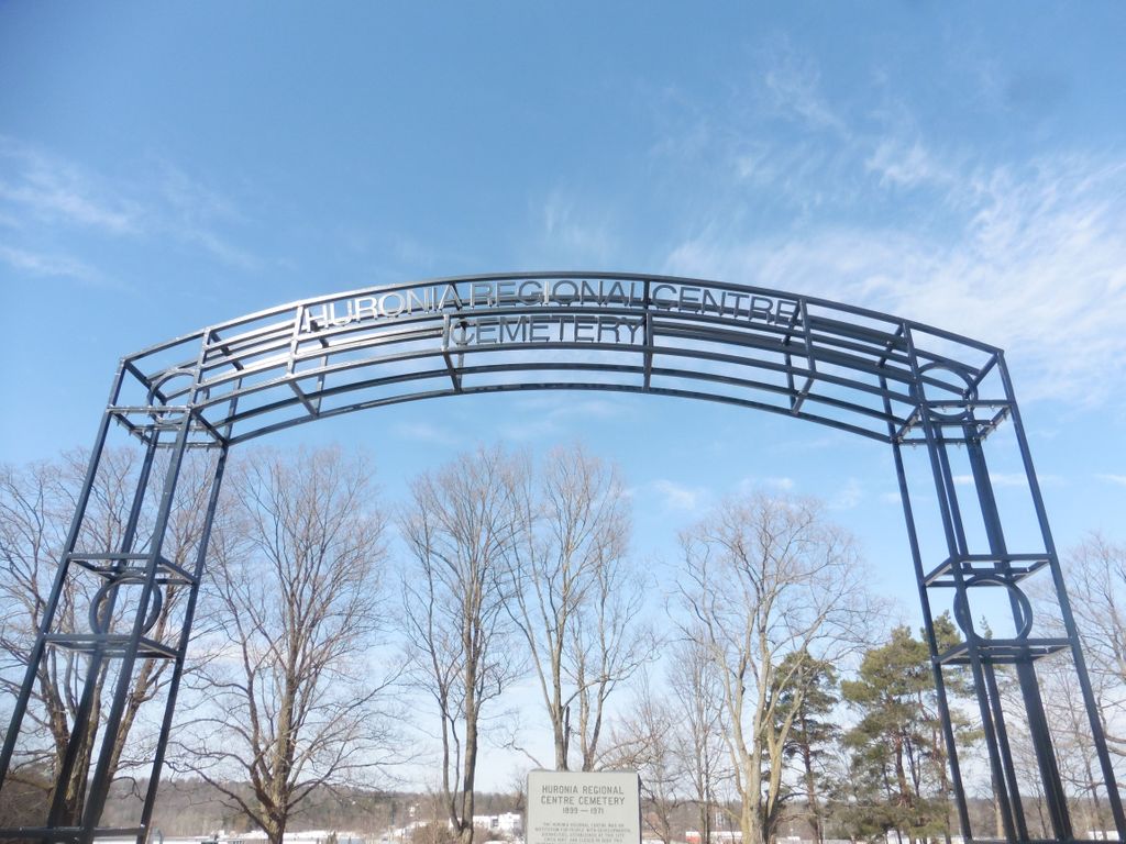
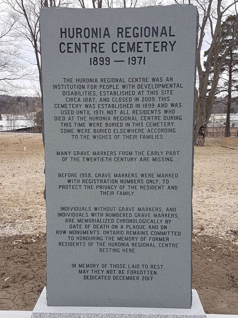
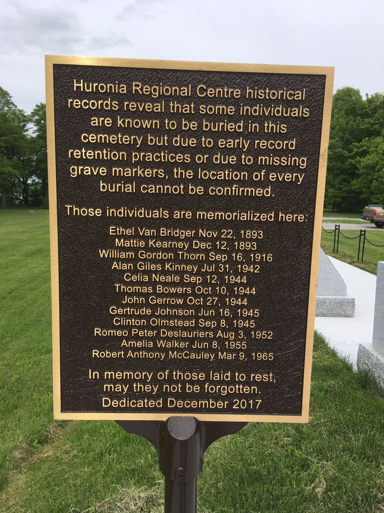
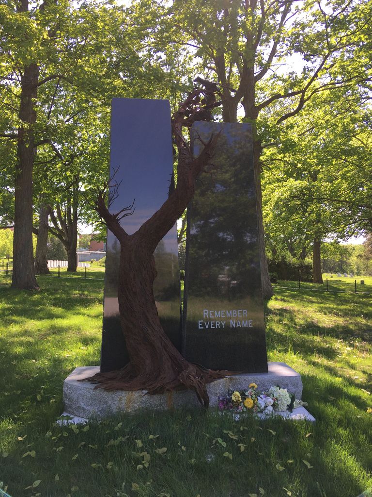
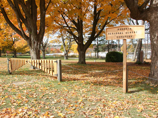
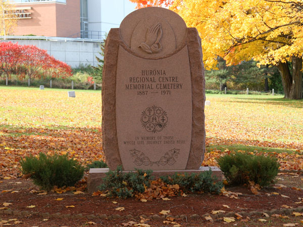
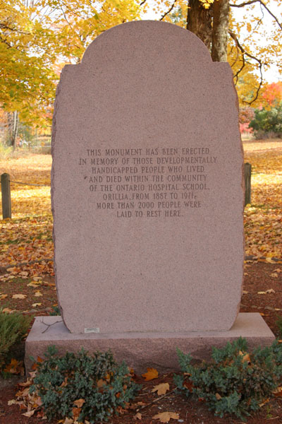
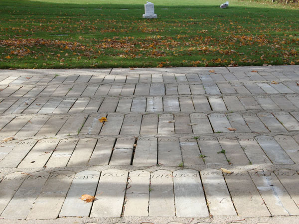
| Description | : | The Cemetery at the Huronia Regional Centre Huronia Regional Centre (previously known as the Orillia Asylum for Idiots) was the only facility [in the Ontario Asylum System] that had its own cemetery for the residents who died there. Before 1958, gravestones were marked with registration numbers only. This was to protect the privacy of the resident and their family. A new section was added to the cemetery in 1953. Starting in 1958, all gravestones were marked with the resident's name, year of birth and year of death. The last institutional burial was in 1971. After 1971, all residents who passed away at the... Read More |
frequently asked questions (FAQ):
-
Where is Huronia Regional Centre Cemetery?
Huronia Regional Centre Cemetery is located at Orillia, Simcoe County ,Ontario ,Canada.
-
Huronia Regional Centre Cemetery cemetery's updated grave count on graveviews.com?
1 memorials
-
Where are the coordinates of the Huronia Regional Centre Cemetery?
Latitude: 44.5849300
Longitude: -79.4268600
Nearby Cemetories:
1. Saint Michael's Roman Catholic Cemetery Old
Orillia, Simcoe County, Canada
Coordinate: 44.6091030, -79.4334050
2. St. James Anglican Cemetery
Orillia, Simcoe County, Canada
Coordinate: 44.6099360, -79.4182040
3. Saint Andrews and Saint James Cemetery
Orillia, Simcoe County, Canada
Coordinate: 44.6115600, -79.4404400
4. Saint Michael's Roman Catholic Cemetery New
Orillia, Simcoe County, Canada
Coordinate: 44.6112460, -79.4498630
5. Saint John's Anglican Cemetery
Atherley, Simcoe County, Canada
Coordinate: 44.5967300, -79.3633800
6. Rugby Cemetery
Rugby, Simcoe County, Canada
Coordinate: 44.5602950, -79.5005460
7. Atherley Cemetery
Atherley, Simcoe County, Canada
Coordinate: 44.5992100, -79.3455600
8. Leigh's Corners Cemetery
Oro-Medonte, Simcoe County, Canada
Coordinate: 44.5365300, -79.4811500
9. Cameron Family Cemetery
Oro-Medonte, Simcoe County, Canada
Coordinate: 44.5808600, -79.5170200
10. Saint Mark's Anglican Cemetery
East Oro, Simcoe County, Canada
Coordinate: 44.5299300, -79.4959000
11. Marchmont Baptist Cemetery
Marchmont, Simcoe County, Canada
Coordinate: 44.6330840, -79.5088510
12. Esson Presbyterian Church Cemetery
Oro-Medonte, Simcoe County, Canada
Coordinate: 44.5518910, -79.5225330
13. Knox Presbyterian Church Cemetery
Uptergrove, Simcoe County, Canada
Coordinate: 44.5999500, -79.3185300
14. Saint Columbkille Roman Catholic Cemetery
Uptergrove, Simcoe County, Canada
Coordinate: 44.6023280, -79.3059680
15. Mnjikaning First Nation Cemetery
Rama, Simcoe County, Canada
Coordinate: 44.6516350, -79.3431760
16. Knox Presbyterian Cemetery
Oro-Medonte, Simcoe County, Canada
Coordinate: 44.5414400, -79.5453900
17. Ardtrea United Church Cemetery
Ardtrea, Simcoe County, Canada
Coordinate: 44.6859350, -79.4021660
18. Longford Mills United Church Cemetery
Longford Mills, Simcoe County, Canada
Coordinate: 44.6761530, -79.3421240
19. Fairvalley Methodist Cemetery
Rathburn, Simcoe County, Canada
Coordinate: 44.6288600, -79.2764600
20. Saint George's Fair Valley Cemetery
Fair Valley, Simcoe County, Canada
Coordinate: 44.6461200, -79.5976200
21. Thompson Cemetery
Oro-Medonte, Simcoe County, Canada
Coordinate: 44.5178800, -79.5973310
22. Brotherston Family Cemetery
Oro-Medonte, Simcoe County, Canada
Coordinate: 44.6110140, -79.6252750
23. Edgar Old Methodist United Church Cemetery
Edgar, Simcoe County, Canada
Coordinate: 44.5114570, -79.6139930
24. Little Brick United Church Cemetery
Oro Station, Simcoe County, Canada
Coordinate: 44.4496700, -79.5317700