
| Memorials | : | 2 |
| Location | : | Atherley, Simcoe County, Canada |
| Coordinate | : | 44.5967300, -79.3633800 |
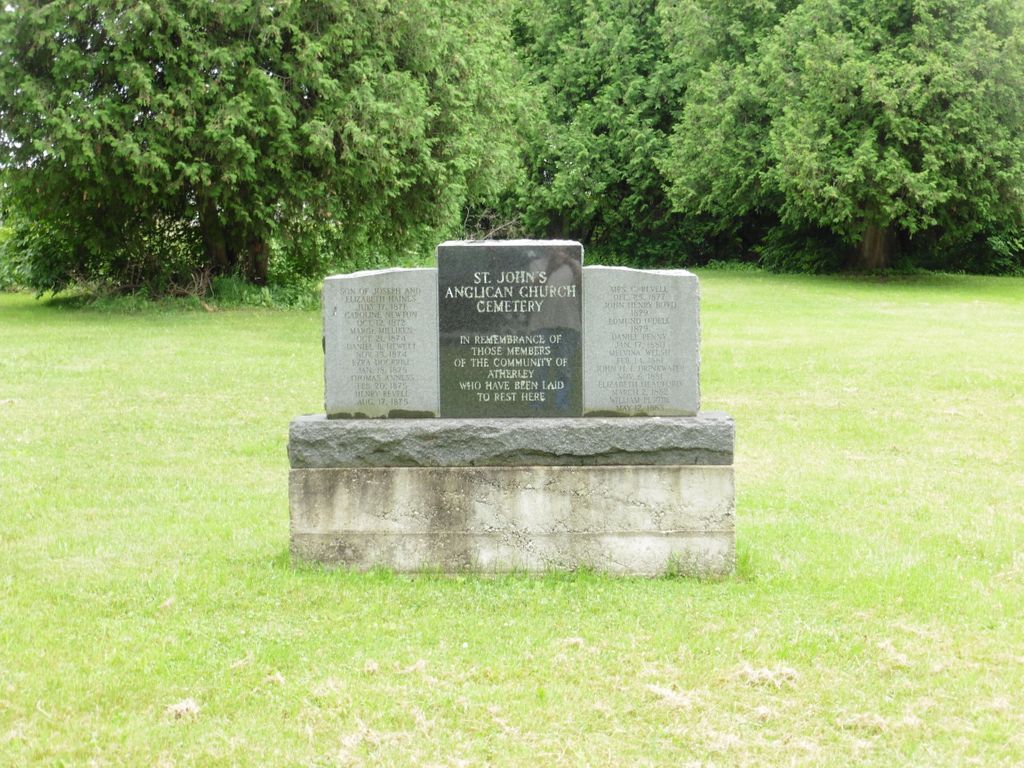
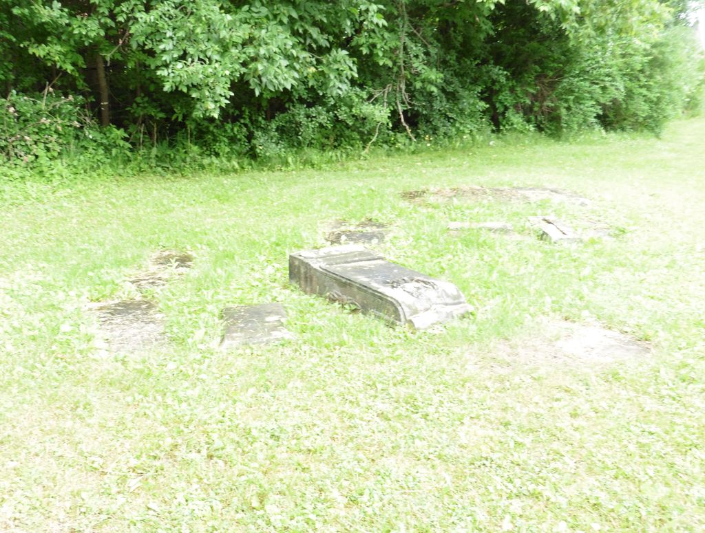
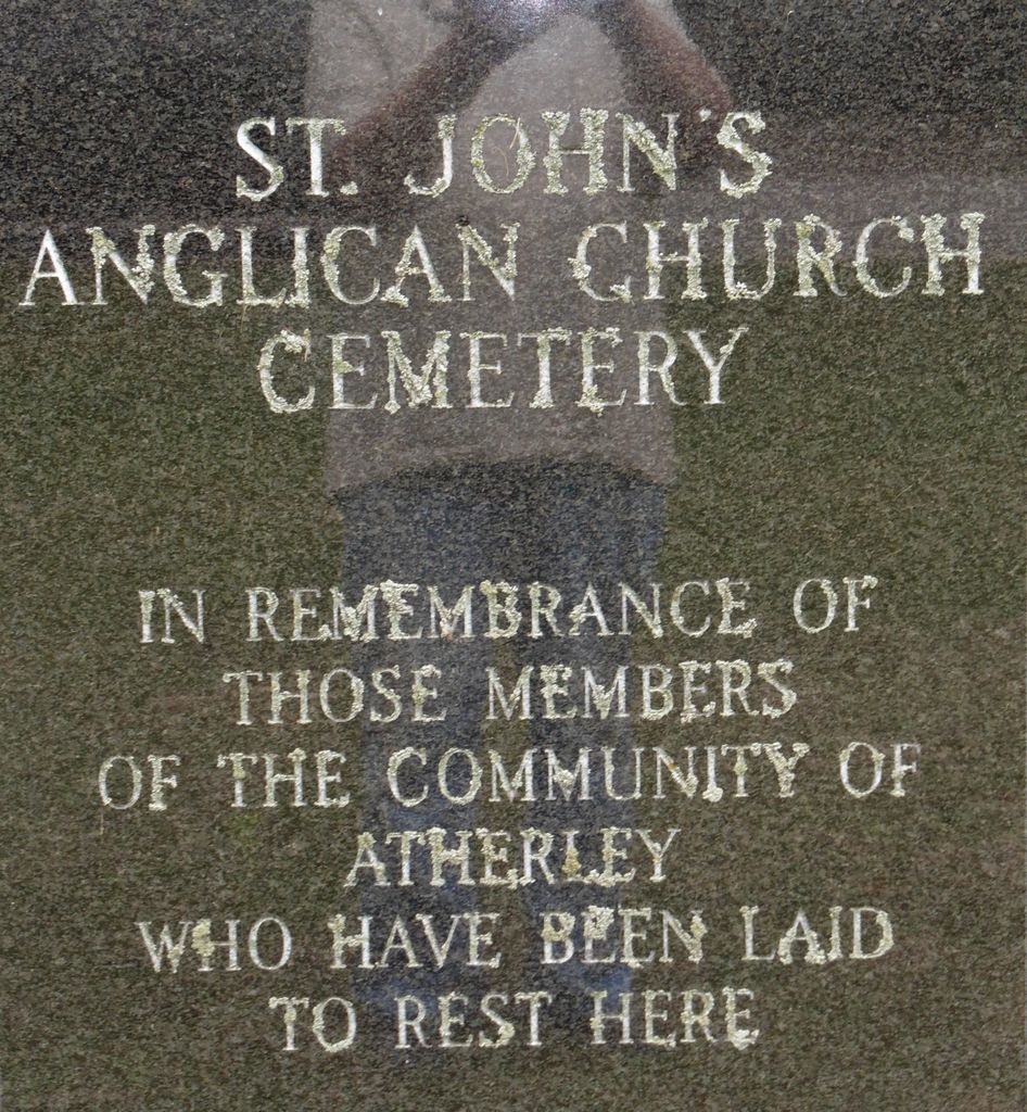
| Description | : | There is a Memorial in the lot to 19 persons. A few individual markers are in the corner of the lot. Captain Ogden Creighton was a officer with the British Army, He was made famous for the planning and developing of the village of Clifton in 1832 (now "Clifton Hill in Niagara Falls). Later he acquired land holdings along Lake Simcoe at the Narrows, he assisted in the planning of Atherley. He donated 1/4 acre of land for a church and the burial grounds. The church has since been torn down. The cemetery was cared for by St. James church... Read More |
frequently asked questions (FAQ):
-
Where is Saint John's Anglican Cemetery?
Saint John's Anglican Cemetery is located at 53 Balsam Rd. Atherley, Simcoe County ,Ontario ,Canada.
-
Saint John's Anglican Cemetery cemetery's updated grave count on graveviews.com?
2 memorials
-
Where are the coordinates of the Saint John's Anglican Cemetery?
Latitude: 44.5967300
Longitude: -79.3633800
Nearby Cemetories:
1. Atherley Cemetery
Atherley, Simcoe County, Canada
Coordinate: 44.5992100, -79.3455600
2. Knox Presbyterian Church Cemetery
Uptergrove, Simcoe County, Canada
Coordinate: 44.5999500, -79.3185300
3. St. James Anglican Cemetery
Orillia, Simcoe County, Canada
Coordinate: 44.6099360, -79.4182040
4. Saint Columbkille Roman Catholic Cemetery
Uptergrove, Simcoe County, Canada
Coordinate: 44.6023280, -79.3059680
5. Huronia Regional Centre Cemetery
Orillia, Simcoe County, Canada
Coordinate: 44.5849300, -79.4268600
6. Saint Michael's Roman Catholic Cemetery Old
Orillia, Simcoe County, Canada
Coordinate: 44.6091030, -79.4334050
7. Mnjikaning First Nation Cemetery
Rama, Simcoe County, Canada
Coordinate: 44.6516350, -79.3431760
8. Saint Andrews and Saint James Cemetery
Orillia, Simcoe County, Canada
Coordinate: 44.6115600, -79.4404400
9. Saint Michael's Roman Catholic Cemetery New
Orillia, Simcoe County, Canada
Coordinate: 44.6112460, -79.4498630
10. Fairvalley Methodist Cemetery
Rathburn, Simcoe County, Canada
Coordinate: 44.6288600, -79.2764600
11. Longford Mills United Church Cemetery
Longford Mills, Simcoe County, Canada
Coordinate: 44.6761530, -79.3421240
12. Ardtrea United Church Cemetery
Ardtrea, Simcoe County, Canada
Coordinate: 44.6859350, -79.4021660
13. Leigh's Corners Cemetery
Oro-Medonte, Simcoe County, Canada
Coordinate: 44.5365300, -79.4811500
14. Rugby Cemetery
Rugby, Simcoe County, Canada
Coordinate: 44.5602950, -79.5005460
15. Marchmont Baptist Cemetery
Marchmont, Simcoe County, Canada
Coordinate: 44.6330840, -79.5088510
16. Cameron Family Cemetery
Oro-Medonte, Simcoe County, Canada
Coordinate: 44.5808600, -79.5170200
17. Udney United Church Cemetery
Udney, Simcoe County, Canada
Coordinate: 44.6288414, -79.2120285
18. Saint Mark's Anglican Cemetery
East Oro, Simcoe County, Canada
Coordinate: 44.5299300, -79.4959000
19. Esson Presbyterian Church Cemetery
Oro-Medonte, Simcoe County, Canada
Coordinate: 44.5518910, -79.5225330
20. Saint Joseph's Black River Roman Catholic Cemetery
Rama, Simcoe County, Canada
Coordinate: 44.7092140, -79.2867240
21. Saint Paul's Anglican Cemetery
Washago, Simcoe County, Canada
Coordinate: 44.7370020, -79.3641390
22. Knox Presbyterian Cemetery
Oro-Medonte, Simcoe County, Canada
Coordinate: 44.5414400, -79.5453900
23. Saint Andrews Roman Catholic Cemetery
Brechin, Simcoe County, Canada
Coordinate: 44.5480800, -79.1745200
24. New Sebright Community Cemetery
Rama, Simcoe County, Canada
Coordinate: 44.6926510, -79.1686110