
| Memorials | : | 6 |
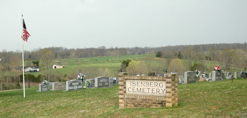
| Location | : | Emberton, Monroe County, USA |
| Coordinate | : | 36.7105390, -85.7999730 |
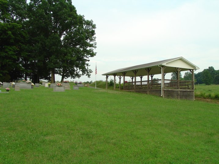
| Description | : | Located just off Hwy. # 1336, between Emberton and Freewill. Located just in front of the old Emberton Ky. Post Office Site, no longer a Post Office there but the community is still known as Emberton. |
frequently asked questions (FAQ):
-
Where is Isenberg Cemetery?
Isenberg Cemetery is located at Emberton, Monroe County ,Kentucky ,USA.
-
Isenberg Cemetery cemetery's updated grave count on graveviews.com?
5 memorials
-
Where are the coordinates of the Isenberg Cemetery?
Latitude: 36.7105390
Longitude: -85.7999730
Nearby Cemetories:
1. Belcher Cemetery
Monroe County, USA
Coordinate: 36.7141991, -85.8080978
2. Mitchell Cemetery
Emberton, Monroe County, USA
Coordinate: 36.7182400, -85.8075850
3. Register Cemetery
Monroe County, USA
Coordinate: 36.7250270, -85.8218480
4. Community Park Cemetery
Gamaliel, Monroe County, USA
Coordinate: 36.6785400, -85.8013600
5. Freetown Church Cemetery
Gamaliel, Monroe County, USA
Coordinate: 36.6747000, -85.7989000
6. New Salem-Turner Cemetery
Mud Lick, Monroe County, USA
Coordinate: 36.7459335, -85.8120651
7. Fraim Slaves Cemetery
Flippin, Monroe County, USA
Coordinate: 36.7036111, -85.8461111
8. County House Cemetery
Tompkinsville, Monroe County, USA
Coordinate: 36.7451750, -85.8283010
9. Mud Lick Cemetery
Monroe County, USA
Coordinate: 36.7523550, -85.7926750
10. Samuel Harlan Family Cemetery
Gamaliel, Monroe County, USA
Coordinate: 36.6669730, -85.7835670
11. Daniels Cemetery
Mud Lick, Monroe County, USA
Coordinate: 36.7562540, -85.8051570
12. Simmons Graveyard
Flippin, Monroe County, USA
Coordinate: 36.7324829, -85.8532576
13. Ebenezer Cemetery
Tompkinsville, Monroe County, USA
Coordinate: 36.6810800, -85.7503670
14. Neal Farm Cemetery
Flippin, Monroe County, USA
Coordinate: 36.7238700, -85.8615000
15. McPherson Farm Cemetery
Flippin, Monroe County, USA
Coordinate: 36.7128122, -85.8649729
16. Bethlehem Cemetery
Mud Lick, Monroe County, USA
Coordinate: 36.7627650, -85.8098640
17. Neal Cemetery
Flippin, Monroe County, USA
Coordinate: 36.7099991, -85.8681030
18. Church of Christ Cemetery
Flippin, Monroe County, USA
Coordinate: 36.7165790, -85.8703340
19. Brown Cemetery
Tompkinsville, Monroe County, USA
Coordinate: 36.7257996, -85.7313995
20. Old Union Church Cemetery
Gamaliel, Monroe County, USA
Coordinate: 36.6578500, -85.8294440
21. Gillenwaters Cemetery
Flippin, Monroe County, USA
Coordinate: 36.7317783, -85.8676882
22. Hale Cemetery
Tompkinsville, Monroe County, USA
Coordinate: 36.6753950, -85.7417460
23. Tyree Cemetery
Monroe County, USA
Coordinate: 36.7696991, -85.7930984
24. Goodall Cemetery
Flippin, Monroe County, USA
Coordinate: 36.7221700, -85.8741700