
| Memorials | : | 0 |
| Location | : | Buckhorn, Grant County, USA |
| Coordinate | : | 33.1070000, -108.7886000 |
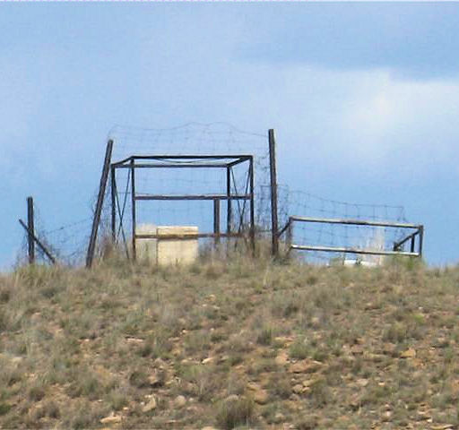
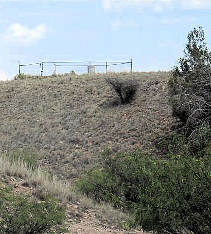
| Description | : | Jackson Cemetery is approximately 50 miles NW of Silver City, NM, 8 miles from the Catron County Line. It served the Grant County settlement of Jackson (near junction US 180 and NM 78). After 1900 Robert W. Jackson and his family had a ranch on what then was known as the Mogollon Road. They began offering lodging to travelers, and they opened a PO bearing their surname. Nothing now remains of Jackson. (Paraphrased from 'The Place Names of New Mexico'... By Robert Hixson Julyan) There are approximately 30 graves, about 20 of these are without headstones. It... Read More |
frequently asked questions (FAQ):
-
Where is Jackson Ranch Cemetery?
Jackson Ranch Cemetery is located at Buckhorn, Grant County ,New Mexico ,USA.
-
Jackson Ranch Cemetery cemetery's updated grave count on graveviews.com?
0 memorials
-
Where are the coordinates of the Jackson Ranch Cemetery?
Latitude: 33.1070000
Longitude: -108.7886000
Nearby Cemetories:
1. Mule Creek Cemetery
Mule Creek, Grant County, USA
Coordinate: 33.1208530, -108.9548000
2. Dinwiddie Cemetery
Cliff, Grant County, USA
Coordinate: 32.9849740, -108.6500240
3. Pleasanton Cemetery
Pleasanton, Catron County, USA
Coordinate: 33.2761620, -108.8737890
4. Stout Cemetery
Cliff, Grant County, USA
Coordinate: 32.9682999, -108.6258011
5. Glenwood Cemetery
Glenwood, Catron County, USA
Coordinate: 33.3090235, -108.8911499
6. Fort West Burial Ground
Cliff, Grant County, USA
Coordinate: 32.9430556, -108.6008333
7. Maldonado Cemetery
Grant County, USA
Coordinate: 33.0050011, -108.5453033
8. Mesa Cemetery
Gila, Grant County, USA
Coordinate: 32.9489500, -108.5872100
9. Cliff Gila Catholic Cemetery
Gila, Grant County, USA
Coordinate: 32.9493910, -108.5831140
10. Clark Cemetery
Grant County, USA
Coordinate: 32.8828011, -108.5975037
11. Alma Cemetery
Alma, Catron County, USA
Coordinate: 33.3803480, -108.9013210
12. Mogollon Cemetery
Catron County, USA
Coordinate: 33.4061012, -108.7913971
13. Cooney Cemetery
Cooney, Catron County, USA
Coordinate: 33.4127998, -108.8368988
14. Boot Hill Cemetery
Alma, Catron County, USA
Coordinate: 33.4005390, -108.9076770
15. Billings Cemetery
Gila, Grant County, USA
Coordinate: 32.8129900, -108.5989700
16. Hill Family Cemetery
Grant County, USA
Coordinate: 32.8115300, -109.0078900
17. Papineau Grave
Catron County, USA
Coordinate: 33.3511009, -108.4332962
18. Fritz Gravesite
Greenlee County, USA
Coordinate: 33.3227580, -109.1908510
19. Redrock Cemetery
Redrock, Grant County, USA
Coordinate: 32.7083015, -108.7024994
20. Clifton Cemetery
Clifton, Greenlee County, USA
Coordinate: 33.0293999, -109.2647018
21. Sheldon Cemetery
Duncan, Greenlee County, USA
Coordinate: 32.8193600, -109.1728900
22. Sacred Heart Church Columbarium
Clifton, Greenlee County, USA
Coordinate: 33.0555540, -109.3054630
23. Metcalf Indian Cemetery
Greenlee County, USA
Coordinate: 33.0445595, -109.3101807
24. Metcalf Cemetery
Greenlee County, USA
Coordinate: 33.0438995, -109.3110962