
| Memorials | : | 6 |
| Location | : | Brown Mountain, Stokes County, USA |
| Coordinate | : | 36.4692001, -80.3771973 |
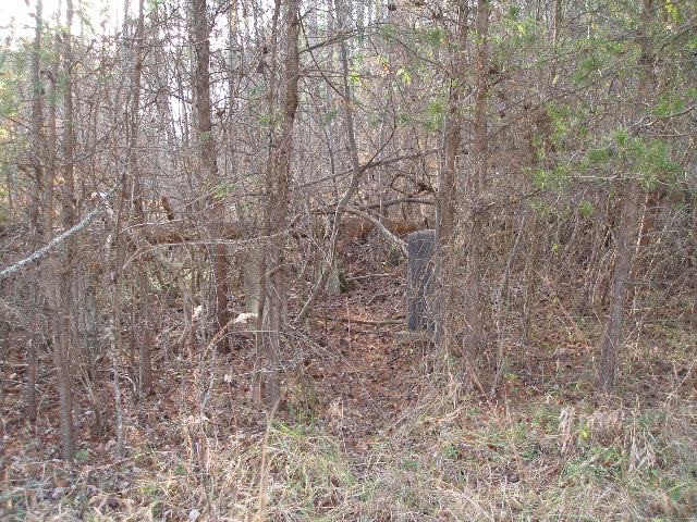
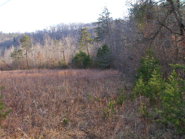
| Description | : | From the intersection of NC Highway 66 North and Smith Road, travel 0.42 miles north on NC Highway 66; the cemetery is at the end of the first grass field on the left. From the NC Highway 66 road shoulder, walk approximately 138 feet down a foot path; the cemetery will be at the bottom of the field on the right in the woods. |
frequently asked questions (FAQ):
-
Where is James Nunn Cemetery?
James Nunn Cemetery is located at NC Highway 66 North Brown Mountain, Stokes County ,North Carolina , 27053USA.
-
James Nunn Cemetery cemetery's updated grave count on graveviews.com?
6 memorials
-
Where are the coordinates of the James Nunn Cemetery?
Latitude: 36.4692001
Longitude: -80.3771973
Nearby Cemetories:
1. John Nunn Cemetery
Brown Mountain, Stokes County, USA
Coordinate: 36.4647210, -80.3772960
2. Nunn Cemetery
Johnstown, Stokes County, USA
Coordinate: 36.4749985, -80.3964005
3. Nunn Family Cemetery
Brown Mountain, Stokes County, USA
Coordinate: 36.4510994, -80.3722000
4. Forest Cemetery
Stokes County, USA
Coordinate: 36.4533005, -80.3647003
5. Brown Mountain Baptist Church Cemetery
Brown Mountain, Stokes County, USA
Coordinate: 36.4482390, -80.3635740
6. Beasley Cemetery
Johnstown, Stokes County, USA
Coordinate: 36.4831009, -80.4044037
7. Simmons Chapel Primitive Baptist Church Cemetery
Brown Mountain, Stokes County, USA
Coordinate: 36.4694410, -80.3419020
8. Collins Family Cemetery
Johnstown, Stokes County, USA
Coordinate: 36.4960220, -80.3908490
9. Big Creek Primitive Baptist Church Cemetery
Francisco, Stokes County, USA
Coordinate: 36.4988300, -80.3743510
10. Smith Family Cemetery
Brown Mountain, Stokes County, USA
Coordinate: 36.4722310, -80.3398120
11. Kings Mountain View Primitive Baptist Cemetery
Brown Mountain, Stokes County, USA
Coordinate: 36.4612690, -80.3317550
12. Frances Memorial Primitive Baptist Church Cemetery
Brown Mountain, Stokes County, USA
Coordinate: 36.4303550, -80.3831110
13. Lawrence Cemetery
Francisco, Stokes County, USA
Coordinate: 36.5042180, -80.3530650
14. Collins Family Cemetery
Francisco, Stokes County, USA
Coordinate: 36.5078940, -80.3590460
15. Francisco Presbyterian Church Cemetery
Francisco, Stokes County, USA
Coordinate: 36.5093260, -80.3580160
16. Smith Family Cemetery
Francisco, Stokes County, USA
Coordinate: 36.5136240, -80.3787000
17. Garland Smith Cemetery
Francisco, Stokes County, USA
Coordinate: 36.5136760, -80.3818510
18. Bondurant Cemetery
Stokes County, USA
Coordinate: 36.4530983, -80.3253021
19. Gallian Francis Family Cemetery
Francisco, Stokes County, USA
Coordinate: 36.5122000, -80.3584000
20. Frye Cemetery
Stokes County, USA
Coordinate: 36.4575005, -80.3214035
21. Forrest Cemetery
Big Creek Township, Stokes County, USA
Coordinate: 36.4754100, -80.3187400
22. Jessup Family Cemetery
Asbury, Stokes County, USA
Coordinate: 36.5066000, -80.4214200
23. Beasley Cemetery
Francisco, Stokes County, USA
Coordinate: 36.5163994, -80.3510971
24. William Riley Francis Family Cemetery
Francisco, Stokes County, USA
Coordinate: 36.5131110, -80.3417940