
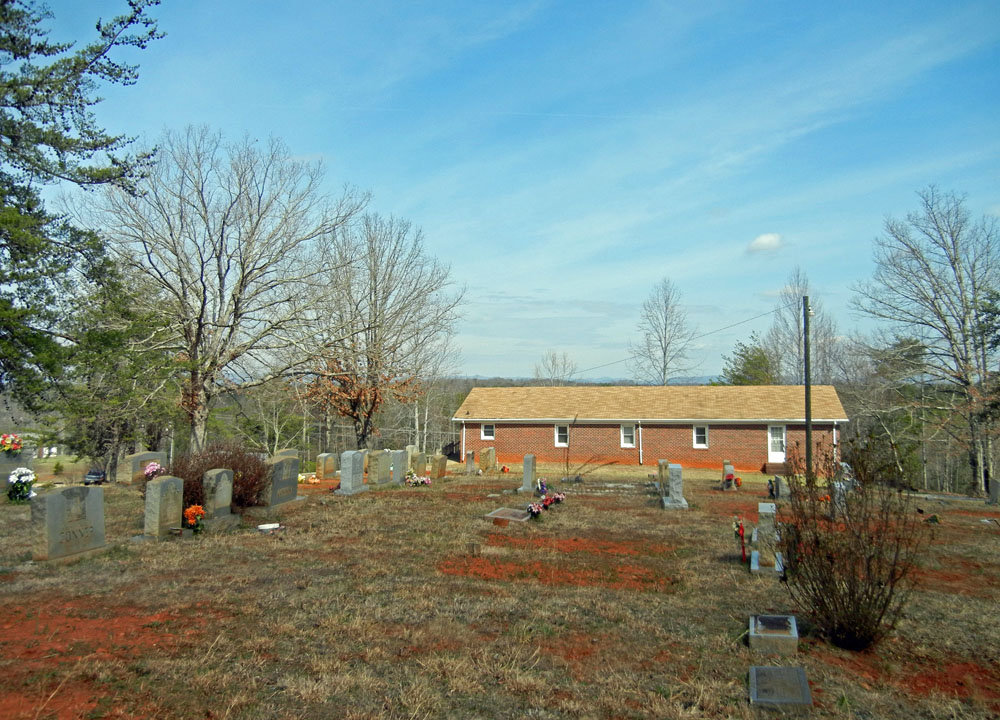
| Memorials | : | 99 |
| Location | : | Brown Mountain, Stokes County, USA |
| Coordinate | : | 36.4694410, -80.3419020 |
| Description | : | From the intersection of Frye Road and Horseshoe Road, travel approx. 0.75 miles on Frye Road, turn right onto Simmons Chapel Church Road, travel 0.07 miles on Simmons Chapel Church Road; the cemetery will be on the left. |
frequently asked questions (FAQ):
-
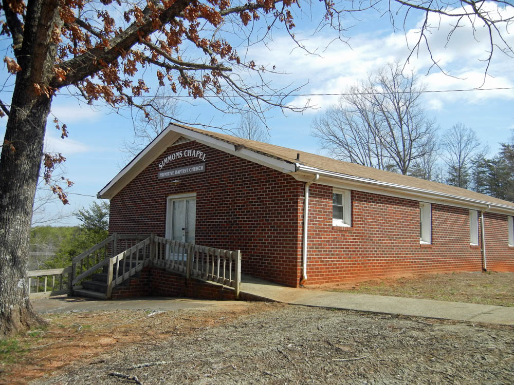
Where is Simmons Chapel Primitive Baptist Church Cemetery?
Simmons Chapel Primitive Baptist Church Cemetery is located at 1025 Simmons Chapel Church Road Brown Mountain, Stokes County ,North Carolina , 27053USA.
-
Simmons Chapel Primitive Baptist Church Cemetery cemetery's updated grave count on graveviews.com?
99 memorials
-
Where are the coordinates of the Simmons Chapel Primitive Baptist Church Cemetery?
Latitude: 36.4694410
Longitude: -80.3419020
Nearby Cemetories:
1. Smith Family Cemetery
Brown Mountain, Stokes County, USA
Coordinate: 36.4722310, -80.3398120
2. Kings Mountain View Primitive Baptist Cemetery
Brown Mountain, Stokes County, USA
Coordinate: 36.4612690, -80.3317550
3. Forrest Cemetery
Big Creek Township, Stokes County, USA
Coordinate: 36.4754100, -80.3187400
4. Frye Cemetery
Stokes County, USA
Coordinate: 36.4575005, -80.3214035
5. Bondurant Cemetery
Stokes County, USA
Coordinate: 36.4530983, -80.3253021
6. Forest Cemetery
Stokes County, USA
Coordinate: 36.4533005, -80.3647003
7. Brown Mountain Baptist Church Cemetery
Brown Mountain, Stokes County, USA
Coordinate: 36.4482390, -80.3635740
8. Paradise Ridge Cemetery
Westfield, Surry County, USA
Coordinate: 36.4720250, -80.3076960
9. James Nunn Cemetery
Brown Mountain, Stokes County, USA
Coordinate: 36.4692001, -80.3771973
10. Flippin Cemetery
Stokes County, USA
Coordinate: 36.4831009, -80.3107986
11. John Nunn Cemetery
Brown Mountain, Stokes County, USA
Coordinate: 36.4647210, -80.3772960
12. Nunn Family Cemetery
Brown Mountain, Stokes County, USA
Coordinate: 36.4510994, -80.3722000
13. Ray Family Cemetery
Francisco, Stokes County, USA
Coordinate: 36.4933014, -80.3178024
14. Frye Cemetery
Francisco, Stokes County, USA
Coordinate: 36.4509750, -80.3097150
15. Powell W. Simmons Family Cemetery
Francisco, Stokes County, USA
Coordinate: 36.4704760, -80.3001980
16. Lawrence Cemetery
Francisco, Stokes County, USA
Coordinate: 36.5042180, -80.3530650
17. Simmons Family Cemetery
Francisco, Stokes County, USA
Coordinate: 36.4679220, -80.2951460
18. Big Creek Primitive Baptist Church Cemetery
Francisco, Stokes County, USA
Coordinate: 36.4988300, -80.3743510
19. Collins Family Cemetery
Francisco, Stokes County, USA
Coordinate: 36.5078940, -80.3590460
20. Moir Family Cemetery
Francisco, Stokes County, USA
Coordinate: 36.5101060, -80.3362960
21. Francisco Presbyterian Church Cemetery
Francisco, Stokes County, USA
Coordinate: 36.5093260, -80.3580160
22. William Riley Francis Family Cemetery
Francisco, Stokes County, USA
Coordinate: 36.5131110, -80.3417940
23. Nunn Cemetery
Johnstown, Stokes County, USA
Coordinate: 36.4749985, -80.3964005
24. Gallian Francis Family Cemetery
Francisco, Stokes County, USA
Coordinate: 36.5122000, -80.3584000