| Memorials | : | 32 |
| Location | : | Manchester, Clay County, USA |
| Coordinate | : | 37.1899100, -83.7932000 |
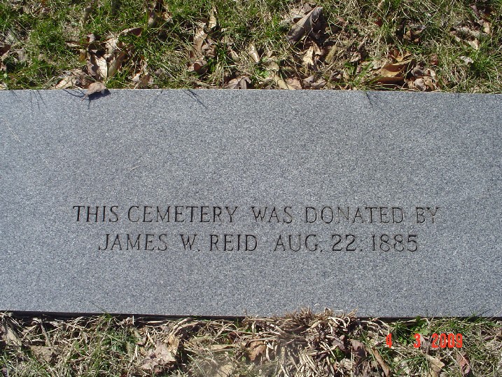
| Description | : | Directions to the James Reid Cemetery from Manchester, KY: go north on Highway 421 and turn left on Highway 3473. Go to the end of this road and turn right on Highway 638. Take Highway 638 and turn right at Greenbriar Subdivision. Go up the hill, taking the right fork in the road which leads to the Cemetery. James Reid Cemetery was established in 1885. N 37.19014 W 83.79148 |
frequently asked questions (FAQ):
-
Where is James Reid Cemetery?
James Reid Cemetery is located at Jarve Hollow Road off Hwy 638 Manchester, Clay County ,Kentucky , 40962USA.
-
James Reid Cemetery cemetery's updated grave count on graveviews.com?
32 memorials
-
Where are the coordinates of the James Reid Cemetery?
Latitude: 37.1899100
Longitude: -83.7932000
Nearby Cemetories:
1. Robinson Cemetery #2
Manchester, Clay County, USA
Coordinate: 37.1847100, -83.7914000
2. Adams Cemetery
Manchester, Clay County, USA
Coordinate: 37.1861800, -83.7826200
3. Hugh Martin Cemetery
Manchester, Clay County, USA
Coordinate: 37.1924700, -83.7816900
4. Parks Cemetery
Manchester, Clay County, USA
Coordinate: 37.1882600, -83.7794200
5. Asher and Halcomb Family Cemetery
Manchester, Clay County, USA
Coordinate: 37.1851900, -83.7791600
6. Lucinda Baker Cemetery
Fall Rock, Clay County, USA
Coordinate: 37.1921000, -83.7781100
7. Charlie Hornsby Cemetery
Fall Rock, Clay County, USA
Coordinate: 37.2016400, -83.7850700
8. Price Cemetery
Sidell, Clay County, USA
Coordinate: 37.1784360, -83.8052750
9. Tipton Cemetery
Sidell, Clay County, USA
Coordinate: 37.1894110, -83.8126710
10. Carnahan Cemetery
Manchester, Clay County, USA
Coordinate: 37.1719620, -83.7917860
11. Herman Lewis Cemetery
Manchester, Clay County, USA
Coordinate: 37.1863850, -83.7701370
12. Roark Family Cemetery
Manchester, Clay County, USA
Coordinate: 37.1862700, -83.7700900
13. Ramsey Cemetery
Manchester, Clay County, USA
Coordinate: 37.1766850, -83.8117940
14. Hoskins Cemetery
Manchester, Clay County, USA
Coordinate: 37.1784600, -83.7707900
15. Bishop Falls Cemetery
Fall Rock, Clay County, USA
Coordinate: 37.2127800, -83.8049030
16. James Keith Cemetery
Fall Rock, Clay County, USA
Coordinate: 37.2097480, -83.7730560
17. Sandlin Cemetery
Sidell, Clay County, USA
Coordinate: 37.2052994, -83.8221970
18. Elijah Campbell Cemetery
Fall Rock, Clay County, USA
Coordinate: 37.2184200, -83.7898400
19. Abe Collins Cemetery
Manchester, Clay County, USA
Coordinate: 37.1614600, -83.7811400
20. Henson Cemetery #4
Clay County, USA
Coordinate: 37.1593700, -83.8012400
21. Burchell Cemetery
Manchester, Clay County, USA
Coordinate: 37.1587500, -83.7805700
22. Lunsford Cemetery (Defunct)
Manchester, Clay County, USA
Coordinate: 37.1603200, -83.7753800
23. Manchester Memorial Gardens
Manchester, Clay County, USA
Coordinate: 37.1603200, -83.7753800
24. Massey Family Cemetery
Bernice, Clay County, USA
Coordinate: 37.2132300, -83.7641700


