
| Memorials | : | 0 |
| Location | : | Frankfurt am Main, Stadtkreis Frankfurt, Germany |
| Coordinate | : | 50.1122400, 8.6904900 |
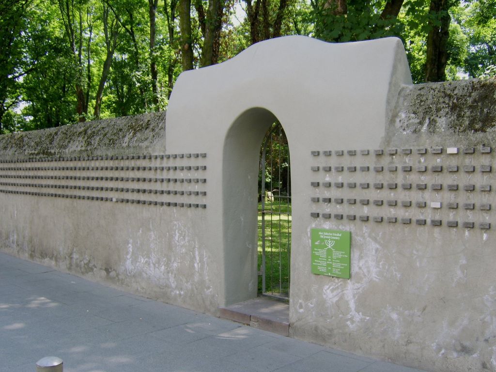
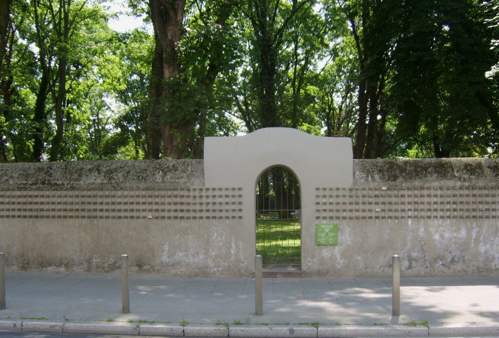
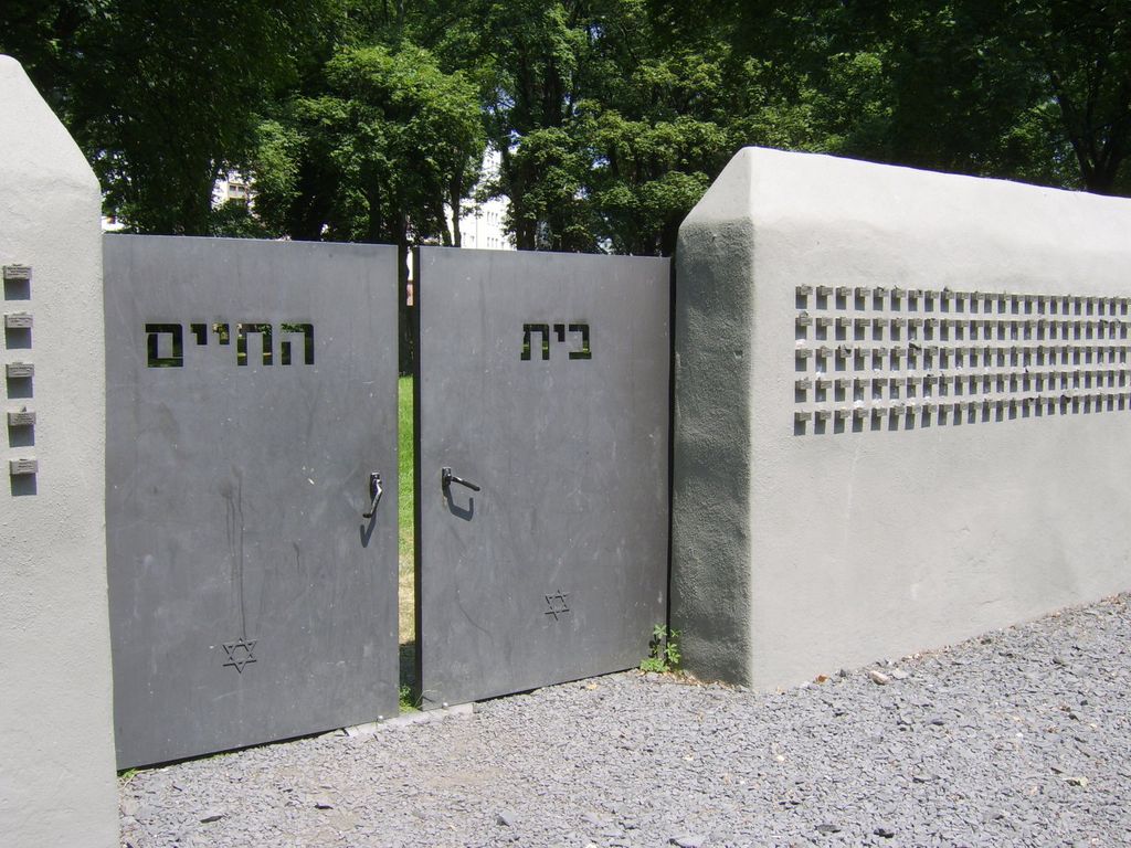
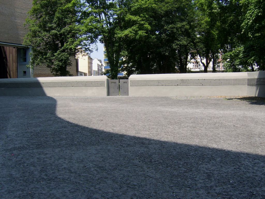
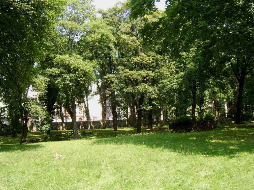
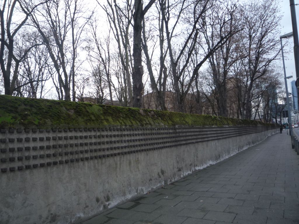
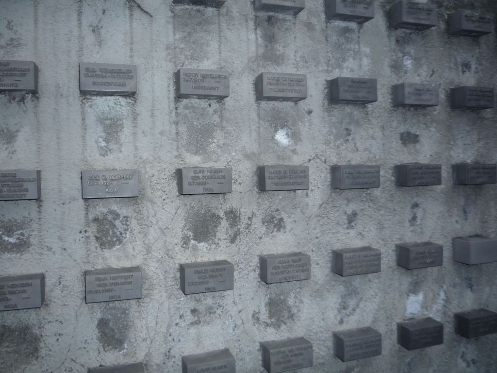
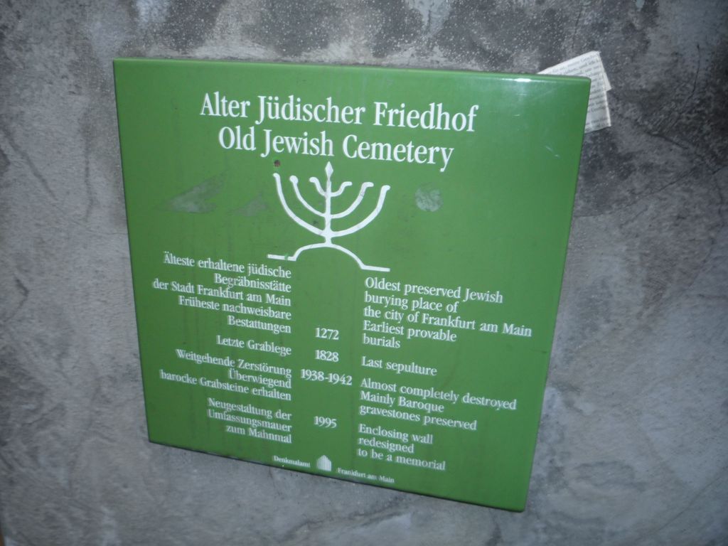
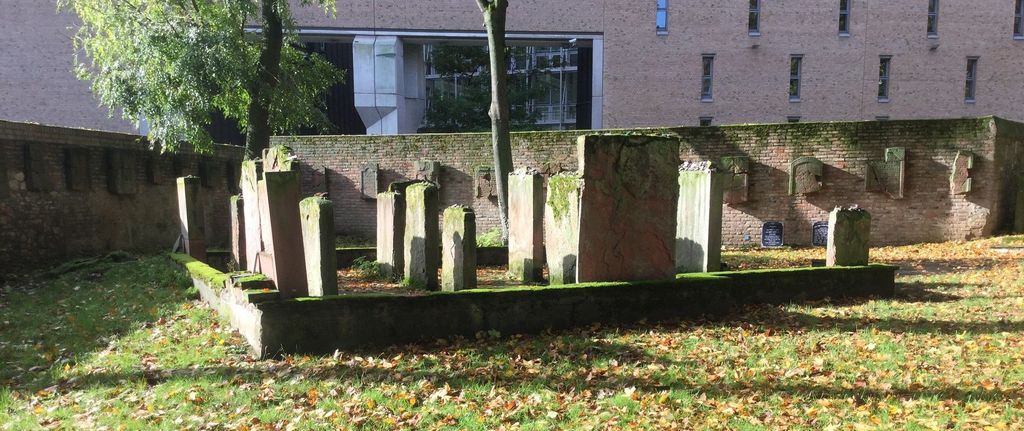
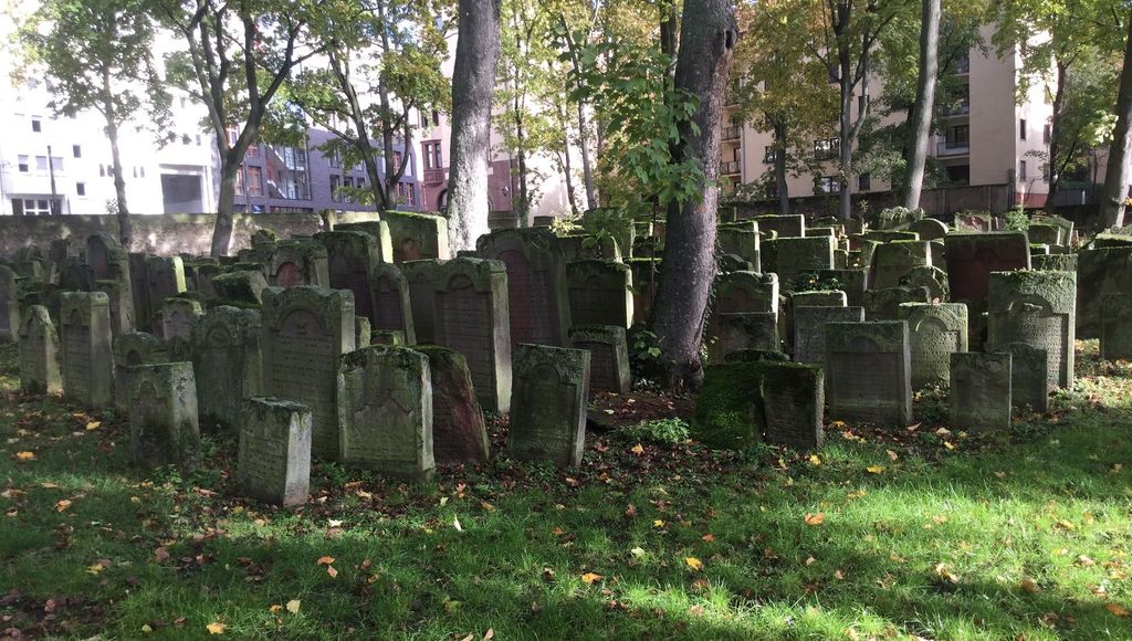
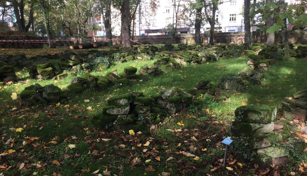
| Description | : | Transport connection: Linie 11 Battonnstraße, Bus 30/36 Börneplatz The cemetery served the Jewish community from 1270 until 1828 and consists of 11,850 m² or 2.93 acres. It is the second oldest Jewish cemetery in Germany after the one in Worms. At the beginning of the 20th Century there were approximately 7000 headstones in the cemetery. In November 1942 mayor Friedrich Krebs, a member of the Nazi party ordered the destruction of the cemetery, today only a small portion of the cemetery is still in the original condition. The Alter Jüdischer Friedhof located on Rat-Beil-Straße opened next to the Haupfriedhof... Read More |
frequently asked questions (FAQ):
-
Where is Jüdischer Friedhof Battonnstraße?
Jüdischer Friedhof Battonnstraße is located at Battonnstraße 2 Frankfurt am Main, Stadtkreis Frankfurt ,Hessen , 60311Germany.
-
Jüdischer Friedhof Battonnstraße cemetery's updated grave count on graveviews.com?
0 memorials
-
Where are the coordinates of the Jüdischer Friedhof Battonnstraße?
Latitude: 50.1122400
Longitude: 8.6904900
Nearby Cemetories:
1. Frankfurter Dom
Frankfurt am Main, Stadtkreis Frankfurt, Germany
Coordinate: 50.1105560, 8.6850000
2. Liebfrauenkirche
Frankfurt am Main, Stadtkreis Frankfurt, Germany
Coordinate: 50.1105560, 8.6822220
3. Peterskirchhof
Frankfurt am Main, Stadtkreis Frankfurt, Germany
Coordinate: 50.1169140, 8.6838340
4. Katharinenkirche
Frankfurt am Main, Stadtkreis Frankfurt, Germany
Coordinate: 50.1133330, 8.6797220
5. Karmeliterkirche
Frankfurt am Main, Stadtkreis Frankfurt, Germany
Coordinate: 50.1090850, 8.6778700
6. Alter Jüdischer Friedhof
Frankfurt am Main, Stadtkreis Frankfurt, Germany
Coordinate: 50.1324400, 8.6911700
7. Südfriedhof Frankfurt am Main
Frankfurt am Main, Stadtkreis Frankfurt, Germany
Coordinate: 50.0907420, 8.6918750
8. Hauptfriedhof Frankfurt am Main
Frankfurt am Main, Stadtkreis Frankfurt, Germany
Coordinate: 50.1358200, 8.6847800
9. Friedhof Bornheim
Frankfurt am Main, Stadtkreis Frankfurt, Germany
Coordinate: 50.1365070, 8.7027800
10. Alter Friedhof Oberrad
Frankfurt am Main, Stadtkreis Frankfurt, Germany
Coordinate: 50.0955010, 8.7226500
11. Waldfriedhof Oberrad
Oberrad, Stadtkreis Frankfurt, Germany
Coordinate: 50.0928113, 8.7310265
12. Alter Friedhof Bockenheim
Frankfurt am Main, Stadtkreis Frankfurt, Germany
Coordinate: 50.1184080, 8.6386630
13. Waldfriedhof Oberrad
Frankfurt am Main, Stadtkreis Frankfurt, Germany
Coordinate: 50.0929160, 8.7338700
14. Friedhof Frankfurt-Bockenheim
Frankfurt am Main, Stadtkreis Frankfurt, Germany
Coordinate: 50.1359710, 8.6439190
15. Friedhof Preungesheim
Frankfurt am Main, Stadtkreis Frankfurt, Germany
Coordinate: 50.1544320, 8.6871910
16. Friedhof Niederrad
Frankfurt am Main, Stadtkreis Frankfurt, Germany
Coordinate: 50.0864180, 8.6307230
17. Friedhof Hausen
Frankfurt am Main, Stadtkreis Frankfurt, Germany
Coordinate: 50.1332610, 8.6198470
18. Friedhof Eschersheim
Frankfurt am Main, Stadtkreis Frankfurt, Germany
Coordinate: 50.1610960, 8.6579400
19. Parkfriedhof Heiligenstock
Frankfurt am Main, Stadtkreis Frankfurt, Germany
Coordinate: 50.1621370, 8.7206430
20. Friedhof Heddernheim
Frankfurt am Main, Stadtkreis Frankfurt, Germany
Coordinate: 50.1535760, 8.6371630
21. Friedhof Enkheim
Frankfurt am Main, Stadtkreis Frankfurt, Germany
Coordinate: 50.1498360, 8.7504490
22. Friedhof Fechenheim
Frankfurt am Main, Stadtkreis Frankfurt, Germany
Coordinate: 50.1200620, 8.7738960
23. Neuer Friedhof Offenbach am Main
Offenbach am Main, Stadtkreis Offenbach am Main, Germany
Coordinate: 50.1058620, 8.7770540
24. Friedhof Rödelheim
Frankfurt am Main, Stadtkreis Frankfurt, Germany
Coordinate: 50.1231710, 8.6026430