
| Memorials | : | 0 |
| Location | : | Frankfurt am Main, Stadtkreis Frankfurt, Germany |
| Coordinate | : | 50.1169140, 8.6838340 |
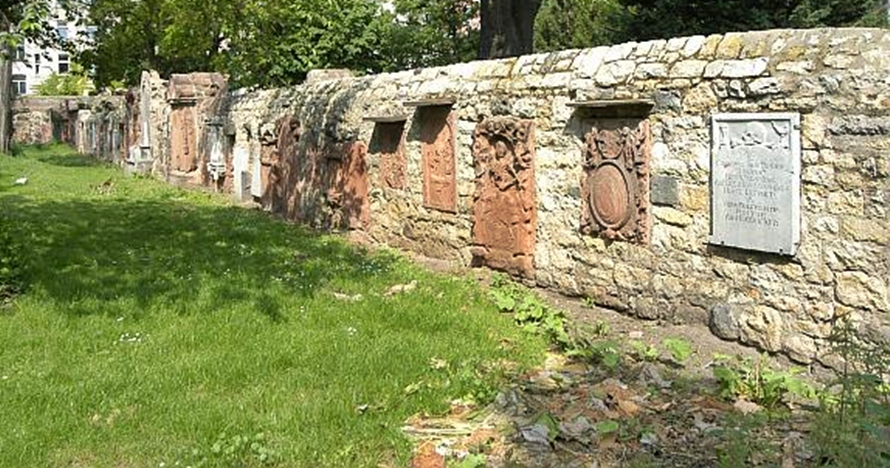
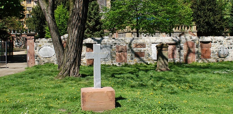
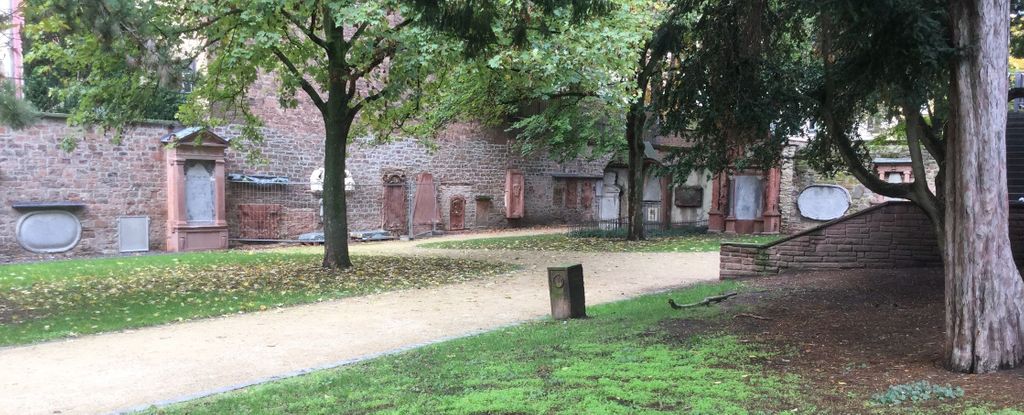
| Description | : | DEFUNCT The historic Peterskirchhof surrounds the Protestant Peter's Church (Peterskirche) in the center of Frankfurt/Main in Germany. Established in 1508 the area is now being used as a park, with some historic markers along the walls and some family plots, which are being taken care of by the city. The cemetery has been closed after the last burial in 1828. The Hauptfriedhof of Frankfurt then became the primary resting place for the citizens of the city. The list of interments in this cemetery is based on historic church documents, publications of the City Archive of Frankfurt, personal visits, and transcription of documents... Read More |
frequently asked questions (FAQ):
-
Where is Peterskirchhof?
Peterskirchhof is located at Bleichstrasse Frankfurt am Main, Stadtkreis Frankfurt ,Hessen , 60313Germany.
-
Peterskirchhof cemetery's updated grave count on graveviews.com?
0 memorials
-
Where are the coordinates of the Peterskirchhof?
Latitude: 50.1169140
Longitude: 8.6838340
Nearby Cemetories:
1. Katharinenkirche
Frankfurt am Main, Stadtkreis Frankfurt, Germany
Coordinate: 50.1133330, 8.6797220
2. Jüdischer Friedhof Battonnstraße
Frankfurt am Main, Stadtkreis Frankfurt, Germany
Coordinate: 50.1122400, 8.6904900
3. Frankfurter Dom
Frankfurt am Main, Stadtkreis Frankfurt, Germany
Coordinate: 50.1105560, 8.6850000
4. Liebfrauenkirche
Frankfurt am Main, Stadtkreis Frankfurt, Germany
Coordinate: 50.1105560, 8.6822220
5. Karmeliterkirche
Frankfurt am Main, Stadtkreis Frankfurt, Germany
Coordinate: 50.1090850, 8.6778700
6. Alter Jüdischer Friedhof
Frankfurt am Main, Stadtkreis Frankfurt, Germany
Coordinate: 50.1324400, 8.6911700
7. Hauptfriedhof Frankfurt am Main
Frankfurt am Main, Stadtkreis Frankfurt, Germany
Coordinate: 50.1358200, 8.6847800
8. Friedhof Bornheim
Frankfurt am Main, Stadtkreis Frankfurt, Germany
Coordinate: 50.1365070, 8.7027800
9. Südfriedhof Frankfurt am Main
Frankfurt am Main, Stadtkreis Frankfurt, Germany
Coordinate: 50.0907420, 8.6918750
10. Alter Friedhof Bockenheim
Frankfurt am Main, Stadtkreis Frankfurt, Germany
Coordinate: 50.1184080, 8.6386630
11. Friedhof Frankfurt-Bockenheim
Frankfurt am Main, Stadtkreis Frankfurt, Germany
Coordinate: 50.1359710, 8.6439190
12. Alter Friedhof Oberrad
Frankfurt am Main, Stadtkreis Frankfurt, Germany
Coordinate: 50.0955010, 8.7226500
13. Friedhof Preungesheim
Frankfurt am Main, Stadtkreis Frankfurt, Germany
Coordinate: 50.1544320, 8.6871910
14. Waldfriedhof Oberrad
Oberrad, Stadtkreis Frankfurt, Germany
Coordinate: 50.0928113, 8.7310265
15. Waldfriedhof Oberrad
Frankfurt am Main, Stadtkreis Frankfurt, Germany
Coordinate: 50.0929160, 8.7338700
16. Friedhof Hausen
Frankfurt am Main, Stadtkreis Frankfurt, Germany
Coordinate: 50.1332610, 8.6198470
17. Friedhof Niederrad
Frankfurt am Main, Stadtkreis Frankfurt, Germany
Coordinate: 50.0864180, 8.6307230
18. Friedhof Eschersheim
Frankfurt am Main, Stadtkreis Frankfurt, Germany
Coordinate: 50.1610960, 8.6579400
19. Friedhof Heddernheim
Frankfurt am Main, Stadtkreis Frankfurt, Germany
Coordinate: 50.1535760, 8.6371630
20. Parkfriedhof Heiligenstock
Frankfurt am Main, Stadtkreis Frankfurt, Germany
Coordinate: 50.1621370, 8.7206430
21. Friedhof Rödelheim
Frankfurt am Main, Stadtkreis Frankfurt, Germany
Coordinate: 50.1231710, 8.6026430
22. Friedhof Praunheim
Frankfurt am Main, Stadtkreis Frankfurt, Germany
Coordinate: 50.1514690, 8.6200820
23. Friedhof Enkheim
Frankfurt am Main, Stadtkreis Frankfurt, Germany
Coordinate: 50.1498360, 8.7504490
24. Friedhof Griesheim
Frankfurt am Main, Stadtkreis Frankfurt, Germany
Coordinate: 50.1021590, 8.6020250