
| Memorials | : | 0 |
| Location | : | Opole, Miasto Opole, Poland |
| Coordinate | : | 50.5451996, 18.3867174 |
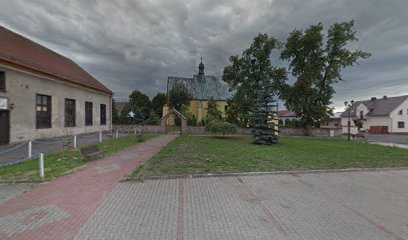
| Description | : | The Church of All Saints in Jemielnica (Himmelwitz) was first mentioned in 1285, and was originally dedicated to St. James the Greater. A brick church was constructed in the 14th century, but it was destroyed in the Hussite Wars and later reconsecrated in 1477. It was again destroyed in the Thirty Years' War, rebuilt in 1655. It served as the parish church of the village until 1812, when the former abbey church was secularized; the Church of All Saints was converted into a funereal church because of its location in the graveyard. In 1934-1945, a series of well-preserved Gothic... Read More |
frequently asked questions (FAQ):
-
Where is Jemielnica Church of All Saints?
Jemielnica Church of All Saints is located at ul. Wiejska, Jemielnica Opole, Miasto Opole ,Opolskie ,Poland.
-
Jemielnica Church of All Saints cemetery's updated grave count on graveviews.com?
0 memorials
-
Where are the coordinates of the Jemielnica Church of All Saints?
Latitude: 50.5451996
Longitude: 18.3867174
Nearby Cemetories:
1. Strzelce Opolskie Communal Cemetery
Opole, Miasto Opole, Poland
Coordinate: 50.5129401, 18.2910418
2. Szymiszów Church of St. Simon and St. Jude
Powiat strzelecki, Poland
Coordinate: 50.5174036, 18.2518617
3. Kolonowskie Communal Cemetery
Opole, Miasto Opole, Poland
Coordinate: 50.6546835, 18.3664719
4. Klucz Catholic Cemetery
Opole, Miasto Opole, Poland
Coordinate: 50.4356519, 18.2828430
5. Ujazd Old Communal Cemetery
Opole, Miasto Opole, Poland
Coordinate: 50.3883296, 18.3589507
6. Góra Świętej Anny Cemetery
Opole, Miasto Opole, Poland
Coordinate: 50.4559500, 18.1709800
7. Leśnica Communal Cemetery
Opole, Miasto Opole, Poland
Coordinate: 50.4340219, 18.1891626
8. Sławięcice Communal Cemetery
Opole, Miasto Opole, Poland
Coordinate: 50.3815500, 18.3126471
9. Cmentarz Raszowa
Raszowa, Powiat opolski, Poland
Coordinate: 50.5988561, 18.1290131
10. Cmentarz Daniec
Daniec, Powiat opolski, Poland
Coordinate: 50.6204025, 18.1243187
11. Church. St. Nicholas
Żyrowa, Powiat krapkowicki, Poland
Coordinate: 50.4534520, 18.1314970
12. Dobrodzień Parish Cemetery
Opole, Miasto Opole, Poland
Coordinate: 50.7287950, 18.4393419
13. Dobrodzień Protestant Cemetery
Opole, Miasto Opole, Poland
Coordinate: 50.7301001, 18.4338807
14. Tarnów Opolski Catholic Cemetery
Powiat opolski, Poland
Coordinate: 50.5736174, 18.0898580
15. Blechhammer Concentration Camp
Powiat kędzierzyńsko-kozielski, Poland
Coordinate: 50.3584050, 18.3221940
16. Kamień Śląski Catholic Cemetery
Opole, Miasto Opole, Poland
Coordinate: 50.5418111, 18.0755713
17. Kamień Śląski Church of St. Hyacint
Opole, Miasto Opole, Poland
Coordinate: 50.5394114, 18.0754378
18. Cemetery in Koty
Powiat tarnogórski, Poland
Coordinate: 50.5520122, 18.7024012
19. Sakrau Labor Camp
Powiat krapkowicki, Poland
Coordinate: 50.4811110, 18.0852780
20. Szczedrzyk Catholic Cemetery
Opole, Miasto Opole, Poland
Coordinate: 50.7035763, 18.1478292
21. Zębowice Catholic Cemetery
Opole, Miasto Opole, Poland
Coordinate: 50.7635101, 18.3419462
22. Cmentarz Komunalny Kuźniczka
Powiat kędzierzyńsko-kozielski, Poland
Coordinate: 50.3561008, 18.1982702
23. Gogolin Parish Cemetery
Opole, Miasto Opole, Poland
Coordinate: 50.4900735, 18.0304671
24. Klodnica Communcal Cemetery
Opole, Miasto Opole, Poland
Coordinate: 50.3519210, 18.1694476