
| Memorials | : | 1 |
| Location | : | Jerome, Yavapai County, USA |
| Coordinate | : | 34.7538500, -112.1049600 |
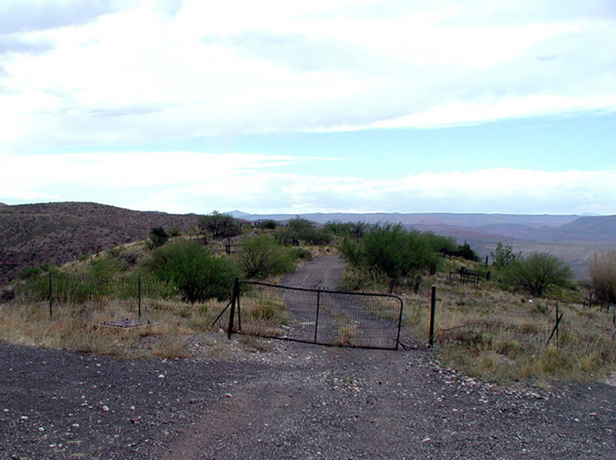
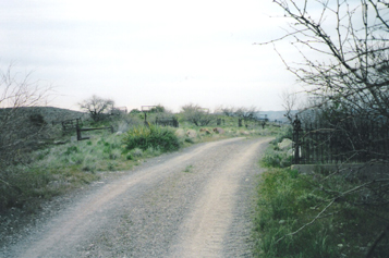
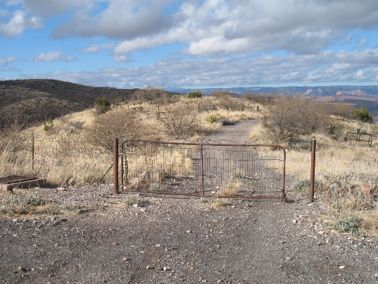
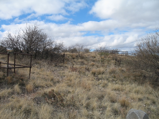
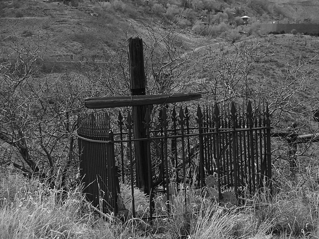
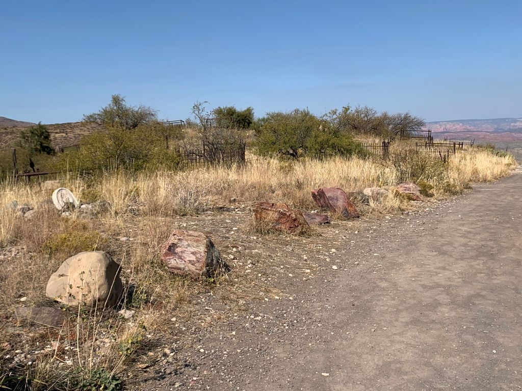
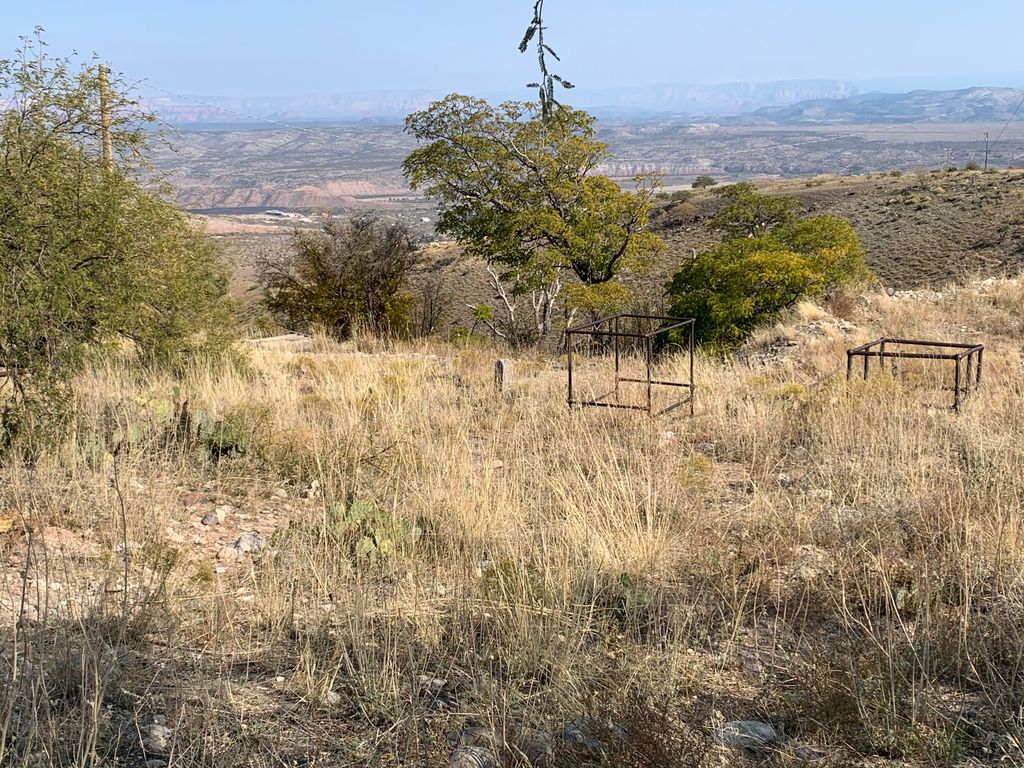
| Description | : | Jerome Cemetery is located just south of Jerome on Hogback Ridge. It has a panoramic view of Jerome and the United Verde Mining operations. However, the cemetery is very unkempt, with many broken headstones and unmarked, fenced grave sites. It is thought that there are approximately 400 graves but there are fewer than 40 headstones. In keeping with Jerome's reputation as "the wickedest town in the west", many of those buried here died of gunshot wounds or in mining accidents. Many others were known as "ladies of the night." The cemetery is reputed to... Read More |
frequently asked questions (FAQ):
-
Where is Jerome Cemetery?
Jerome Cemetery is located at North Drive Jerome, Yavapai County ,Arizona , 86331USA.
-
Jerome Cemetery cemetery's updated grave count on graveviews.com?
1 memorials
-
Where are the coordinates of the Jerome Cemetery?
Latitude: 34.7538500
Longitude: -112.1049600
Nearby Cemetories:
1. Jerome Valley Cemetery
Clarkdale, Yavapai County, USA
Coordinate: 34.7488100, -112.0624800
2. Mescal Gulch Cemetery
Jerome, Yavapai County, USA
Coordinate: 34.7256360, -112.1338340
3. Valley View Cemetery
Clarkdale, Yavapai County, USA
Coordinate: 34.7566986, -112.0599976
4. Saint Thomas Episcopal Church Columbarium
Clarkdale, Yavapai County, USA
Coordinate: 34.7710420, -112.0568670
5. Jerome Mine Laborers Cemetery
Cottonwood, Yavapai County, USA
Coordinate: 34.7569900, -112.0182500
6. Azteca Cemetery
Cottonwood, Yavapai County, USA
Coordinate: 34.7454000, -112.0138000
7. Cottonwood Cemetery
Cottonwood, Yavapai County, USA
Coordinate: 34.7448900, -112.0130400
8. All Souls Cemetery
Cottonwood, Yavapai County, USA
Coordinate: 34.7459000, -111.9710000
9. Perkinsville Cemetery
Perkinsville, Yavapai County, USA
Coordinate: 34.8946500, -112.2031500
10. Cherry Cemetery
Yavapai County, USA
Coordinate: 34.5884000, -112.0478000
11. Thompson Family Cemetery
Cornville, Yavapai County, USA
Coordinate: 34.7440400, -111.8885900
12. Middle Verde Yavapai-Apache Cemetery
Camp Verde, Yavapai County, USA
Coordinate: 34.6306030, -111.8862190
13. Middle Verde Cemetery
Camp Verde, Yavapai County, USA
Coordinate: 34.6253014, -111.8886032
14. Heritage Memorial Park
Dewey, Yavapai County, USA
Coordinate: 34.5687000, -112.2558000
15. Rainbow Acres Columbarium
Camp Verde, Yavapai County, USA
Coordinate: 34.6206470, -111.8876170
16. May Family Memorials
Dewey, Yavapai County, USA
Coordinate: 34.5247870, -112.1611680
17. Henderson Cemetery
Yavapai County, USA
Coordinate: 34.5311012, -112.2277985
18. Schuerman Red Rock Cemetery
Sedona, Yavapai County, USA
Coordinate: 34.8271280, -111.8153020
19. Saint Andrew's Episcopal Church Columbarium
West Sedona, Yavapai County, USA
Coordinate: 34.8597400, -111.8142250
20. Humboldt Cemetery
Yavapai County, USA
Coordinate: 34.5147018, -112.2371979
21. Prescott Valley Arizona Moose Memorial Grounds
Prescott Valley, Yavapai County, USA
Coordinate: 34.5779020, -112.3516410
22. Sedona United Methodist Church Columbarium
Sedona, Coconino County, USA
Coordinate: 34.8263120, -111.7776790
23. Saint Lukes Memorial Garden
Sedona, Coconino County, USA
Coordinate: 34.8306100, -111.7779100
24. Christ Lutheran Church Memorial Garden
Sedona, Coconino County, USA
Coordinate: 34.8325380, -111.7758970